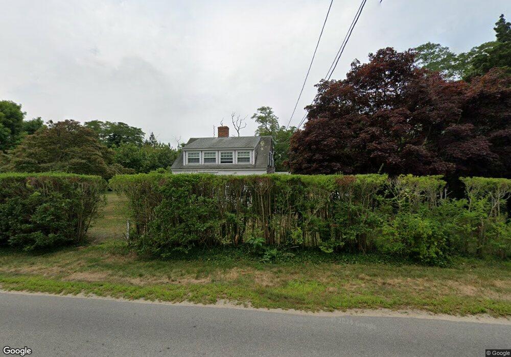
55 Bridge Rd Orleans, MA 02653
Estimated Value: $923,000 - $1,438,000
4
Beds
2
Baths
1,950
Sq Ft
$544/Sq Ft
Est. Value
About This Home
This home is located at 55 Bridge Rd, Orleans, MA 02653 and is currently estimated at $1,060,861, approximately $544 per square foot. 55 Bridge Rd is a home located in Barnstable County with nearby schools including Orleans Elementary School, Nauset Regional Middle School, and Nauset Regional High School.
Ownership History
Date
Name
Owned For
Owner Type
Purchase Details
Closed on
Oct 1, 1993
Sold by
Pierce Bion C
Bought by
Flack Joyce E
Current Estimated Value
Home Financials for this Owner
Home Financials are based on the most recent Mortgage that was taken out on this home.
Original Mortgage
$112,000
Interest Rate
7%
Mortgage Type
Purchase Money Mortgage
Create a Home Valuation Report for This Property
The Home Valuation Report is an in-depth analysis detailing your home's value as well as a comparison with similar homes in the area
Home Values in the Area
Average Home Value in this Area
Purchase History
| Date | Buyer | Sale Price | Title Company |
|---|---|---|---|
| Flack Joyce E | $222,000 | -- |
Source: Public Records
Mortgage History
| Date | Status | Borrower | Loan Amount |
|---|---|---|---|
| Open | Flack Joyce E | $67,000 | |
| Closed | Flack Joyce E | $82,000 | |
| Closed | Flack Joyce E | $112,000 |
Source: Public Records
Tax History
| Year | Tax Paid | Tax Assessment Tax Assessment Total Assessment is a certain percentage of the fair market value that is determined by local assessors to be the total taxable value of land and additions on the property. | Land | Improvement |
|---|---|---|---|---|
| 2025 | $4,939 | $791,500 | $372,100 | $419,400 |
| 2024 | $4,741 | $739,600 | $364,700 | $374,900 |
| 2023 | $4,400 | $706,300 | $337,800 | $368,500 |
| 2022 | $3,874 | $538,000 | $293,100 | $244,900 |
| 2021 | $3,948 | $503,600 | $290,500 | $213,100 |
| 2020 | $3,777 | $499,600 | $290,500 | $209,100 |
| 2019 | $3,608 | $487,600 | $282,400 | $205,200 |
| 2018 | $3,106 | $468,500 | $277,000 | $191,500 |
| 2017 | $2,910 | $459,700 | $277,000 | $182,700 |
| 2016 | $2,932 | $453,900 | $274,700 | $179,200 |
| 2015 | $2,847 | $443,500 | $269,300 | $174,200 |
Source: Public Records
Map
Nearby Homes
- 59 Bridge Rd
- 181 Rock Harbor Rd
- 26 Locust Rd
- 339 Dyer Prince Rd
- 2 Shell Ln
- 480 Dyer Prince Rd
- 60 Rock Harbor Rd
- 40 Bayview Rd
- 6 Defiance Ln
- 320 State Hwy
- 89 Rock Harbor Rd
- 21 S Orleans Rd
- 17 Kings Way
- 36 Old Colony Way Unit 21
- 36 Old Colony Way Unit 3022
- 28 Mallard Dr
- 42 Old Colony Way Unit 15
- 42 Old Colony Way Unit 29
- 704 State Hwy
- 12 Phoebes Close
- 53 Bridge Rd
- 77 Bridge Rd
- 54 Bridge Rd
- 58 Bridge Rd
- 49 Bridge Rd
- 50 Bridge Rd
- 48 Bridge Rd
- 45 Bridge Rd
- 10 Dyer Prince Rd
- 10 Dyer Prince Rd Unit 1
- 46 Bridge Rd
- 213 Rock Harbor Rd
- 217 Rock Harbor Rd
- 42 Bridge Rd
- 21 Dyer Prince Rd
- 25 Bridge Rd
- 221 Rock Harbor Rd
- 211 Rock Harbor Rd
- 211 Rock Harbor Rd
- 31 Dyer Prince Rd
Your Personal Tour Guide
Ask me questions while you tour the home.