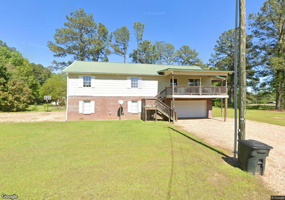
55 Carlisle Dr West Point, MS 39773
Estimated Value: $161,000 - $321,050
3
Beds
--
Bath
3,221
Sq Ft
$86/Sq Ft
Est. Value
About This Home
This home is located at 55 Carlisle Dr, West Point, MS 39773 and is currently estimated at $275,763, approximately $85 per square foot. 55 Carlisle Dr is a home with nearby schools including East Side Elementary School, West Clay Elementary School, and Church Hill Elementary School.
Ownership History
Date
Name
Owned For
Owner Type
Purchase Details
Closed on
Apr 10, 2023
Sold by
Barksdale Donald E
Bought by
Phillips Charlotte
Current Estimated Value
Home Financials for this Owner
Home Financials are based on the most recent Mortgage that was taken out on this home.
Original Mortgage
$196,000
Outstanding Balance
$189,650
Interest Rate
5.75%
Mortgage Type
New Conventional
Estimated Equity
$86,113
Purchase Details
Closed on
Oct 8, 2020
Sold by
Burns Kenneth M
Bought by
Barksdale Donald E
Home Financials for this Owner
Home Financials are based on the most recent Mortgage that was taken out on this home.
Original Mortgage
$206,150
Interest Rate
2.8%
Mortgage Type
Unknown
Create a Home Valuation Report for This Property
The Home Valuation Report is an in-depth analysis detailing your home's value as well as a comparison with similar homes in the area
Home Values in the Area
Average Home Value in this Area
Purchase History
| Date | Buyer | Sale Price | Title Company |
|---|---|---|---|
| Phillips Charlotte | -- | None Listed On Document | |
| Barksdale Donald E | -- | -- |
Source: Public Records
Mortgage History
| Date | Status | Borrower | Loan Amount |
|---|---|---|---|
| Open | Phillips Charlotte | $196,000 | |
| Previous Owner | Barksdale Donald E | $206,150 |
Source: Public Records
Tax History Compared to Growth
Tax History
| Year | Tax Paid | Tax Assessment Tax Assessment Total Assessment is a certain percentage of the fair market value that is determined by local assessors to be the total taxable value of land and additions on the property. | Land | Improvement |
|---|---|---|---|---|
| 2024 | $1,077 | $21,827 | $1,000 | $20,827 |
| 2023 | $1,525 | $16,083 | $1,000 | $15,083 |
| 2022 | $739 | $16,083 | $1,000 | $15,083 |
| 2021 | $739 | $16,083 | $1,000 | $15,083 |
| 2020 | $739 | $16,083 | $1,000 | $15,083 |
| 2019 | $689 | $15,948 | $1,000 | $14,948 |
| 2018 | $654 | $15,948 | $1,000 | $14,948 |
| 2017 | $654 | $15,948 | $1,000 | $14,948 |
| 2016 | $626 | $15,948 | $1,000 | $14,948 |
| 2015 | $583 | $14,551 | $1,000 | $13,551 |
| 2014 | $65 | $14,551 | $1,000 | $13,551 |
| 2013 | $65 | $21,827 | $1,500 | $20,327 |
Source: Public Records
Map
Nearby Homes
- 0 Riverchase Dr
- 495 Humphries Cove Rd
- 0 Humphries Cove Rd
- 115 Mallard Point Dr
- 120 Nelda Dr
- 1873 Sandy Land Rd
- 0 Jess Lyons Rd
- 230 Acorn Alley
- 0 Mississippi 373
- 0 Downs Rd
- 0 Officers Lake Rd
- 1 W Jess Lyons Rd
- 4 W Jess Lyons Rd
- 3 W Jess Lyons Rd
- 6 W Jess Lyons Rd
- 5 W Jess Lyons Rd
- 20 Shore Dr
- 134 S Perkins Rd
- 295 Jess Lyons Rd
- 6900 Highway 45 N
- 10921 Carlisle Cir
- 1295 Carlisle Cir
- 1375 Carlisle Cir
- 1345 Carlisle Cir
- 1245 Carlisle Cir
- 40 Louise Dr
- 188 Carlisle Dr
- 1339 Carlisle Cir
- 1481 Carlisle Cir
- 1357 Carlisle Cir
- 147 Louise Dr
- 158 Louise Dr
- 45 Roberts Dr
- 11125 Louise Dr
- 111 Roberts Dr
- 133 Roberts Dr
- 1325 Roberts Dr
- 1340 Roberts Dr
- 1264 Roberts Dr
- 1222 Roberts Dr