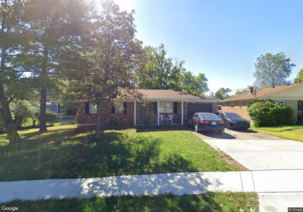
55 Circle Dr Florence, KY 41042
Estimated Value: $142,000 - $218,000
3
Beds
2
Baths
962
Sq Ft
$193/Sq Ft
Est. Value
About This Home
This home is located at 55 Circle Dr, Florence, KY 41042 and is currently estimated at $185,473, approximately $192 per square foot. 55 Circle Dr is a home located in Boone County with nearby schools including Hillard Collins Elementary School, Jones Middle School, and Boone County High School.
Ownership History
Date
Name
Owned For
Owner Type
Purchase Details
Closed on
Aug 29, 2025
Sold by
Worthington Michael M
Bought by
Velasquez Jordan and Worthington Jaidyn
Current Estimated Value
Home Financials for this Owner
Home Financials are based on the most recent Mortgage that was taken out on this home.
Original Mortgage
$120,500
Outstanding Balance
$120,500
Interest Rate
6.74%
Mortgage Type
New Conventional
Estimated Equity
$64,973
Purchase Details
Closed on
Nov 3, 2009
Sold by
Wilson Daniel C and Wilson Joyce
Bought by
Worthington Michael M
Home Financials for this Owner
Home Financials are based on the most recent Mortgage that was taken out on this home.
Original Mortgage
$76,312
Interest Rate
5.01%
Mortgage Type
FHA
Create a Home Valuation Report for This Property
The Home Valuation Report is an in-depth analysis detailing your home's value as well as a comparison with similar homes in the area
Home Values in the Area
Average Home Value in this Area
Purchase History
| Date | Buyer | Sale Price | Title Company |
|---|---|---|---|
| Velasquez Jordan | $140,000 | Bluegrass Land Title | |
| Worthington Michael M | $85,000 | Lawyers Title Cincinnati Inc |
Source: Public Records
Mortgage History
| Date | Status | Borrower | Loan Amount |
|---|---|---|---|
| Open | Velasquez Jordan | $120,500 | |
| Previous Owner | Worthington Michael M | $76,312 |
Source: Public Records
Tax History
| Year | Tax Paid | Tax Assessment Tax Assessment Total Assessment is a certain percentage of the fair market value that is determined by local assessors to be the total taxable value of land and additions on the property. | Land | Improvement |
|---|---|---|---|---|
| 2025 | $1,267 | $129,200 | $15,000 | $114,200 |
| 2024 | $1,242 | $129,200 | $15,000 | $114,200 |
| 2023 | $1,218 | $129,200 | $15,000 | $114,200 |
| 2022 | $1,224 | $129,200 | $15,000 | $114,200 |
| 2021 | $1,620 | $129,200 | $15,000 | $114,200 |
| 2020 | $989 | $102,000 | $15,000 | $87,000 |
| 2019 | $998 | $102,000 | $15,000 | $87,000 |
| 2018 | $1,055 | $102,000 | $15,000 | $87,000 |
| 2017 | $987 | $102,000 | $15,000 | $87,000 |
| 2015 | $979 | $102,000 | $15,000 | $87,000 |
| 2013 | -- | $101,280 | $15,000 | $86,280 |
Source: Public Records
Map
Nearby Homes
- 32 Julia Ave
- 23 Edwards Ave
- 6 Ann St
- 4 Woodland Ave
- 154 Roger Ln
- 17 Shenandoah Dr
- 6 Spruce Dr
- 7402 Shenandoah Dr
- 416 Foster Ave
- 119 Honeysuckle Dr
- 65 Miriam Dr
- 7796 Walnut Creek Dr
- 7075 Glen Kerry Ct
- 7791 Ewing Blvd
- 7775 Cedar Wood Cir
- 6965 Parkview Dr
- 6823 Dixie Hwy
- 198 Langshire Ct Unit 13
- 20 Parkside Dr
- 160 Langshire Ct Unit 15
Your Personal Tour Guide
Ask me questions while you tour the home.