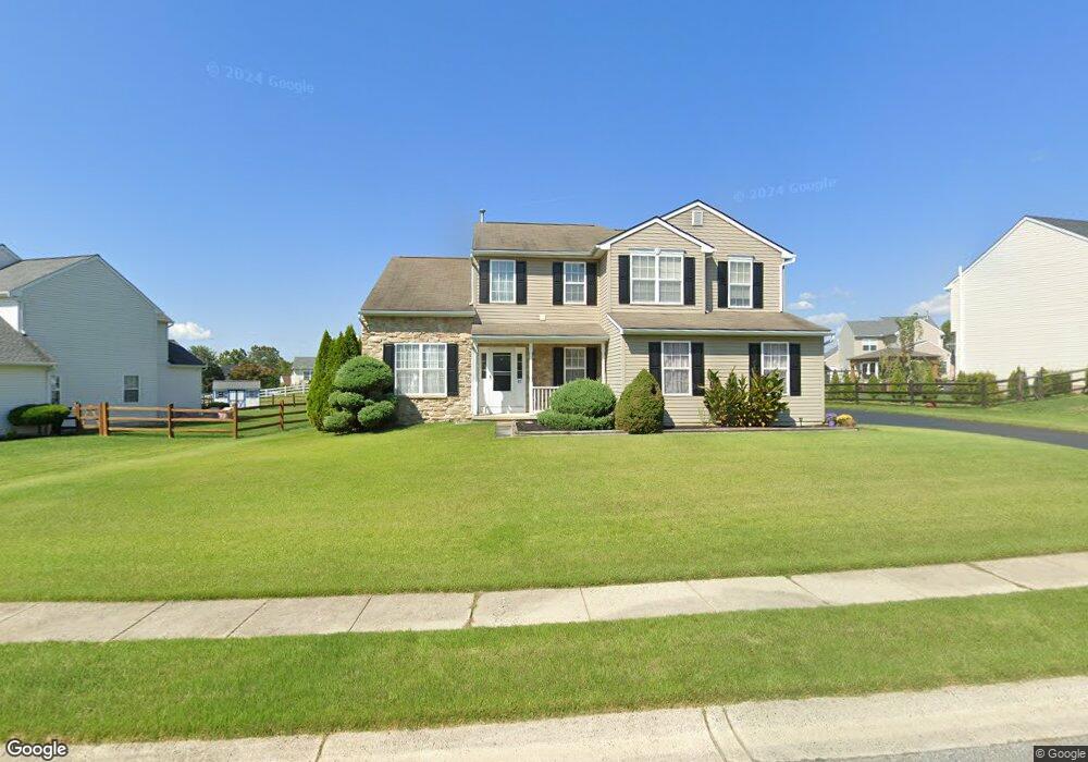
55 Crestpoint Dr New Castle, DE 19720
Saint Georges NeighborhoodEstimated Value: $466,465 - $523,000
4
Beds
3
Baths
1,736
Sq Ft
$290/Sq Ft
Est. Value
About This Home
This home is located at 55 Crestpoint Dr, New Castle, DE 19720 and is currently estimated at $504,116, approximately $290 per square foot. 55 Crestpoint Dr is a home located in New Castle County with nearby schools including Southern Elementary School, Gunning Bedford Middle School, and Aquinas Academy.
Ownership History
Date
Name
Owned For
Owner Type
Purchase Details
Closed on
Jun 15, 2007
Sold by
Tryon Patrick G and Tryon Merrie Lynn
Bought by
Taylor Raymond L and Taylor Paulette D
Current Estimated Value
Home Financials for this Owner
Home Financials are based on the most recent Mortgage that was taken out on this home.
Original Mortgage
$268,000
Outstanding Balance
$169,160
Interest Rate
6.78%
Mortgage Type
Unknown
Estimated Equity
$334,956
Purchase Details
Closed on
Feb 10, 2003
Sold by
Tryon Patrick G
Bought by
Tryon Patrick G and Tryon Merrie Lynn
Create a Home Valuation Report for This Property
The Home Valuation Report is an in-depth analysis detailing your home's value as well as a comparison with similar homes in the area
Home Values in the Area
Average Home Value in this Area
Purchase History
| Date | Buyer | Sale Price | Title Company |
|---|---|---|---|
| Taylor Raymond L | $338,900 | None Available | |
| Tryon Patrick G | -- | -- |
Source: Public Records
Mortgage History
| Date | Status | Borrower | Loan Amount |
|---|---|---|---|
| Open | Taylor Raymond L | $268,000 |
Source: Public Records
Tax History
| Year | Tax Paid | Tax Assessment Tax Assessment Total Assessment is a certain percentage of the fair market value that is determined by local assessors to be the total taxable value of land and additions on the property. | Land | Improvement |
|---|---|---|---|---|
| 2024 | $1,317 | $83,100 | $12,300 | $70,800 |
| 2023 | $1,160 | $83,100 | $12,300 | $70,800 |
| 2022 | $1,218 | $83,100 | $12,300 | $70,800 |
| 2021 | $2,730 | $83,100 | $12,300 | $70,800 |
| 2020 | $2,740 | $83,100 | $12,300 | $70,800 |
| 2019 | $3,159 | $83,100 | $12,300 | $70,800 |
| 2018 | $2,695 | $83,100 | $12,300 | $70,800 |
| 2017 | $2,523 | $83,100 | $12,300 | $70,800 |
| 2016 | $2,250 | $83,100 | $12,300 | $70,800 |
| 2015 | $2,253 | $83,100 | $12,300 | $70,800 |
| 2014 | $2,256 | $83,100 | $12,300 | $70,800 |
Source: Public Records
Map
Nearby Homes
- 4 Alden Ct
- 26 Cobblestone Dr
- 0 Delaware St
- 205 E Harvest Dr
- 120 N Main St
- 107 Nicholas Ct
- 1225 Caitlin Way
- 1119 Casey Dr
- 808 Quinn Ct
- 1049 Matthew Way
- 613 Garron Point Pass
- 211 Audubon Dr
- 248 Ann Dr
- 1447 Olmsted Dr
- 265 Ann Dr
- 336 Acasta Dr
- 3934 Kirkwood Saint Georges
- 87 N Dragon Dr Unit 131
- 715 Javelin Way Unit 71
- 0 Port Penn Rd
Your Personal Tour Guide
Ask me questions while you tour the home.