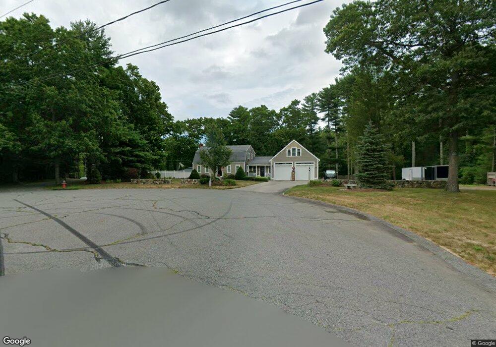
55 Cypress Rd Pembroke, MA 02359
Estimated Value: $586,000 - $763,000
3
Beds
2
Baths
2,300
Sq Ft
$304/Sq Ft
Est. Value
About This Home
This home is located at 55 Cypress Rd, Pembroke, MA 02359 and is currently estimated at $699,459, approximately $304 per square foot. 55 Cypress Rd is a home located in Plymouth County with nearby schools including Pembroke High School.
Ownership History
Date
Name
Owned For
Owner Type
Purchase Details
Closed on
Nov 5, 2024
Sold by
Nichols Danielle and Nichols Scott A
Bought by
Nichols T T and Nichols N
Current Estimated Value
Purchase Details
Closed on
Oct 5, 2001
Sold by
Plausse Lucille T
Bought by
Nichols Scott A and Nichols Danielle
Home Financials for this Owner
Home Financials are based on the most recent Mortgage that was taken out on this home.
Original Mortgage
$120,000
Interest Rate
6.89%
Mortgage Type
Purchase Money Mortgage
Create a Home Valuation Report for This Property
The Home Valuation Report is an in-depth analysis detailing your home's value as well as a comparison with similar homes in the area
Home Values in the Area
Average Home Value in this Area
Purchase History
| Date | Buyer | Sale Price | Title Company |
|---|---|---|---|
| Nichols T T | -- | None Available | |
| Nichols T T | -- | None Available | |
| Nichols Scott A | $275,000 | -- | |
| Nichols Scott A | $275,000 | -- |
Source: Public Records
Mortgage History
| Date | Status | Borrower | Loan Amount |
|---|---|---|---|
| Previous Owner | Nichols Scott A | $121,000 | |
| Previous Owner | Nichols Scott A | $120,000 | |
| Previous Owner | Nichols Scott A | $20,000 |
Source: Public Records
Tax History Compared to Growth
Tax History
| Year | Tax Paid | Tax Assessment Tax Assessment Total Assessment is a certain percentage of the fair market value that is determined by local assessors to be the total taxable value of land and additions on the property. | Land | Improvement |
|---|---|---|---|---|
| 2025 | $7,541 | $627,400 | $309,200 | $318,200 |
| 2024 | $6,892 | $572,900 | $304,000 | $268,900 |
| 2023 | $6,913 | $543,500 | $289,200 | $254,300 |
| 2022 | $6,563 | $463,800 | $238,200 | $225,600 |
| 2021 | $6,315 | $433,100 | $223,000 | $210,100 |
| 2020 | $6,083 | $419,800 | $218,200 | $201,600 |
| 2019 | $6,004 | $411,200 | $212,800 | $198,400 |
| 2018 | $5,908 | $396,800 | $212,800 | $184,000 |
| 2017 | $5,788 | $383,300 | $198,000 | $185,300 |
| 2016 | $5,639 | $369,500 | $182,800 | $186,700 |
| 2015 | $5,323 | $361,100 | $172,800 | $188,300 |
Source: Public Records
Map
Nearby Homes
- 27 Chestnut Rd
- 234 Forest St
- 72 Valley St
- 249 High St
- 290 High St
- 118 Plain St
- 72 Old Cart Path Ln Unit Lot 2
- 77 Old Cart Path Ln Unit Lot 4
- 78 Old Cart Path Ln Unit Lot 3
- 16 Chapel St
- 20 Edward Dr
- 99 Old Washington St
- 61 Chapel St
- 26 Pierce Dr
- 26 Jessica Cir
- 30 Old Washington St Unit 9
- 47 Wellington Ln
- 299 Center St
- 40 Brisan Way
- 10 Emily Ln