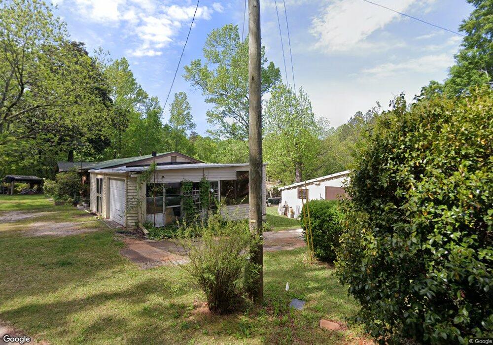
55 Darby Rd Covington, GA 30016
Estimated Value: $273,000 - $320,000
Studio
2
Baths
1,606
Sq Ft
$190/Sq Ft
Est. Value
About This Home
This home is located at 55 Darby Rd, Covington, GA 30016 and is currently estimated at $304,948, approximately $189 per square foot. 55 Darby Rd is a home located in Newton County with nearby schools including South Salem Elementary School, Liberty Middle School, and Alcovy High School.
Ownership History
Date
Name
Owned For
Owner Type
Purchase Details
Closed on
Feb 6, 2006
Sold by
Darby Rd Covington Newton
Bought by
Brooks Craig D and Brooks Vicki S
Current Estimated Value
Home Financials for this Owner
Home Financials are based on the most recent Mortgage that was taken out on this home.
Original Mortgage
$152,100
Outstanding Balance
$83,847
Interest Rate
6.14%
Mortgage Type
New Conventional
Estimated Equity
$221,101
Purchase Details
Closed on
Jun 6, 2005
Sold by
Morvick Desirie
Bought by
Darby Rd Covington Newton
Purchase Details
Closed on
Feb 24, 1995
Sold by
Howard Pratt William L and Howard Wynelle
Bought by
Morvik Albert E and Morvik Desirie M
Create a Home Valuation Report for This Property
The Home Valuation Report is an in-depth analysis detailing your home's value as well as a comparison with similar homes in the area
Home Values in the Area
Average Home Value in this Area
Purchase History
We collect this data history from publicly available records. To have your information removed, we recommend requesting removal directly through your county’s website.
| Date | Buyer | Sale Price | Title Company |
|---|---|---|---|
| Brooks Craig D | $169,000 | -- | |
| Darby Rd Covington Newton | -- | -- | |
| Morvik Albert E | $56,400 | -- |
Source: Public Records
Mortgage History
We collect this data history from publicly available records. To have your information removed, we recommend requesting removal directly through your county’s website.
| Date | Status | Borrower | Loan Amount |
|---|---|---|---|
| Open | Brooks Craig D | $152,100 | |
| Closed | Morvik Albert E | $0 |
Source: Public Records
Tax History
| Year | Tax Paid | Tax Assessment Tax Assessment Total Assessment is a certain percentage of the fair market value that is determined by local assessors to be the total taxable value of land and additions on the property. | Land | Improvement |
|---|---|---|---|---|
| 2025 | $2,956 | $126,240 | $29,560 | $96,680 |
| 2024 | $2,666 | $109,120 | $25,480 | $83,640 |
| 2023 | $2,674 | $102,400 | $25,480 | $76,920 |
| 2022 | $1,750 | $68,360 | $17,320 | $51,040 |
| 2021 | $1,647 | $58,200 | $15,280 | $42,920 |
| 2020 | $1,503 | $48,640 | $12,240 | $36,400 |
| 2019 | $1,387 | $44,560 | $12,240 | $32,320 |
| 2018 | $1,319 | $42,320 | $12,240 | $30,080 |
| 2017 | $1,310 | $42,040 | $11,800 | $30,240 |
| 2016 | $1,083 | $35,440 | $6,720 | $28,720 |
| 2015 | $1,046 | $34,360 | $6,720 | $27,640 |
| 2014 | $1,118 | $36,520 | $0 | $0 |
Source: Public Records
Map
Nearby Homes
- 55 Twin Lakes Dr
- 35 Mallard Ct
- 215 Morningside Dr
- 711 Highway 162
- 102 Tempie Ln
- 0 Tempie Ln
- 15 Lisa Ct
- 15 Kevin Ct
- 70 Kevin Ct
- 160 Heaton Place Trail
- 2 Willow St
- 220 Betty Ann Ln
- 35 Pembroke Place Unit 3
- 65 Lakeside Dr
- Hwy 81
- 195 Lakeside Dr
- 260 Heaton Place Trail
- 35 Wynfield Keep
- 0 Spring Hill Dr Unit 7725409
- 0 Spring Hill Dr Unit 10699182
- 15 Chapman Rd
- 33 Chapman Rd
- 145 Darby Rd
- 49 Chapman Rd
- 71 Larue Rd
- 83 Larue Rd
- 210 Blue Heron Way Unit LOT B25
- 200 Blue Heron Way Unit Lot B26
- 200 Blue Heron Way Unit B26
- 200 Blue Heron Way
- 58 Chapman Rd
- 580 Highway 162
- 72 Darby Rd
- 190 Blue Heron Way Unit Lot B27
- 125 Darby Rd
- 180 Blue Heron Way Unit Lot B28
- 99 Larue Rd
- 205 Blue Heron Way Unit LOT B24
- 170 Blue Heron Way Unit Lot B29
- 170 Blue Heron Way Unit B29
Your Personal Tour Guide
Ask me questions while you tour the home.