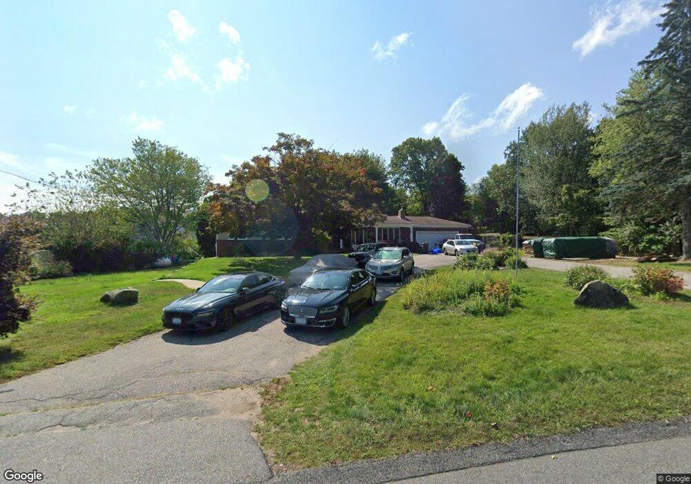
55 Echo Ln Cranston, RI 02921
Comstock Gardens NeighborhoodEstimated Value: $714,934 - $743,000
3
Beds
3
Baths
3,920
Sq Ft
$185/Sq Ft
Est. Value
About This Home
This home is located at 55 Echo Ln, Cranston, RI 02921 and is currently estimated at $723,734, approximately $184 per square foot. 55 Echo Ln is a home located in Providence County with nearby schools including Orchard Farms El. School, Western Hills Middle School, and Cranston High School West.
Ownership History
Date
Name
Owned For
Owner Type
Purchase Details
Closed on
Oct 1, 2024
Sold by
Halsall Robert and Halsall Camille
Bought by
Halsall Ret and Halsall
Current Estimated Value
Purchase Details
Closed on
Feb 1, 2005
Sold by
Meldonian Dennis and Meldonian Paul
Bought by
Halsall Robert and Pless Camille
Create a Home Valuation Report for This Property
The Home Valuation Report is an in-depth analysis detailing your home's value as well as a comparison with similar homes in the area
Home Values in the Area
Average Home Value in this Area
Purchase History
| Date | Buyer | Sale Price | Title Company |
|---|---|---|---|
| Halsall Ret | -- | None Available | |
| Halsall Ret | -- | None Available | |
| Halsall Robert | $385,000 | -- | |
| Halsall Robert | $385,000 | -- |
Source: Public Records
Mortgage History
| Date | Status | Borrower | Loan Amount |
|---|---|---|---|
| Previous Owner | Halsall Robert | $346,000 | |
| Previous Owner | Halsall Robert | $328,000 | |
| Previous Owner | Halsall Robert | $33,000 |
Source: Public Records
Tax History
| Year | Tax Paid | Tax Assessment Tax Assessment Total Assessment is a certain percentage of the fair market value that is determined by local assessors to be the total taxable value of land and additions on the property. | Land | Improvement |
|---|---|---|---|---|
| 2025 | $8,918 | $642,500 | $171,200 | $471,300 |
| 2024 | $8,744 | $642,500 | $171,200 | $471,300 |
| 2023 | $8,460 | $447,600 | $122,300 | $325,300 |
| 2022 | $8,285 | $447,600 | $122,300 | $325,300 |
| 2021 | $8,057 | $447,600 | $122,300 | $325,300 |
| 2020 | $7,820 | $376,500 | $122,300 | $254,200 |
| 2019 | $7,820 | $376,500 | $122,300 | $254,200 |
| 2018 | $7,625 | $375,800 | $122,300 | $253,500 |
| 2017 | $7,439 | $324,300 | $104,800 | $219,500 |
| 2016 | $7,281 | $324,300 | $104,800 | $219,500 |
| 2015 | $7,281 | $324,300 | $104,800 | $219,500 |
| 2014 | $6,681 | $292,500 | $100,500 | $192,000 |
Source: Public Records
Map
Nearby Homes
- 141 Fox Ridge Dr
- 20 Doreen Ct
- 65 Janet Dr
- 121 Ashbrook Dr
- 25 Janet Dr
- 95 Amy Dr
- 105 Amy Dr
- 102 Moccasin Trail
- 7 Taylor Rd
- 1757 Plainfield Pike
- 2073 Plainfield Pike
- 0 Anthony Dr Unit 1394338
- 02 Paula Ln
- 01 Paula Ln
- 129 Simmonsville Ave
- 27 Nardolillo St
- 1 Roblyn Dr
- 1495 Pippin Orchard Rd
- 244 Stony Acre Dr
- 1603 Plainfield Pike Unit G8
- 0 Echo Ln
- 0 Coletta Ct Unit 1364321
- 0 Coletta Ct Unit 1318959
- 0 Coletta Ct Unit 1317903
- 0 Coletta Ct Unit 1317793
- 0 Coletta Ct Unit 1317665
- 0 Coletta Ct Unit 1309982
- 0 Coletta Ct Unit 1306336
- 0 Coletta Ct Unit 1306120
- 50 Echo Ln
- 0 Williams Way
- 41 Echo Ln
- 85 Echo Ln
- 59 Echo Ln
- 40 Echo Ln
- 27 Echo Ln
- 7 Williams Way
- 23 Coletta Ct
- 30 Echo Ln
- 17 Echo Ln
Your Personal Tour Guide
Ask me questions while you tour the home.