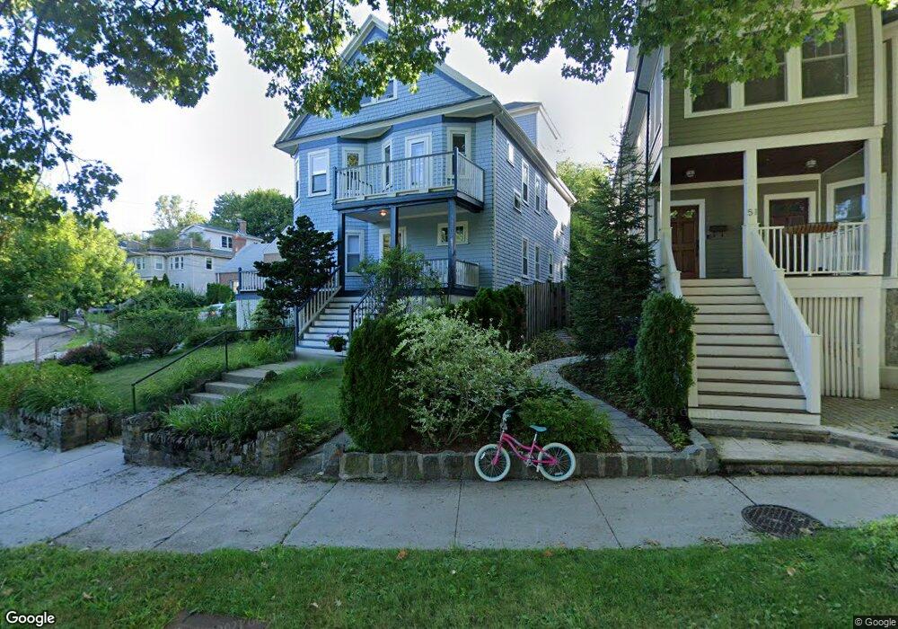
55 Eliot St Unit 1 Chestnut Hill, MA 02467
Chestnut Hill NeighborhoodEstimated Value: $753,000 - $1,010,469
3
Beds
2
Baths
1,200
Sq Ft
$749/Sq Ft
Est. Value
About This Home
This home is located at 55 Eliot St Unit 1, Chestnut Hill, MA 02467 and is currently estimated at $898,617, approximately $748 per square foot. 55 Eliot St Unit 1 is a home located in Norfolk County with nearby schools including Heath Elementary School, Maimonides School, and Brimmer & May School.
Ownership History
Date
Name
Owned For
Owner Type
Purchase Details
Closed on
Jun 6, 2008
Sold by
Susan Kosoff Rt and Genser Andrea S
Bought by
Doane Andrea E
Current Estimated Value
Home Financials for this Owner
Home Financials are based on the most recent Mortgage that was taken out on this home.
Original Mortgage
$250,000
Outstanding Balance
$160,915
Interest Rate
6.11%
Mortgage Type
Purchase Money Mortgage
Estimated Equity
$737,702
Create a Home Valuation Report for This Property
The Home Valuation Report is an in-depth analysis detailing your home's value as well as a comparison with similar homes in the area
Home Values in the Area
Average Home Value in this Area
Purchase History
| Date | Buyer | Sale Price | Title Company |
|---|---|---|---|
| Doane Andrea E | $370,000 | -- |
Source: Public Records
Mortgage History
| Date | Status | Borrower | Loan Amount |
|---|---|---|---|
| Open | Doane Andrea E | $250,000 |
Source: Public Records
Tax History Compared to Growth
Tax History
| Year | Tax Paid | Tax Assessment Tax Assessment Total Assessment is a certain percentage of the fair market value that is determined by local assessors to be the total taxable value of land and additions on the property. | Land | Improvement |
|---|---|---|---|---|
| 2025 | $8,894 | $901,100 | $0 | $901,100 |
| 2024 | $8,631 | $883,400 | $0 | $883,400 |
| 2023 | $7,769 | $779,200 | $0 | $779,200 |
| 2022 | $7,710 | $756,600 | $0 | $756,600 |
| 2021 | $7,341 | $749,100 | $0 | $749,100 |
| 2020 | $7,009 | $741,700 | $0 | $741,700 |
| 2019 | $6,619 | $706,400 | $0 | $706,400 |
| 2018 | $6,365 | $672,800 | $0 | $672,800 |
| 2017 | $6,154 | $622,900 | $0 | $622,900 |
| 2016 | $5,901 | $566,300 | $0 | $566,300 |
| 2015 | $5,498 | $514,800 | $0 | $514,800 |
| 2014 | $5,477 | $480,900 | $0 | $480,900 |
Source: Public Records
Map
Nearby Homes
- 675 Chestnut Hill Ave
- 55 Reservoir Rd Unit 2
- 30 Ackers Ave
- 59 Ackers Ave Unit 1
- 540 Chestnut Hill Ave
- 88 Cutler Ln
- 120 Seaver St Unit A103
- 120 Seaver St Unit C-102
- 55 Leicester St
- 9 Willard Rd
- 130 Cabot St
- 142 Crafts Rd
- 372 Warren St
- 39 Clyde St
- 80 Dudley St
- 8 Strathmore Rd Unit G
- 17 Strathmore Rd Unit 2
- 333 Clark Rd
- 2400 Beacon St Unit 112
- 1014 Boylston St
- 55 Eliot St Unit 2
- 55 Eliot St
- 643 Chestnut Hill Ave Unit 1
- 643 Chestnut Hill Ave Unit 3
- 643 Chestnut Hill Ave Unit 2
- 643 Chestnut Hill Ave Unit 3
- 643 Chestnut Hill Ave Unit 1,643
- 52 Loveland Rd
- 51 Eliot St
- 51 Eliot St Unit 2
- 51 Eliot St Unit 1
- 47 Eliot St
- 47 Eliot St Unit 2
- 43 Eliot St
- 48 Loveland Rd Unit 2
- 48 Loveland Rd Unit 1
- 67 Eliot St
- 67 Eliot St Unit B
- 67 Eliot St Unit A
- 67 Eliot St Unit 2