Estimated Value: $1,263,000 - $1,622,000
4
Beds
2
Baths
1,969
Sq Ft
$718/Sq Ft
Est. Value
About This Home
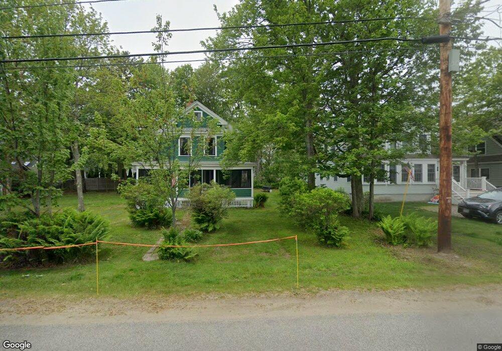
This home is located at 55 Grove St, Wells, ME 04090 and is currently estimated at $1,413,143, approximately $717 per square foot. 55 Grove St is a home located in York County with nearby schools including Wells Junior High School, Wells Elementary School, and Wells High School.
Ownership History
Date
Name
Owned For
Owner Type
Purchase Details
Closed on
Jan 5, 2018
Sold by
Vaillancourt Kevin P and Vaillancourt Meghan H
Bought by
Vitolo Sandra S and Vitolo Michael J
Current Estimated Value
Purchase Details
Closed on
Sep 5, 2006
Sold by
Harrington Leah E and Harrington Daniel J
Bought by
Vaillancourt Meghan H and Vaillancourt Kevin P
Home Financials for this Owner
Home Financials are based on the most recent Mortgage that was taken out on this home.
Original Mortgage
$560,000
Interest Rate
6%
Mortgage Type
Adjustable Rate Mortgage/ARM
Purchase Details
Closed on
Jul 18, 2006
Sold by
Harrington Frances M and Harrington Danie J
Bought by
Harrington Leah E and Harrington Danie J
Home Financials for this Owner
Home Financials are based on the most recent Mortgage that was taken out on this home.
Original Mortgage
$560,000
Interest Rate
6%
Mortgage Type
Adjustable Rate Mortgage/ARM
Create a Home Valuation Report for This Property
The Home Valuation Report is an in-depth analysis detailing your home's value as well as a comparison with similar homes in the area
Home Values in the Area
Average Home Value in this Area
Purchase History
| Date | Buyer | Sale Price | Title Company |
|---|---|---|---|
| Vitolo Sandra S | -- | -- | |
| Vitolo Sandra S | -- | -- | |
| Vaillancourt Meghan H | -- | -- | |
| Vaillancourt Meghan H | -- | -- | |
| Harrington Leah E | -- | -- | |
| Harrington Leah E | -- | -- |
Source: Public Records
Mortgage History
| Date | Status | Borrower | Loan Amount |
|---|---|---|---|
| Previous Owner | Vaillancourt Meghan H | $560,000 | |
| Previous Owner | Vaillancourt Meghan H | $1 | |
| Previous Owner | Harrington Leah E | $600,000 |
Source: Public Records
Tax History Compared to Growth
Tax History
| Year | Tax Paid | Tax Assessment Tax Assessment Total Assessment is a certain percentage of the fair market value that is determined by local assessors to be the total taxable value of land and additions on the property. | Land | Improvement |
|---|---|---|---|---|
| 2024 | $8,798 | $1,447,000 | $1,044,620 | $402,380 |
| 2023 | $8,618 | $1,446,000 | $1,044,620 | $401,380 |
| 2022 | $6,811 | $651,130 | $430,820 | $220,310 |
| 2021 | $6,850 | $651,130 | $430,820 | $220,310 |
| 2020 | $6,824 | $651,130 | $430,820 | $220,310 |
| 2019 | $6,785 | $651,130 | $430,820 | $220,310 |
| 2018 | $6,237 | $631,490 | $430,820 | $200,670 |
| 2017 | $6,416 | $631,490 | $430,820 | $200,670 |
| 2016 | $6,023 | $598,740 | $430,820 | $167,920 |
| 2015 | $5,957 | $598,740 | $430,820 | $167,920 |
| 2013 | $4,978 | $545,870 | $377,950 | $167,920 |
Source: Public Records
Map
Nearby Homes
- 475 Drakes Island Rd
- 163 Island Beach Rd
- 22 Saints Place
- 500 Atlantic Ave Unit 2
- 446 Atlantic Ave
- 9 Robert Ln
- 238 Laudholm Farm Rd
- 1801 Post Rd Unit 143
- 1801 Post Rd Unit 110
- 1830 Post Rd
- 2073 Post Rd Unit 34T
- 2073 Post Rd Unit 5
- 229 Atlantic Ave
- 2090 Post Rd Unit 4B
- 43 Sylvan Way Unit 10
- 54 Blacksmith Rd Unit 11D
- 1733 Post Rd
- 1762 Post Rd Unit 209
- 35 Burnt Mill Rd Unit B
- 23 Chestnut Ln Unit 30