
B
Seller's Agent in 2025
Brittany Saab
Tom Saab Real Estate
(978) 465-5116
1 in this area
36 Total Sales
Estimated Value: $660,139 - $684,000
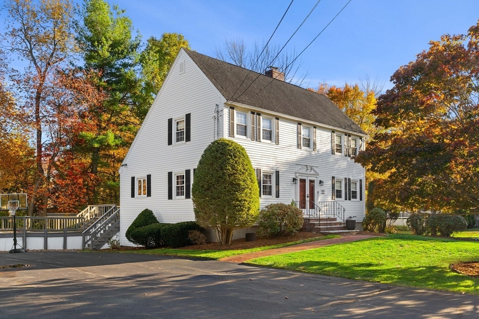
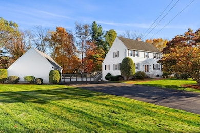
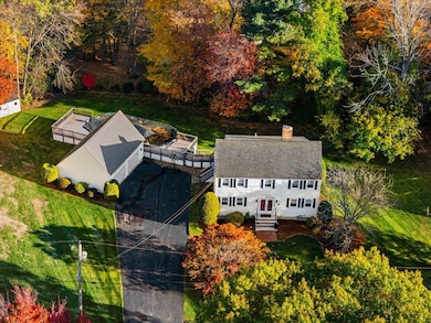
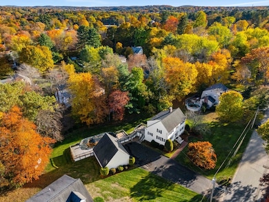
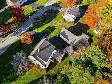
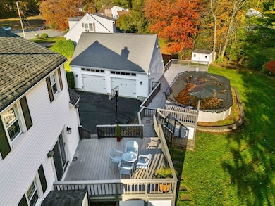
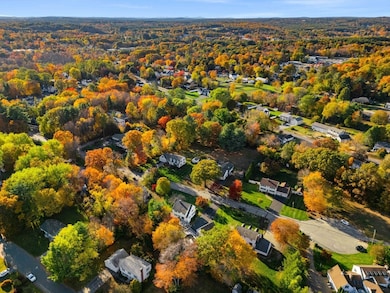
Motivated Seller, with their new home under agreement, has generously adjusted their price. Picturesque, spacious New England home, located towards the end of a cul-de-sac that serves much needed privacy while being right on the Haverhill/Plaistow line, gives quick access to an array of stores and restaurants. 3 bedroom 2.5 bath colonial features unique space with a landing on the 2nd floor, office room,3 rooms in the lower lower level (basement, laundry room, and large heated room with 2 access points) with incredible potential, and a pristine loft above the 2 stall garage. Not to mention an incredible array of yard space, driveway, massive deck, pool, shed, irrigation system, and more charming features. Both turn key and ready for your spruce ups to get you tucked in asap. Limited Showings Schedule from 11/14-11/21:Showings by appointment only for either time blocks on Sat 11/15 11am–1pm or Mon 11/17 from 5pm–6pm. All Buyers must be accompanied by their own Realtor.
| Date | Buyer | Sale Price | Title Company |
|---|---|---|---|
| Tourkantonis Cassandra | $677,000 | -- | |
| Deschamp Lisa M | $427,000 | -- |
| Date | Status | Borrower | Loan Amount |
|---|---|---|---|
| Open | Tourkantonis Cassandra | $620,050 | |
| Previous Owner | Deschamp Lisa M | $20,000 | |
| Previous Owner | Deschamp Lisa M | $341,600 | |
| Previous Owner | Deschamp Lisa M | $102,000 | |
| Previous Owner | Deschamp Lisa M | $150,700 |
| Date | Event | Price | List to Sale | Price per Sq Ft |
|---|---|---|---|---|
| 12/18/2025 12/18/25 | Sold | $677,000 | +0.3% | $260 / Sq Ft |
| 11/18/2025 11/18/25 | Pending | -- | -- | -- |
| 11/13/2025 11/13/25 | Price Changed | $674,900 | -3.6% | $259 / Sq Ft |
| 11/05/2025 11/05/25 | Price Changed | $699,900 | -2.8% | $268 / Sq Ft |
| 10/23/2025 10/23/25 | For Sale | $720,000 | -- | $276 / Sq Ft |
| Year | Tax Paid | Tax Assessment Tax Assessment Total Assessment is a certain percentage of the fair market value that is determined by local assessors to be the total taxable value of land and additions on the property. | Land | Improvement |
|---|---|---|---|---|
| 2025 | $6,392 | $596,800 | $217,100 | $379,700 |
| 2024 | $6,203 | $583,000 | $217,100 | $365,900 |
| 2023 | $5,920 | $530,900 | $195,400 | $335,500 |
| 2022 | $5,671 | $445,800 | $171,900 | $273,900 |
| 2021 | $5,611 | $417,500 | $164,700 | $252,800 |
| 2020 | $5,443 | $400,200 | $153,800 | $246,400 |
| 2019 | $5,305 | $380,300 | $133,900 | $246,400 |
| 2018 | $5,109 | $358,300 | $126,700 | $231,600 |
| 2017 | $5,134 | $342,500 | $123,000 | $219,500 |
| 2016 | $5,027 | $327,300 | $112,200 | $215,100 |
| 2015 | $5,024 | $327,300 | $112,200 | $215,100 |
B
Seller's Agent in 2025
Brittany Saab
Tom Saab Real Estate
(978) 465-5116
1 in this area
36 Total Sales
J
Buyer's Agent in 2025
Janelle Bohan
Real Broker MA, LLC
(978) 755-2545
1 in this area
20 Total Sales
Source: MLS Property Information Network (MLS PIN)
MLS Number: 73447175
APN: HAVE-000635-000005-000016
Disclaimer: Certain information contained herein is derived from information provided by parties other than Homes.com. All information provided is deemed reliable, but is not guaranteed to be accurate and should be independently verified.
![]() The property listing data and information, or the Images, set forth herein were provided to MLS Property Information Network, Inc. from third party sources, including sellers, lessors and public records, and were compiled by MLS Property Information Network, Inc. The property listing data and information, and the Images, are for the personal, non-commercial use of consumers having a good faith interest in purchasing or leasing listed properties of the type displayed to them and may not be used for any purpose other than to identify prospective properties which such consumers may have a good faith interest in purchasing or leasing. MLS Property Information Network, Inc. and its subscribers disclaim any and all representations and warranties as to the accuracy of the property listing data and information, or as to the accuracy of any of the Images, set forth herein.
The property listing data and information, or the Images, set forth herein were provided to MLS Property Information Network, Inc. from third party sources, including sellers, lessors and public records, and were compiled by MLS Property Information Network, Inc. The property listing data and information, and the Images, are for the personal, non-commercial use of consumers having a good faith interest in purchasing or leasing listed properties of the type displayed to them and may not be used for any purpose other than to identify prospective properties which such consumers may have a good faith interest in purchasing or leasing. MLS Property Information Network, Inc. and its subscribers disclaim any and all representations and warranties as to the accuracy of the property listing data and information, or as to the accuracy of any of the Images, set forth herein.
Ask me questions while you tour the home.