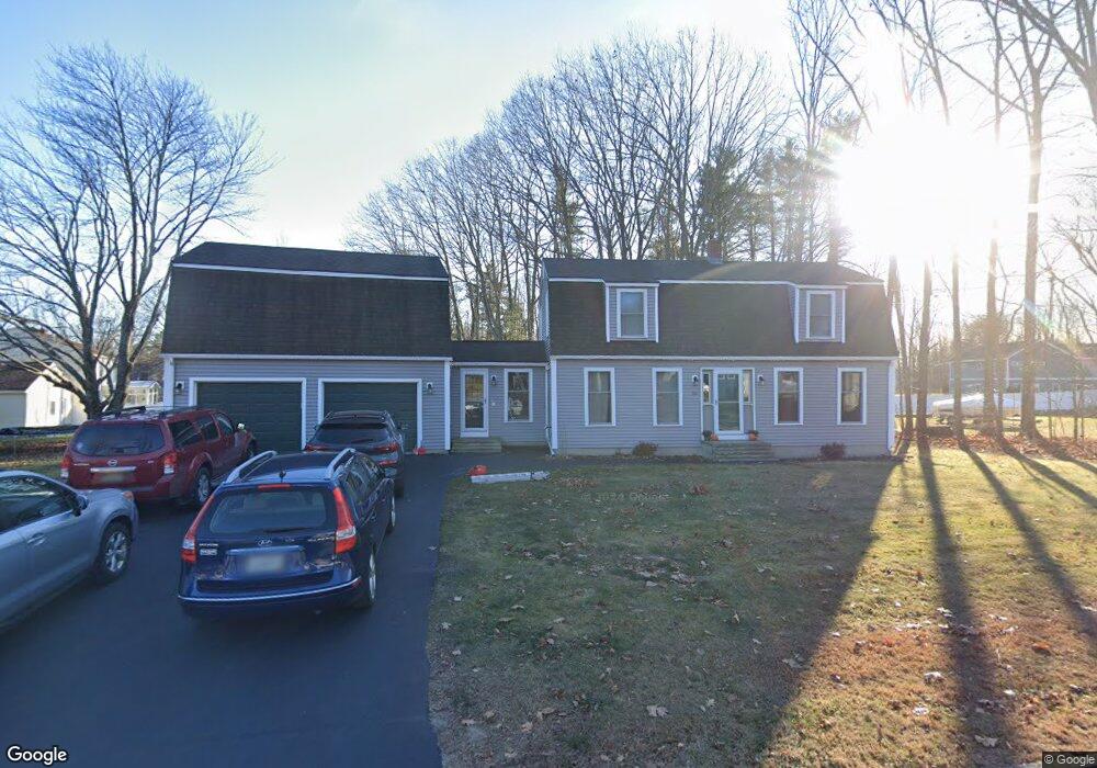
55 Lugrin St Westbrook, ME 04092
Estimated Value: $538,000 - $615,000
3
Beds
2
Baths
1,884
Sq Ft
$304/Sq Ft
Est. Value
About This Home
This home is located at 55 Lugrin St, Westbrook, ME 04092 and is currently estimated at $573,034, approximately $304 per square foot. 55 Lugrin St is a home located in Cumberland County with nearby schools including Westbrook High School, Breakwater School, and St. Brigid School.
Ownership History
Date
Name
Owned For
Owner Type
Purchase Details
Closed on
Aug 6, 2018
Sold by
Gilligan David M and Gilligan Marie E
Bought by
Goddard Jamie H and Goddard Michelle L
Current Estimated Value
Home Financials for this Owner
Home Financials are based on the most recent Mortgage that was taken out on this home.
Original Mortgage
$260,000
Outstanding Balance
$225,799
Interest Rate
4.5%
Mortgage Type
New Conventional
Estimated Equity
$347,235
Purchase Details
Closed on
Jan 26, 2012
Sold by
Mcinnis Elizabeth J
Bought by
Gilligan David M and Gilligan Marie E
Home Financials for this Owner
Home Financials are based on the most recent Mortgage that was taken out on this home.
Original Mortgage
$197,253
Interest Rate
3.94%
Mortgage Type
FHA
Create a Home Valuation Report for This Property
The Home Valuation Report is an in-depth analysis detailing your home's value as well as a comparison with similar homes in the area
Home Values in the Area
Average Home Value in this Area
Purchase History
| Date | Buyer | Sale Price | Title Company |
|---|---|---|---|
| Goddard Jamie H | -- | -- | |
| Gilligan David M | -- | -- |
Source: Public Records
Mortgage History
| Date | Status | Borrower | Loan Amount |
|---|---|---|---|
| Open | Goddard Jamie H | $260,000 | |
| Previous Owner | Gilligan David M | $197,253 |
Source: Public Records
Tax History Compared to Growth
Tax History
| Year | Tax Paid | Tax Assessment Tax Assessment Total Assessment is a certain percentage of the fair market value that is determined by local assessors to be the total taxable value of land and additions on the property. | Land | Improvement |
|---|---|---|---|---|
| 2023 | $5,961 | $357,400 | $90,100 | $267,300 |
| 2022 | $5,405 | $298,600 | $75,000 | $223,600 |
| 2021 | $5,324 | $298,600 | $75,000 | $223,600 |
| 2020 | $5,333 | $298,600 | $75,000 | $223,600 |
| 2019 | $5,333 | $298,600 | $75,000 | $223,600 |
| 2018 | $4,886 | $244,900 | $65,200 | $179,700 |
| 2017 | $4,624 | $244,900 | $65,200 | $179,700 |
| 2016 | $4,506 | $244,900 | $65,200 | $179,700 |
| 2015 | $4,398 | $244,900 | $65,200 | $179,700 |
| 2014 | $4,212 | $244,900 | $65,200 | $179,700 |
| 2013 | $4,212 | $244,900 | $65,200 | $179,700 |
Source: Public Records
Map
Nearby Homes
- 55 Lugrin St
- 51 Lugrin St
- 65 Lugrin St
- 65 Lugrin Street Extension
- 58 Lugrin Street Extension
- 2 Alberta Dr
- 45 Lugrin St
- 48 Lugrin St
- Lot 4 Grayce's Way
- Lot 5 Grayce's Way
- TBD Melody Ln
- 536 Riverside St
- Lot 32 Clearwater Unit 32
- Lot 30 Clearwater Dr Unit 30
- Lot 29 Clearwater Dr Unit 29
- Lot 28 Clearwater Dr Unit 28
- Lot 33 Clearwater Dr
- Lot 22 Presumpscot Estates Unit 22
- Lot 34 Presumpscot Estates
- Lot 34 Presumpscot Estates Unit 34