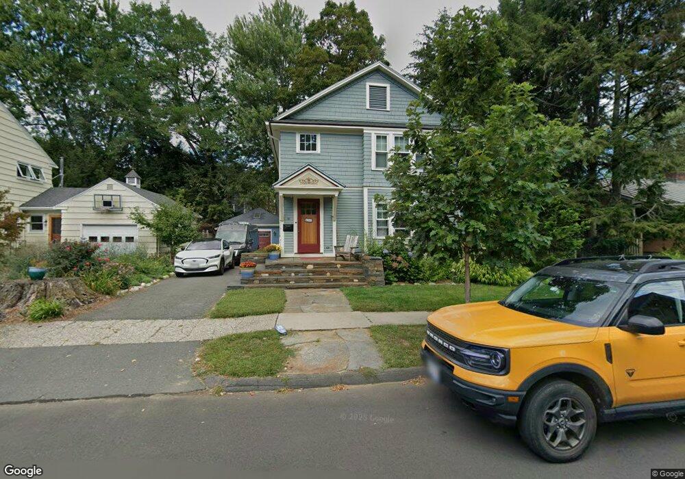
55 Maynard Rd Northampton, MA 01060
Estimated Value: $1,088,749 - $1,140,000
6
Beds
3
Baths
2,860
Sq Ft
$390/Sq Ft
Est. Value
About This Home
This home is located at 55 Maynard Rd, Northampton, MA 01060 and is currently estimated at $1,116,250, approximately $390 per square foot. 55 Maynard Rd is a home located in Hampshire County with nearby schools including Northampton High School, Hilltown Cooperative Charter Public School, and The Montessori School of Northampton.
Ownership History
Date
Name
Owned For
Owner Type
Purchase Details
Closed on
Sep 26, 2001
Sold by
Fisher-Katz Diane
Bought by
Glading Dilorenzo Joann G and Glading Dilorenzo Lisa
Current Estimated Value
Purchase Details
Closed on
Dec 30, 1992
Sold by
Lugar Denis A and Dyer Daniel Joseph
Bought by
Fisher Leslie R and Katz Diane E
Create a Home Valuation Report for This Property
The Home Valuation Report is an in-depth analysis detailing your home's value as well as a comparison with similar homes in the area
Home Values in the Area
Average Home Value in this Area
Purchase History
| Date | Buyer | Sale Price | Title Company |
|---|---|---|---|
| Glading Dilorenzo Joann G | $75,000 | -- | |
| Fisher Leslie R | $205,000 | -- |
Source: Public Records
Mortgage History
| Date | Status | Borrower | Loan Amount |
|---|---|---|---|
| Open | Fisher Leslie R | $50,000 | |
| Open | Fisher Leslie R | $378,750 | |
| Closed | Fisher Leslie R | $59,800 |
Source: Public Records
Tax History
| Year | Tax Paid | Tax Assessment Tax Assessment Total Assessment is a certain percentage of the fair market value that is determined by local assessors to be the total taxable value of land and additions on the property. | Land | Improvement |
|---|---|---|---|---|
| 2025 | $13,011 | $934,000 | $312,100 | $621,900 |
| 2024 | $12,567 | $827,300 | $312,100 | $515,200 |
| 2023 | $11,441 | $722,300 | $312,100 | $410,200 |
| 2022 | $10,716 | $599,000 | $291,700 | $307,300 |
| 2021 | $10,182 | $586,200 | $277,900 | $308,300 |
| 2020 | $9,848 | $586,200 | $277,900 | $308,300 |
| 2019 | $9,130 | $525,600 | $245,000 | $280,600 |
| 2018 | $8,978 | $526,900 | $245,000 | $281,900 |
| 2017 | $8,794 | $526,900 | $245,000 | $281,900 |
| 2016 | $8,515 | $526,900 | $245,000 | $281,900 |
| 2015 | $8,891 | $562,700 | $245,000 | $317,700 |
| 2014 | $8,660 | $562,700 | $245,000 | $317,700 |
Source: Public Records
Map
Nearby Homes
- 61 Harrison Ave
- 218 Elm St
- 14 Arlington St
- 61 Woodlawn Ave
- 63 Riverside Dr
- 23 Ford Crossing
- 61 Crescent St Unit 8
- 61 Crescent St Unit 7
- 37 Finn St
- 43 Center St Unit K
- 244 Main St
- 12 School St
- 48 Chapel St Unit A
- 0 Terrace Ln
- 9 Walnut St Unit B
- 30 Cherry St
- 29 Pleasant St Unit 1
- 283 South St
- 30 Graves Ave Unit B
- 50 Union St Unit 18