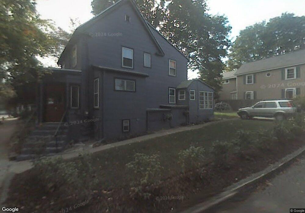
55 Murray Rd West Newton, MA 02465
Auburndale NeighborhoodEstimated Value: $756,575 - $945,000
3
Beds
3
Baths
1,242
Sq Ft
$680/Sq Ft
Est. Value
About This Home
This home is located at 55 Murray Rd, West Newton, MA 02465 and is currently estimated at $844,894, approximately $680 per square foot. 55 Murray Rd is a home located in Middlesex County with nearby schools including C.C. Burr, F.A. Day Middle School, and Newton North High School.
Ownership History
Date
Name
Owned For
Owner Type
Purchase Details
Closed on
Sep 13, 2022
Sold by
Fisher Lisa H
Bought by
55 Murray Road Rt
Current Estimated Value
Purchase Details
Closed on
Aug 7, 2007
Sold by
Hoagland Sandra
Bought by
Fisher Lisa H
Purchase Details
Closed on
May 24, 2007
Sold by
Butler Marcia A and Bourgeois Mary J
Bought by
Fisher Lisa H and Hoagland Sandra
Home Financials for this Owner
Home Financials are based on the most recent Mortgage that was taken out on this home.
Original Mortgage
$264,000
Interest Rate
6.27%
Mortgage Type
Purchase Money Mortgage
Purchase Details
Closed on
Mar 29, 2007
Sold by
Bourgeois Gary F
Bought by
Bourgeois William and Butler Marcia A
Home Financials for this Owner
Home Financials are based on the most recent Mortgage that was taken out on this home.
Original Mortgage
$264,000
Interest Rate
6.27%
Mortgage Type
Purchase Money Mortgage
Create a Home Valuation Report for This Property
The Home Valuation Report is an in-depth analysis detailing your home's value as well as a comparison with similar homes in the area
Home Values in the Area
Average Home Value in this Area
Purchase History
| Date | Buyer | Sale Price | Title Company |
|---|---|---|---|
| 55 Murray Road Rt | -- | None Available | |
| Fisher Lisa H | -- | -- | |
| Fisher Lisa H | $330,000 | -- | |
| Bourgeois William | -- | -- |
Source: Public Records
Mortgage History
| Date | Status | Borrower | Loan Amount |
|---|---|---|---|
| Previous Owner | Fisher Lisa H | $264,000 |
Source: Public Records
Tax History Compared to Growth
Tax History
| Year | Tax Paid | Tax Assessment Tax Assessment Total Assessment is a certain percentage of the fair market value that is determined by local assessors to be the total taxable value of land and additions on the property. | Land | Improvement |
|---|---|---|---|---|
| 2025 | $5,611 | $572,500 | $0 | $0 |
| 2024 | $5,425 | $0 | $0 | $0 |
| 2023 | $5,110 | $502,000 | $0 | $0 |
| 2022 | $4,890 | $464,800 | $464,800 | $0 |
| 2021 | $4,718 | $438,500 | $438,500 | $0 |
| 2020 | $4,578 | $438,500 | $438,500 | $0 |
| 2019 | $4,449 | $425,700 | $0 | $0 |
| 2018 | $4,334 | $400,600 | $0 | $0 |
| 2017 | $4,224 | $379,900 | $0 | $0 |
| 2016 | $4,040 | $355,000 | $0 | $0 |
| 2015 | $3,852 | $331,800 | $331,800 | $0 |
Source: Public Records
Map
Nearby Homes
- 17 Crescent St
- 10 Crescent St Unit 1
- 10 Crescent St Unit 2
- 62-64 Rowe St Unit B
- 160 Pine St Unit 12
- 90 Auburndale Ave
- 13 Weir St
- 0 Duncan Rd Unit 72925240
- 42 Evergreen Cir
- 51 Bourne St
- 33 Lill Ave
- 17 Gilbert St
- 1488 Washington St Unit 1488
- 212 River St Unit 2
- 226 Auburn St Unit 226
- 224 Auburn St Unit 224
- 224 Auburn St Unit A
- 2 Elm St Unit 6
- 2 Elm St Unit 8
- 106 River St Unit 18
- 57 Murray Rd
- 8 Murray Terrace
- 45 Murray Rd
- 50 Murray Rd
- 261 Webster St
- 14 Murray Terrace Unit 14
- 14 Murray Terrace Unit 16
- 14 Murray Terrace Unit 2
- 14-16 Murray Terrace
- 257 Webster St Unit 259
- 263 Webster St
- 263 Webster St
- 13 Murray Terrace
- 259 Webster St Unit 1
- 269 Webster St
- 9 Larkin Rd
- 251 Webster St
- 251 Webster St Unit 1
- 251 Webster St Unit 2
- 8 Larkin Rd