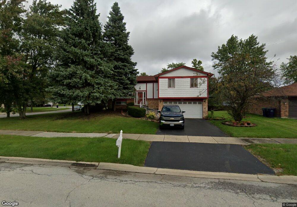
55 Oakview Rd Matteson, IL 60443
West Matteson NeighborhoodEstimated Value: $280,000 - $347,000
4
Beds
4
Baths
2,249
Sq Ft
$145/Sq Ft
Est. Value
About This Home
This home is located at 55 Oakview Rd, Matteson, IL 60443 and is currently estimated at $325,705, approximately $144 per square foot. 55 Oakview Rd is a home located in Cook County with nearby schools including Colin Powell Middle School.
Ownership History
Date
Name
Owned For
Owner Type
Purchase Details
Closed on
Feb 14, 2005
Sold by
Scott Larry V
Bought by
Scott Veronica
Current Estimated Value
Purchase Details
Closed on
May 11, 1995
Sold by
Bearden Tyrone
Bought by
Scott Larry V and Scott Veronica
Home Financials for this Owner
Home Financials are based on the most recent Mortgage that was taken out on this home.
Original Mortgage
$107,350
Interest Rate
8.25%
Purchase Details
Closed on
Dec 23, 1994
Sold by
Bearden Kathleen M
Bought by
Bearden Tyrone
Create a Home Valuation Report for This Property
The Home Valuation Report is an in-depth analysis detailing your home's value as well as a comparison with similar homes in the area
Home Values in the Area
Average Home Value in this Area
Purchase History
| Date | Buyer | Sale Price | Title Company |
|---|---|---|---|
| Scott Veronica | -- | -- | |
| Scott Larry V | $113,000 | -- | |
| Bearden Tyrone | -- | -- |
Source: Public Records
Mortgage History
| Date | Status | Borrower | Loan Amount |
|---|---|---|---|
| Closed | Scott Larry V | $107,350 |
Source: Public Records
Tax History Compared to Growth
Tax History
| Year | Tax Paid | Tax Assessment Tax Assessment Total Assessment is a certain percentage of the fair market value that is determined by local assessors to be the total taxable value of land and additions on the property. | Land | Improvement |
|---|---|---|---|---|
| 2024 | $7,889 | $25,000 | $4,506 | $20,494 |
| 2023 | $2,531 | $25,000 | $4,506 | $20,494 |
| 2022 | $2,531 | $16,380 | $3,942 | $12,438 |
| 2021 | $2,488 | $16,379 | $3,942 | $12,437 |
| 2020 | $2,239 | $16,379 | $3,942 | $12,437 |
| 2019 | $2,590 | $16,775 | $3,660 | $13,115 |
| 2018 | $2,556 | $16,775 | $3,660 | $13,115 |
| 2017 | $2,442 | $16,775 | $3,660 | $13,115 |
| 2016 | $3,956 | $11,925 | $3,379 | $8,546 |
| 2015 | $4,727 | $11,925 | $3,379 | $8,546 |
| 2014 | $5,686 | $14,071 | $3,379 | $10,692 |
| 2013 | $5,586 | $14,771 | $3,379 | $11,392 |
Source: Public Records
Map
Nearby Homes
- 50 Oakhurst Rd
- 25 Pheasant Rd
- 111 Deerpath Rd
- 5911 Timberlane Rd
- 116 Cloverleaf Rd
- 123 Oriole Rd
- 13 Oakview Rd
- 42 Pheasant Rd
- 5838 Woodgate Dr
- 217 Oriole Rd
- 5808 Allemong Dr
- 50 Willow Rd
- 5628 Crestwood Rd
- 5629 Crestwood Rd
- 10 Wedgewood Rd
- 255 Central Ave
- 322 Central Ave
- 6021 Spring Ln
- 433 Wheatfield Rd
- 6226 Beechwood Rd