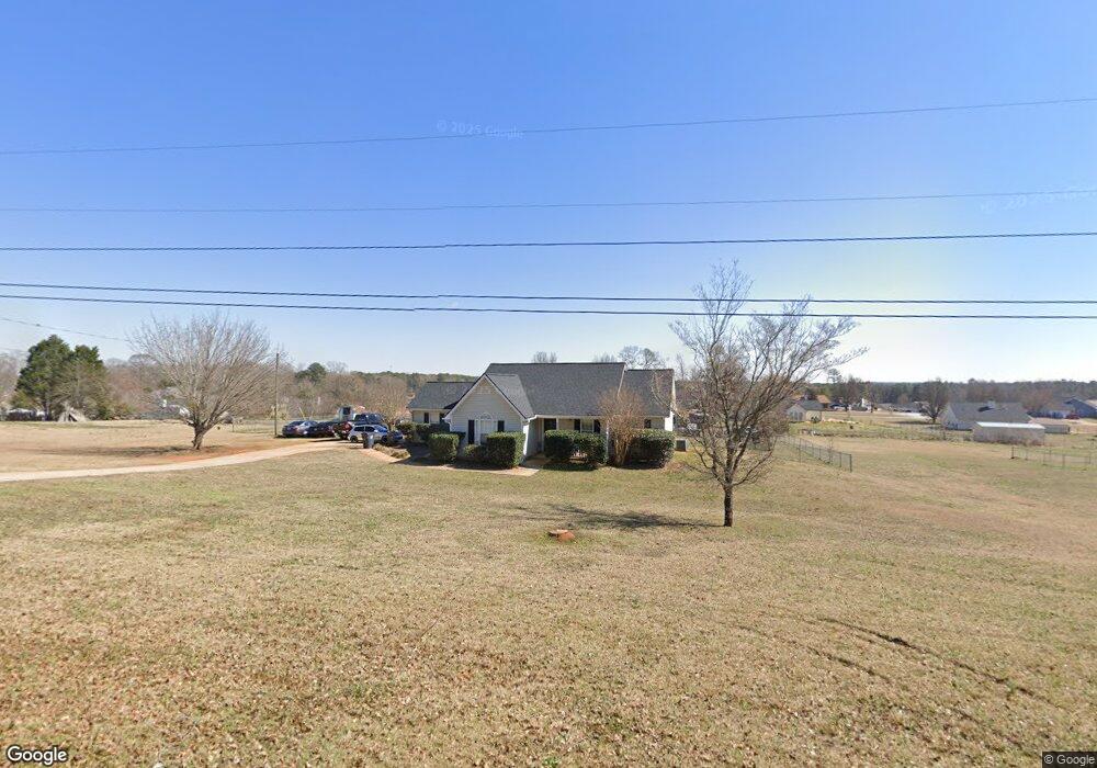
55 S Barnes Dr Locust Grove, GA 30248
Estimated Value: $241,000 - $268,000
3
Beds
2
Baths
1,323
Sq Ft
$194/Sq Ft
Est. Value
About This Home
This home is located at 55 S Barnes Dr, Locust Grove, GA 30248 and is currently estimated at $256,696, approximately $194 per square foot. 55 S Barnes Dr is a home located in Henry County with nearby schools including Locust Grove Elementary School, Locust Grove Middle School, and Locust Grove High School.
Ownership History
Date
Name
Owned For
Owner Type
Purchase Details
Closed on
Sep 24, 2018
Sold by
Cain Ryan T
Bought by
Bryant Courtney and Hill Logan
Current Estimated Value
Home Financials for this Owner
Home Financials are based on the most recent Mortgage that was taken out on this home.
Original Mortgage
$135,499
Outstanding Balance
$117,920
Interest Rate
4.5%
Mortgage Type
VA
Estimated Equity
$138,776
Purchase Details
Closed on
Apr 30, 2010
Sold by
Baker Bryan D and Baker Michelle D
Bought by
Cain Ryan T
Home Financials for this Owner
Home Financials are based on the most recent Mortgage that was taken out on this home.
Original Mortgage
$104,080
Interest Rate
5.25%
Mortgage Type
FHA
Purchase Details
Closed on
Aug 14, 1997
Sold by
Bunn Andrew Carey
Bought by
Baker Bryan D and Morton Michelle D
Home Financials for this Owner
Home Financials are based on the most recent Mortgage that was taken out on this home.
Original Mortgage
$79,601
Interest Rate
7.52%
Mortgage Type
FHA
Create a Home Valuation Report for This Property
The Home Valuation Report is an in-depth analysis detailing your home's value as well as a comparison with similar homes in the area
Home Values in the Area
Average Home Value in this Area
Purchase History
| Date | Buyer | Sale Price | Title Company |
|---|---|---|---|
| Bryant Courtney | $138,000 | -- | |
| Cain Ryan T | $106,000 | -- | |
| Baker Bryan D | $86,500 | -- |
Source: Public Records
Mortgage History
| Date | Status | Borrower | Loan Amount |
|---|---|---|---|
| Open | Bryant Courtney | $135,499 | |
| Previous Owner | Cain Ryan T | $104,080 | |
| Previous Owner | Baker Bryan D | $79,601 |
Source: Public Records
Tax History Compared to Growth
Tax History
| Year | Tax Paid | Tax Assessment Tax Assessment Total Assessment is a certain percentage of the fair market value that is determined by local assessors to be the total taxable value of land and additions on the property. | Land | Improvement |
|---|---|---|---|---|
| 2025 | $3,943 | $101,120 | $15,240 | $85,880 |
| 2024 | $3,943 | $100,600 | $13,880 | $86,720 |
| 2023 | $3,505 | $96,560 | $13,360 | $83,200 |
| 2022 | $2,626 | $71,600 | $12,320 | $59,280 |
| 2021 | $2,232 | $60,600 | $10,600 | $50,000 |
| 2020 | $1,996 | $54,080 | $9,960 | $44,120 |
| 2019 | $1,933 | $51,480 | $9,440 | $42,040 |
| 2018 | $0 | $43,960 | $8,720 | $35,240 |
| 2016 | $1,395 | $35,320 | $6,480 | $28,840 |
| 2015 | $1,291 | $31,640 | $7,320 | $24,320 |
| 2014 | $1,129 | $27,200 | $7,320 | $19,880 |
Source: Public Records
Map
Nearby Homes
- 143 Massey Ln
- 231 Ferguson Ave
- 239 Ferguson Ave
- 4 Skyland Dr W
- 1064 Lear Dr
- 501 Grove Park Dr
- 565 Carleton Place
- 50 Grove Rd
- 65 Grove Creek Dr
- 36 Highpoint Ln
- 1537 Jackson St
- 155 Skyland Dr E
- 26 Skyland Dr W
- 0 Locust Rd Unit 10495072
- 0 Locust Rd Unit 19967321
- 0 Jackson St Unit 10554689
- 176 Rockwood Ln
- 149 Pristine Dr
- 878 Jackson St
- 1119 Saint Phillips Ct
- S S Barnes Dr
- 57 S Barnes Dr
- 53 S Barnes Dr
- 108 Massey Ln
- 66 S Barnes Dr
- 112 Massey Ln
- 106 Massey Ln
- 59 S Barnes Dr
- 114 Massey Ln
- 46 S Barnes Dr
- 104 Massey Ln
- 33 S Barnes Dr
- 129 Barnes Dr
- 0 Massey Ln Unit 7226707
- 0 Massey Ln Unit 7148644
- 140 Barnes Dr
- 116 Massey Ln
- 22 S Barnes Dr
- 96 S Barnes Dr
- 102 Massey Ln