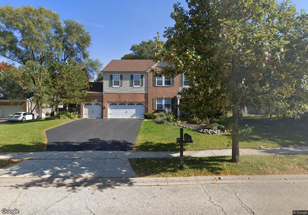
55 S Oakleaf Rd Algonquin, IL 60102
Estimated Value: $461,131 - $545,000
4
Beds
4
Baths
3,190
Sq Ft
$158/Sq Ft
Est. Value
About This Home
This home is located at 55 S Oakleaf Rd, Algonquin, IL 60102 and is currently estimated at $502,783, approximately $157 per square foot. 55 S Oakleaf Rd is a home located in McHenry County with nearby schools including Westfield Community School, Lincoln Prairie Elementary School, and Harry D Jacobs High School.
Ownership History
Date
Name
Owned For
Owner Type
Purchase Details
Closed on
Oct 5, 2016
Sold by
Atadero Arsenio D and Atadero Jennifer A
Bought by
Atadero Arsenio D and Atadero Jennifer A
Current Estimated Value
Purchase Details
Closed on
Dec 14, 1998
Sold by
Kennedy Group Ltd Partnership
Bought by
Atadero Arsenio D and Atadero Jennifer A
Home Financials for this Owner
Home Financials are based on the most recent Mortgage that was taken out on this home.
Original Mortgage
$268,300
Interest Rate
6.95%
Create a Home Valuation Report for This Property
The Home Valuation Report is an in-depth analysis detailing your home's value as well as a comparison with similar homes in the area
Purchase History
| Date | Buyer | Sale Price | Title Company |
|---|---|---|---|
| Atadero Arsenio D | -- | None Available | |
| Atadero Arsenio D | $282,500 | -- |
Source: Public Records
Mortgage History
| Date | Status | Borrower | Loan Amount |
|---|---|---|---|
| Previous Owner | Atadero Arsenio D | $268,300 |
Source: Public Records
Tax History
| Year | Tax Paid | Tax Assessment Tax Assessment Total Assessment is a certain percentage of the fair market value that is determined by local assessors to be the total taxable value of land and additions on the property. | Land | Improvement |
|---|---|---|---|---|
| 2024 | $10,828 | $146,414 | $27,819 | $118,595 |
| 2023 | $10,292 | $130,949 | $24,881 | $106,068 |
| 2022 | $9,849 | $120,850 | $27,811 | $93,039 |
| 2021 | $9,458 | $112,586 | $25,909 | $86,677 |
| 2020 | $9,213 | $108,601 | $24,992 | $83,609 |
| 2019 | $11,333 | $129,417 | $23,920 | $105,497 |
| 2018 | $11,551 | $127,185 | $23,507 | $103,678 |
| 2017 | $11,334 | $119,816 | $22,145 | $97,671 |
| 2016 | $11,186 | $112,377 | $20,770 | $91,607 |
| 2013 | -- | $98,884 | $19,376 | $79,508 |
Source: Public Records
Map
Nearby Homes
- 145 S Oakleaf Rd
- 7 Falcon Ridge Ct
- 14 Wander Way
- 101 Oakleaf Rd
- 113 Pheasant Trail
- 1920 Jester Ln
- 135 Arquilla Dr
- 681 Majestic Dr
- 2380 Dawson Ln Unit 165
- 1431 Essex St
- 700 Fairfield Ln
- 760 Regal Ln
- 74 Harvest Gate
- LOT 3 Blackhawk Dr
- 1354 Essex St Unit 2
- 1820 Crofton Dr
- 1157 Sawmill Ln
- 13 Brian Ct
- 521 Pawnee Dr
- 187 Hilltop Dr
- 45 S Oakleaf Rd
- 65 S Oakleaf Rd Unit 2
- 6 Salford Ct
- 4 Salford Ct Unit 2
- 50 S Oakleaf Rd
- 35 S Oakleaf Rd
- 60 S Oakleaf Rd
- 40 S Oakleaf Rd
- 8 Salford Ct
- 2 Salford Ct
- 30 S Oakleaf Rd Unit 2
- 3 Oakleaf Ct
- 1 Oakleaf Ct
- 70 S Oakleaf Rd
- 20 S Oakleaf Rd
- 3 Salford Ct
- 5 Salford Ct
- 80 S Oakleaf Rd
- 85 S Oakleaf Rd
- 10 S Oakleaf Rd
Your Personal Tour Guide
Ask me questions while you tour the home.