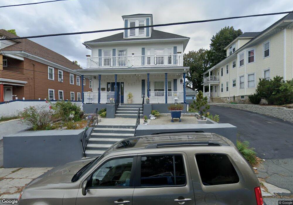
55 Saunders St Lawrence, MA 01841
Arlington NeighborhoodEstimated Value: $589,000 - $968,000
6
Beds
2
Baths
3,652
Sq Ft
$216/Sq Ft
Est. Value
About This Home
This home is located at 55 Saunders St, Lawrence, MA 01841 and is currently estimated at $788,403, approximately $215 per square foot. 55 Saunders St is a home located in Essex County with nearby schools including School For Exceptional Studies and Central Catholic High School.
Ownership History
Date
Name
Owned For
Owner Type
Purchase Details
Closed on
Jan 2, 2001
Sold by
Perez Luis
Bought by
Pena Francisco A
Current Estimated Value
Purchase Details
Closed on
Jan 2, 1990
Sold by
Horan John V
Bought by
Perez Luis
Purchase Details
Closed on
Mar 3, 1987
Sold by
Sheehy Margaret A
Bought by
Horan John
Create a Home Valuation Report for This Property
The Home Valuation Report is an in-depth analysis detailing your home's value as well as a comparison with similar homes in the area
Home Values in the Area
Average Home Value in this Area
Purchase History
| Date | Buyer | Sale Price | Title Company |
|---|---|---|---|
| Pena Francisco A | $154,000 | -- | |
| Perez Luis | $126,000 | -- | |
| Horan John | $139,900 | -- |
Source: Public Records
Mortgage History
| Date | Status | Borrower | Loan Amount |
|---|---|---|---|
| Open | Horan John | $165,000 | |
| Closed | Horan John | $85,000 | |
| Closed | Horan John | $121,000 |
Source: Public Records
Tax History
| Year | Tax Paid | Tax Assessment Tax Assessment Total Assessment is a certain percentage of the fair market value that is determined by local assessors to be the total taxable value of land and additions on the property. | Land | Improvement |
|---|---|---|---|---|
| 2025 | $6,727 | $764,400 | $120,300 | $644,100 |
| 2024 | $6,399 | $691,800 | $126,400 | $565,400 |
| 2023 | $6,627 | $652,300 | $122,000 | $530,300 |
| 2022 | $6,326 | $553,000 | $115,100 | $437,900 |
| 2021 | $6,152 | $501,400 | $115,100 | $386,300 |
| 2020 | $5,413 | $435,500 | $95,900 | $339,600 |
| 2019 | $5,111 | $373,600 | $71,300 | $302,300 |
| 2018 | $4,913 | $343,100 | $64,600 | $278,500 |
| 2017 | $4,410 | $287,500 | $61,200 | $226,300 |
| 2016 | $4,164 | $268,500 | $47,800 | $220,700 |
| 2015 | $3,993 | $264,100 | $47,800 | $216,300 |
Source: Public Records
Map
Nearby Homes
- 129-131 Lexington St
- 131A Lawrence St Unit 40
- 7-9 Bennington St
- 192 Union St
- 434-438 Hampshire St
- 25-27 Bicknell Ave
- 89 Newbury St Unit 89B
- 80-82 Haverhill St
- 27 Willow St Unit A
- 14 Court St
- 11 Lawrence St Unit 606
- 82 Oakside Ave
- 39 Swan Ave
- 10 Holly St
- 46 Amesbury St Unit 2B
- 97 Kenwood Rd
- 324-326 Broadway
- 29 Center St
- 36 Manchester St
- 12 Annette St
- 49 Saunders St Unit 51
- 49-51 Saunders St
- 16 Arlitt Ct
- 46 Thorndike St Unit 48
- 50 Thorndike St
- 14 Arlitt Ct
- 44 Thorndike St
- 44 Thorndike St Unit 1
- 30 Saunders St
- 58 Thorndike St
- 46 Saunders St
- 48 Saunders St Unit 50
- 48-50 Saunders St
- 37 Saunders St Unit 39
- 54 Saunders St Unit 56
- 62 Thorndike St
- 23 Monmouth St
- 4 Arlitt Ct
- 15 Monmouth St
- 49 Thorndike St
Your Personal Tour Guide
Ask me questions while you tour the home.