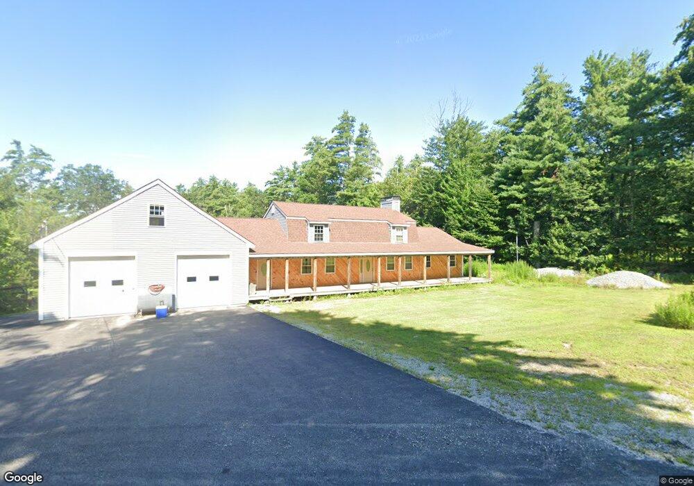
55 Stark Hwy S Dunbarton, NH 03046
Estimated Value: $515,585 - $635,000
3
Beds
3
Baths
2,345
Sq Ft
$254/Sq Ft
Est. Value
About This Home
This home is located at 55 Stark Hwy S, Dunbarton, NH 03046 and is currently estimated at $596,146, approximately $254 per square foot. 55 Stark Hwy S is a home located in Merrimack County with nearby schools including Dunbarton Elementary School, Bow Memorial School, and Bow High School.
Create a Home Valuation Report for This Property
The Home Valuation Report is an in-depth analysis detailing your home's value as well as a comparison with similar homes in the area
Home Values in the Area
Average Home Value in this Area
Tax History Compared to Growth
Tax History
| Year | Tax Paid | Tax Assessment Tax Assessment Total Assessment is a certain percentage of the fair market value that is determined by local assessors to be the total taxable value of land and additions on the property. | Land | Improvement |
|---|---|---|---|---|
| 2024 | $7,932 | $300,700 | $64,800 | $235,900 |
| 2023 | $7,689 | $300,700 | $64,800 | $235,900 |
| 2022 | $6,910 | $300,700 | $64,800 | $235,900 |
| 2021 | $7,039 | $300,700 | $64,800 | $235,900 |
| 2020 | $6,700 | $300,700 | $64,800 | $235,900 |
| 2018 | $5,157 | $228,900 | $56,900 | $172,000 |
| 2017 | $5,278 | $206,100 | $56,900 | $149,200 |
| 2016 | $4,676 | $195,000 | $56,900 | $138,100 |
| 2015 | $4,600 | $195,000 | $56,900 | $138,100 |
| 2014 | $4,376 | $207,000 | $56,900 | $150,100 |
| 2013 | $4,349 | $207,000 | $56,900 | $150,100 |
Source: Public Records
Map
Nearby Homes
- 15 Robert Rogers Rd
- 1003 School St
- 49 Stark Hwy N
- 78 Rangeway Rd
- 3 Stephanie Rd
- 0 Fairway Dr Unit 11
- 22 Fairway Dr
- 43 Sterling Place
- 849 River Rd
- 1 Hop Kiln Rd
- 70 Gile Hill Rd
- 104 Brown Hill Rd
- 250 Grapevine Rd
- 0 Brown Hill Rd Unit 5032600
- 0 Huntington Hill Rd Unit 69
- 5 Longview Dr
- 8 Longview Dr
- 602 Black Brook Rd
- 40 N Woods Rd
- 57 Lyndsey Ln