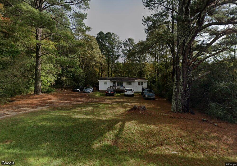
55 Stewart Rd Lagrange, GA 30241
Estimated Value: $95,520 - $161,000
2
Beds
1
Bath
880
Sq Ft
$150/Sq Ft
Est. Value
About This Home
This home is located at 55 Stewart Rd, Lagrange, GA 30241 and is currently estimated at $132,130, approximately $150 per square foot. 55 Stewart Rd is a home with nearby schools including Callaway Elementary School, Hogansville Elementary School, and Callaway Middle School.
Ownership History
Date
Name
Owned For
Owner Type
Purchase Details
Closed on
Jun 1, 2021
Sold by
Stribling Ty
Bought by
T Squared 1 Llc
Current Estimated Value
Purchase Details
Closed on
Oct 13, 2003
Sold by
Martin J Miller
Bought by
Stribling Ty
Purchase Details
Closed on
May 11, 1995
Sold by
John J Ormsby
Bought by
Martin J Miller
Purchase Details
Closed on
Mar 1, 1989
Bought by
John J Ormsby
Purchase Details
Closed on
Oct 18, 1988
Purchase Details
Closed on
Jan 1, 1973
Purchase Details
Closed on
Jan 1, 1972
Purchase Details
Closed on
Jan 1, 1966
Create a Home Valuation Report for This Property
The Home Valuation Report is an in-depth analysis detailing your home's value as well as a comparison with similar homes in the area
Purchase History
| Date | Buyer | Sale Price | Title Company |
|---|---|---|---|
| T Squared 1 Llc | -- | -- | |
| Stribling Ty | $1,181,000 | -- | |
| Martin J Miller | -- | -- | |
| John J Ormsby | -- | -- | |
| -- | $13,500 | -- | |
| -- | $13,500 | -- | |
| -- | -- | -- | |
| -- | -- | -- | |
| -- | -- | -- |
Source: Public Records
Tax History
| Year | Tax Paid | Tax Assessment Tax Assessment Total Assessment is a certain percentage of the fair market value that is determined by local assessors to be the total taxable value of land and additions on the property. | Land | Improvement |
|---|---|---|---|---|
| 2025 | $482 | $17,668 | $2,160 | $15,508 |
| 2024 | $461 | $16,908 | $2,160 | $14,748 |
| 2023 | $316 | $11,604 | $2,160 | $9,444 |
| 2022 | $299 | $10,724 | $1,720 | $9,004 |
| 2021 | $237 | $7,856 | $1,360 | $6,496 |
| 2020 | $237 | $7,856 | $1,360 | $6,496 |
| 2019 | $226 | $7,496 | $1,080 | $6,416 |
| 2018 | $226 | $7,496 | $1,080 | $6,416 |
| 2017 | $226 | $7,496 | $1,080 | $6,416 |
| 2016 | $220 | $7,310 | $1,023 | $6,287 |
| 2015 | $221 | $7,310 | $1,023 | $6,287 |
| 2014 | $221 | $7,310 | $1,023 | $6,287 |
| 2013 | -- | $10,747 | $1,364 | $9,383 |
Source: Public Records
Map
Nearby Homes
- 91 Almond Rd
- 453 E Mount Zion Church Rd
- 2477 Upper Big Springs Rd
- 425 Mount Zion Church Rd
- 100 Dove Creek Ct
- 56 John Lovelace Rd
- 86 John Lovelace Rd
- 90 Beaver Run
- 123 Wexford Dr
- 142 Carr Rd
- 200 River Meadow Dr
- 113 Pine Cir
- 300 Glenhaven Dr Unit 1D
- 125 Hazel Way
- 302 Glenhaven Dr Unit 2D
- 503 Headwater Ct Unit 4D
- 156 Pine Cir
- 507 Headwater Ct Unit 6
- 502 Headwater Ct Unit 8D
- 129 Mallory Dr
- 65 Stewart Rd
- 57 Stewart Rd
- 38 Stewart Rd
- 83 Stewart Rd
- 74 Stewart Rd
- 97 Stewart Rd
- 2423 Greenville Rd
- 2464 Greenville Rd
- 120 Stewart Rd
- 142 Stewart Rd
- 2508 Greenville Rd
- 166 Stewart Rd
- 2520 Greenville Rd
- 2266 Greenville Rd
- 171 Stewart Rd
- 2538 Greenville Rd
- 219 Stewart Rd
- 2236 Greenville Rd
- 2560 Greenville Rd
- 1 Towns Rd
Your Personal Tour Guide
Ask me questions while you tour the home.