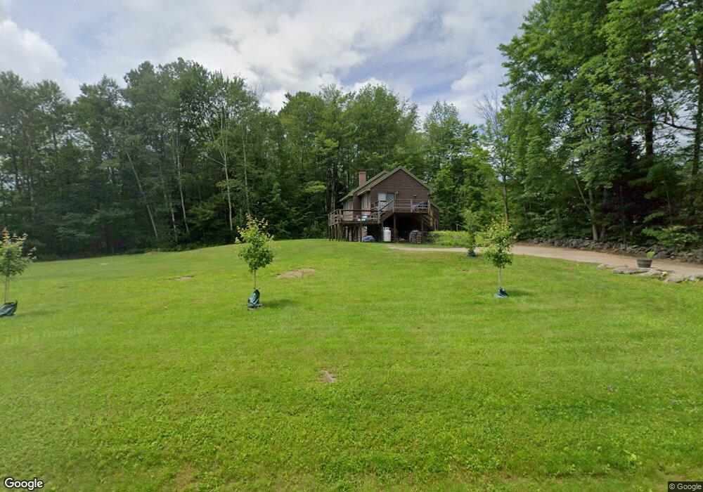
55 Sugar Run Thornton, NH 03285
Estimated Value: $449,243 - $565,000
2
Beds
2
Baths
1,649
Sq Ft
$297/Sq Ft
Est. Value
About This Home
This home is located at 55 Sugar Run, Thornton, NH 03285 and is currently estimated at $489,561, approximately $296 per square foot. 55 Sugar Run is a home located in Grafton County with nearby schools including Thornton Central School and Plymouth Regional High School.
Ownership History
Date
Name
Owned For
Owner Type
Purchase Details
Closed on
May 10, 2019
Sold by
Lander Clarence
Bought by
C and Lander L
Current Estimated Value
Purchase Details
Closed on
May 4, 2018
Sold by
Wise Christine L
Bought by
Almeida Nicholas and Lander Clarence
Home Financials for this Owner
Home Financials are based on the most recent Mortgage that was taken out on this home.
Original Mortgage
$196,000
Interest Rate
4.45%
Mortgage Type
New Conventional
Purchase Details
Closed on
Feb 27, 2014
Sold by
Morahan Peter
Bought by
Morahan Peter
Create a Home Valuation Report for This Property
The Home Valuation Report is an in-depth analysis detailing your home's value as well as a comparison with similar homes in the area
Home Values in the Area
Average Home Value in this Area
Purchase History
| Date | Buyer | Sale Price | Title Company |
|---|---|---|---|
| C | -- | -- | |
| Almeida Nicholas | $253,533 | -- | |
| Morahan Peter | -- | -- |
Source: Public Records
Mortgage History
| Date | Status | Borrower | Loan Amount |
|---|---|---|---|
| Previous Owner | Morahan Peter | $196,000 | |
| Previous Owner | Morahan Peter | $100,000 |
Source: Public Records
Tax History Compared to Growth
Tax History
| Year | Tax Paid | Tax Assessment Tax Assessment Total Assessment is a certain percentage of the fair market value that is determined by local assessors to be the total taxable value of land and additions on the property. | Land | Improvement |
|---|---|---|---|---|
| 2024 | $4,211 | $370,400 | $126,500 | $243,900 |
| 2023 | $4,405 | $212,200 | $79,500 | $132,700 |
| 2022 | $4,246 | $212,200 | $79,500 | $132,700 |
| 2021 | $4,407 | $212,200 | $79,500 | $132,700 |
| 2020 | $4,267 | $212,200 | $79,500 | $132,700 |
| 2019 | $3,964 | $212,200 | $79,500 | $132,700 |
| 2018 | $3,703 | $180,800 | $66,600 | $114,200 |
| 2017 | $3,498 | $179,000 | $66,600 | $112,400 |
| 2016 | $3,471 | $179,000 | $66,600 | $112,400 |
| 2015 | $3,419 | $179,000 | $66,600 | $112,400 |
| 2014 | $3,363 | $179,000 | $66,600 | $112,400 |
| 2013 | $3,303 | $180,100 | $58,900 | $121,200 |
Source: Public Records
Map
Nearby Homes
- 110 Tamarack Rd
- 000 Upper Mad River Rd Unit 7
- 911 New Hampshire 49
- 612 Upper Mad River Rd Unit B
- 612 Upper Mad River Rd Unit A
- 612 Upper Mad River Rd Unit C
- 34 Liberty Ln Unit 2
- 11 Weeping Birches Ln
- 0 Checkerberry Ridge Rd Unit 142
- 129 Hodgeman Hill Rd
- C100 Hodgeman Hill Rd
- 1 Condo Rd Unit 1
- 18 Condo Rd Unit 1
- 14 Parker Rd Unit C-2
- 89 Woodwinds Dr
- 37 Pegwood Hill Rd
- 36 Briarcliff Cir
- Map 231 Woodwinds Dr
- 88 Donovan Farm Rd
- Lot 1 Pegwood Rd
- 55 Sugar Run Rd
- 57 Sugar Run
- 57 Sugar Run Rd
- 14 Berry Knoll Rd
- 50 Sugar Run
- 10 Berry Knoll Rd
- 42 Sugar Run
- 8 Fox Hollow Rd
- 11 Edgewater Ln
- 22 Beaver Path
- 79 Sugar Run
- 32 Sugar Run
- 44 Tamarack Rd
- 33 Sugar Run
- 20 Beaver Path
- 21 Beaver Path
- Lot 20 Beaver Path
- 18 Meadow Way
- 90 Tamarack Rd
- 16 Beaver Path