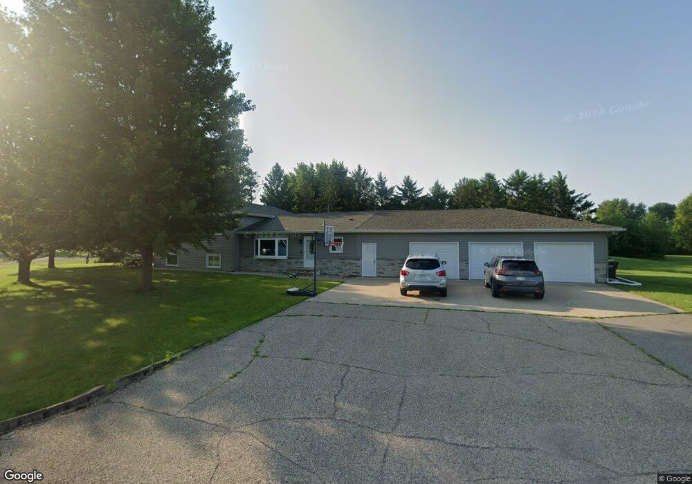
55 Turner Ct Mankato, MN 56001
Estimated Value: $483,000 - $510,000
4
Beds
3
Baths
2,592
Sq Ft
$190/Sq Ft
Est. Value
About This Home
This home is located at 55 Turner Ct, Mankato, MN 56001 and is currently estimated at $492,733, approximately $190 per square foot. 55 Turner Ct is a home located in Blue Earth County with nearby schools including Franklin Elementary School, Prairie Winds Middle School, and Mankato East Senior High School.
Ownership History
Date
Name
Owned For
Owner Type
Purchase Details
Closed on
Jul 8, 2016
Sold by
Findley Keith A and Findley Kathleen R
Bought by
George Bryon and George Jennifer
Current Estimated Value
Home Financials for this Owner
Home Financials are based on the most recent Mortgage that was taken out on this home.
Original Mortgage
$227,700
Outstanding Balance
$182,124
Interest Rate
3.64%
Mortgage Type
New Conventional
Estimated Equity
$310,609
Create a Home Valuation Report for This Property
The Home Valuation Report is an in-depth analysis detailing your home's value as well as a comparison with similar homes in the area
Home Values in the Area
Average Home Value in this Area
Purchase History
| Date | Buyer | Sale Price | Title Company |
|---|---|---|---|
| George Bryon | $253,000 | Stewart Title |
Source: Public Records
Mortgage History
| Date | Status | Borrower | Loan Amount |
|---|---|---|---|
| Open | George Bryon | $227,700 |
Source: Public Records
Tax History Compared to Growth
Tax History
| Year | Tax Paid | Tax Assessment Tax Assessment Total Assessment is a certain percentage of the fair market value that is determined by local assessors to be the total taxable value of land and additions on the property. | Land | Improvement |
|---|---|---|---|---|
| 2025 | $3,806 | $494,400 | $86,400 | $408,000 |
| 2024 | $3,806 | $459,500 | $86,400 | $373,100 |
| 2023 | $3,570 | $456,900 | $86,400 | $370,500 |
| 2022 | $3,204 | $420,300 | $86,400 | $333,900 |
| 2021 | $3,148 | $345,600 | $86,400 | $259,200 |
| 2020 | $3,018 | $321,500 | $76,200 | $245,300 |
| 2019 | $2,936 | $321,500 | $76,200 | $245,300 |
| 2018 | $2,704 | $316,000 | $60,900 | $255,100 |
| 2017 | $2,352 | $293,800 | $60,900 | $232,900 |
| 2016 | $1,996 | $546,200 | $121,800 | $424,400 |
| 2015 | $20 | $234,700 | $60,900 | $173,800 |
| 2014 | $2,166 | $234,800 | $60,900 | $173,900 |
Source: Public Records
Map
Nearby Homes
- 413 Elm Dr Unit 111
- 407 Elm Dr Unit 114
- 405 Elm Dr Unit 115
- 403 Elm Dr Unit 116
- 304 Oak Ln Unit 109
- 306 Oak Ln Unit 108
- 314 Oak Ln Unit 104
- 313 Double Eagle Dr
- 309 Double Eagle Dr
- 305 Oak Ln Unit 100
- 305 Double Eagle Dr
- 212 Spruce Ln Unit 89
- 156 Butler Falls Rd
- 210 Spruce Ln Unit 90
- 204 Spruce Ln Unit 93
- 126 Maple Dr Unit 62
- 130 Maple Dr Unit 64
- 133 Maple Dr Unit 59
- 228 Double Eagle Dr
- 110 Maple Dr Unit 74
- 215 Hensonshire Dr
- 185 Hensonshire Dr
- 30 Turner Ct
- 50 Hensonshire Ct
- 70 Hensonshire Ct
- 25 Turner Ct
- 225 Hensonshire Dr
- 300 Hensonshire Dr
- 260 Hensonshire Dr
- 165 Hensonshire Dr
- 30 Hensonshire Ct
- 316 Hensonshire Dr
- 20 Turner Ct
- 155 Hensonshire Dr
- 75 Hensonshire Ct
- 240 Hensonshire Dr
- 5 Turner Ct
- 45 Hensonshire Ct
- 35 Hensonshire Ct
- 105 Hensonshire Ct