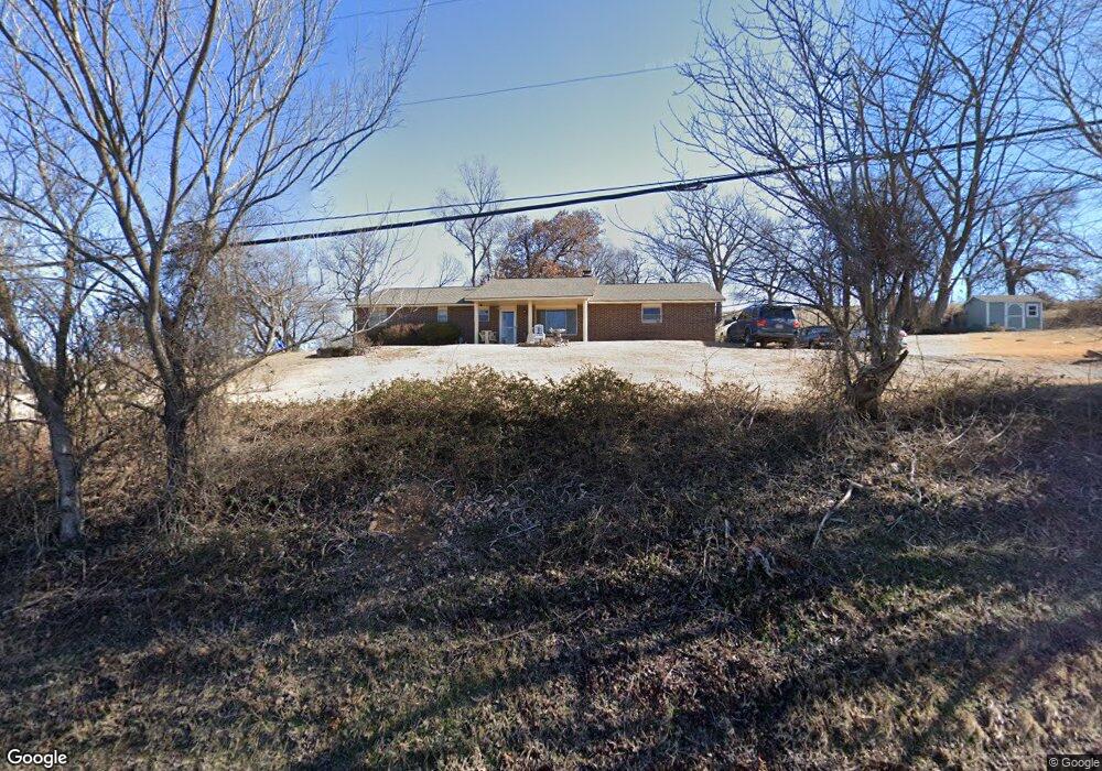
550 N Main St Cave Springs, AR 72718
Estimated Value: $348,282 - $381,000
--
Bed
2
Baths
1,838
Sq Ft
$196/Sq Ft
Est. Value
About This Home
This home is located at 550 N Main St, Cave Springs, AR 72718 and is currently estimated at $361,071, approximately $196 per square foot. 550 N Main St is a home located in Benton County with nearby schools including Evening Star Elementary School, Bright Field Middle School, and Fulbright Junior High School.
Ownership History
Date
Name
Owned For
Owner Type
Purchase Details
Closed on
Nov 25, 2020
Sold by
Bush Darrel Ray and Bush Teresa
Bought by
Harbin Travis and Harbin Kelly
Current Estimated Value
Home Financials for this Owner
Home Financials are based on the most recent Mortgage that was taken out on this home.
Original Mortgage
$194,000
Outstanding Balance
$172,238
Interest Rate
2.8%
Mortgage Type
New Conventional
Estimated Equity
$188,833
Purchase Details
Closed on
Jun 28, 2007
Sold by
Bush Darrel R and Bush Teresa
Bought by
Bush Darrel R and Bush Deltone
Purchase Details
Closed on
Jun 29, 2004
Bought by
Bush
Purchase Details
Closed on
Jun 11, 2002
Bought by
Bush
Purchase Details
Closed on
Apr 26, 1977
Bought by
Marsh
Purchase Details
Closed on
Mar 15, 1977
Bought by
Marsh
Create a Home Valuation Report for This Property
The Home Valuation Report is an in-depth analysis detailing your home's value as well as a comparison with similar homes in the area
Home Values in the Area
Average Home Value in this Area
Purchase History
| Date | Buyer | Sale Price | Title Company |
|---|---|---|---|
| Harbin Travis | $200,000 | First National Title | |
| Bush Darrel R | -- | None Available | |
| Bush | -- | -- | |
| Bush | $90,000 | -- | |
| Marsh | -- | -- | |
| Marsh | -- | -- |
Source: Public Records
Mortgage History
| Date | Status | Borrower | Loan Amount |
|---|---|---|---|
| Open | Harbin Travis | $194,000 |
Source: Public Records
Tax History Compared to Growth
Tax History
| Year | Tax Paid | Tax Assessment Tax Assessment Total Assessment is a certain percentage of the fair market value that is determined by local assessors to be the total taxable value of land and additions on the property. | Land | Improvement |
|---|---|---|---|---|
| 2025 | $1,757 | $50,893 | $17,000 | $33,893 |
| 2024 | $1,750 | $50,893 | $17,000 | $33,893 |
| 2023 | $1,666 | $33,870 | $4,000 | $29,870 |
| 2022 | $1,196 | $33,870 | $4,000 | $29,870 |
| 2021 | $1,122 | $33,870 | $4,000 | $29,870 |
| 2020 | $1,066 | $24,750 | $3,400 | $21,350 |
| 2019 | $1,391 | $24,750 | $3,400 | $21,350 |
| 2018 | $1,292 | $24,750 | $3,400 | $21,350 |
| 2017 | $1,096 | $24,750 | $3,400 | $21,350 |
| 2016 | $1,096 | $24,750 | $3,400 | $21,350 |
| 2015 | $876 | $22,500 | $3,400 | $19,100 |
| 2014 | $526 | $22,500 | $3,400 | $19,100 |
Source: Public Records
Map
Nearby Homes
- 868 N Main St
- 0 Hwy 112 and N Wallis Rd Unit Lot B 1269862
- 0 Hwy 112 and N Wallis Rd Unit Lot E 1269870
- 0 Hwy 112 and N Wallis Rd Unit Lot D 1269867
- 0 Hwy 112 and N Wallis Rd Unit Lot A 1269859
- 0 Hwy 112 and N Wallis Rd Unit Lot C 1269864
- 609 Sands Rd
- 671 Sands Rd
- 1418 Lookout Ln
- 1420 Lookout Ln
- 1504 Lookout Ln
- 503 Steep Hill Ln
- 1500 Lookout Ln
- 1508 Lookout Ln
- 603 Steep Hill Ln
- 1502 Lookout Ln
- 1506 Lookout Ln
- 203 N Cascade Cir
- 0 W Wallis Rd
- 206 S Gleneagle Dr
- 0 S Main St Unit 557590
- 0 S Main St Unit 582258
- 0 S Main St Unit 582260
- 0 S Main St Unit 582264
- 0 S Main St Unit 582268
- 0 S Main St Unit 624478
- 0 S Main St Unit 1079406
- Tract 3 W Shores Ave
- 5 Shores Ave
- 527 N Main St
- 28.48Ac Shores Ave
- 28.48 Ac W Shores Ave
- Tract 2 W Shores Ave
- 476 N Main St
- 451 S Main St
- 571 N Main St
- 283 Shores Ave
- 365 N Main St
- 336 S Main St
- 272 N Main St