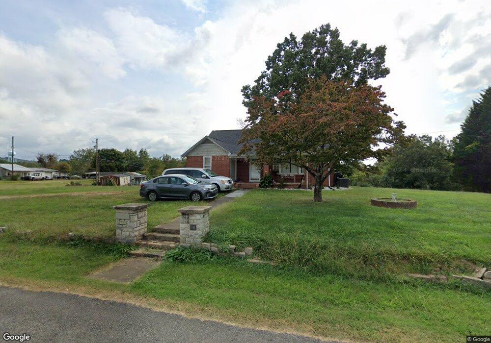
550 Poteat Rd Mount Airy, NC 27030
Estimated Value: $120,000 - $272,000
2
Beds
1
Bath
1,527
Sq Ft
$118/Sq Ft
Est. Value
About This Home
This home is located at 550 Poteat Rd, Mount Airy, NC 27030 and is currently estimated at $180,358, approximately $118 per square foot. 550 Poteat Rd is a home with nearby schools including Flat Rock Elementary School, Meadowview Magnet Middle School, and North Surry High School.
Ownership History
Date
Name
Owned For
Owner Type
Purchase Details
Closed on
May 19, 2022
Sold by
Doss 1 Ronnie Lee & Kaye
Bought by
Mcmackin Carolyn Doss
Current Estimated Value
Purchase Details
Closed on
Oct 30, 2017
Sold by
Doss Ronnie Lee and Doss Teresa Kaye
Bought by
Craddock James Andrew and Craddock Shelia C
Purchase Details
Closed on
Oct 11, 2017
Sold by
Doss Wheeling Pansy Ann and Wheeling Cecil S
Bought by
Doss Roy Gary and Doss Ronnie Lee
Purchase Details
Closed on
Sep 19, 2017
Sold by
Steelman Doss Jonathan and Steelman Alan Doss
Bought by
Doss Roy Gary and Doss Ronnie Lee
Create a Home Valuation Report for This Property
The Home Valuation Report is an in-depth analysis detailing your home's value as well as a comparison with similar homes in the area
Home Values in the Area
Average Home Value in this Area
Purchase History
| Date | Buyer | Sale Price | Title Company |
|---|---|---|---|
| Mcmackin Carolyn Doss | -- | Mills Gary J | |
| Craddock James Andrew | -- | None Available | |
| Doss Roy Gary | -- | None Available | |
| Doss Roy Gary | -- | None Available |
Source: Public Records
Tax History Compared to Growth
Tax History
| Year | Tax Paid | Tax Assessment Tax Assessment Total Assessment is a certain percentage of the fair market value that is determined by local assessors to be the total taxable value of land and additions on the property. | Land | Improvement |
|---|---|---|---|---|
| 2025 | $570 | $88,900 | $15,000 | $73,900 |
| 2024 | $466 | $67,130 | $12,000 | $55,130 |
| 2023 | $458 | $67,130 | $12,000 | $55,130 |
| 2022 | $458 | $67,130 | $12,000 | $55,130 |
| 2021 | $466 | $67,130 | $12,000 | $55,130 |
| 2020 | $451 | $62,800 | $12,000 | $50,800 |
| 2019 | $448 | $62,800 | $12,000 | $50,800 |
| 2018 | $447 | $62,800 | $0 | $0 |
| 2017 | $445 | $62,800 | $0 | $0 |
| 2016 | $445 | $62,800 | $0 | $0 |
| 2013 | -- | $67,130 | $0 | $0 |
Source: Public Records
Map
Nearby Homes
- 200 Englewood Trail
- 201 Circle View Rd
- 177 Janice Dr
- 731 Indian Grove Church Rd
- 208 Holly Ave
- Lot 5 Howell Rd
- 2384 Westfield Rd
- 2326 Westfield Rd
- 278 Old Us Highway 52
- 446 Gilley Rd
- 0 Blue Hollow Rd Unit 33 1176021
- 0 Blue Hollow Rd Unit 23105199
- 000 Blue Hollow Rd Unit 27
- 583 Snody Rd
- 0 Chestnut Ridge Rd
- xx Gilley Rd Unit 20.63 acres
- 280 Burke Rd
- 124 Rocky Ln
- 366 Sheep Farm Rd
- 00 Paynetown Rd
- 538 Poteat Rd
- 572 Poteat Rd
- 528 Poteat Rd
- 529 Poteat Rd
- 520 Poteat Rd
- 583 Poteat Rd
- 506 Poteat Rd
- 500 & 506 Poteat Rd
- 500 Poteat Rd
- 118 Brookdell Ridge Trail
- 490 Poteat Rd
- 20 Ac on Poteat Rd
- 456 Poteat Rd
- 20 Poteat Rd
- 418 Poteat Rd
- 404 Poteat Rd
- 00 Poteat Rd
- 22.5 Ac on Poteat Rd
- 1119 Holly Springs Rd
- 159 Sheila St