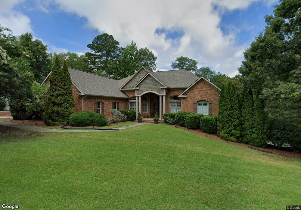
550 Rock Springs Rd Unit 3/P Lancaster, SC 29720
Estimated Value: $516,000 - $635,000
--
Bed
4
Baths
4,004
Sq Ft
$146/Sq Ft
Est. Value
About This Home
This home is located at 550 Rock Springs Rd Unit 3/P, Lancaster, SC 29720 and is currently estimated at $582,590, approximately $145 per square foot. 550 Rock Springs Rd Unit 3/P is a home located in Lancaster County with nearby schools including North Elementary School, A.R. Rucker Middle School, and Lancaster High School.
Ownership History
Date
Name
Owned For
Owner Type
Purchase Details
Closed on
Oct 23, 2020
Sold by
Kramer Eric L
Bought by
Kramer Eric L and Catha Kramer Rhonda
Current Estimated Value
Home Financials for this Owner
Home Financials are based on the most recent Mortgage that was taken out on this home.
Original Mortgage
$380,000
Outstanding Balance
$337,374
Interest Rate
2.8%
Mortgage Type
New Conventional
Estimated Equity
$245,216
Purchase Details
Closed on
Sep 12, 2003
Sold by
Mungo Charles B and Mungo Tina W
Bought by
Snipes William T and Snipes Sharon H
Create a Home Valuation Report for This Property
The Home Valuation Report is an in-depth analysis detailing your home's value as well as a comparison with similar homes in the area
Home Values in the Area
Average Home Value in this Area
Purchase History
| Date | Buyer | Sale Price | Title Company |
|---|---|---|---|
| Kramer Eric L | -- | None Available | |
| Kramer Eric L | $480,000 | None Available | |
| Snipes William T | $43,000 | -- |
Source: Public Records
Mortgage History
| Date | Status | Borrower | Loan Amount |
|---|---|---|---|
| Open | Kramer Eric L | $380,000 |
Source: Public Records
Tax History Compared to Growth
Tax History
| Year | Tax Paid | Tax Assessment Tax Assessment Total Assessment is a certain percentage of the fair market value that is determined by local assessors to be the total taxable value of land and additions on the property. | Land | Improvement |
|---|---|---|---|---|
| 2024 | $3,741 | $18,988 | $1,004 | $17,984 |
| 2023 | $4,251 | $18,988 | $1,004 | $17,984 |
| 2022 | $4,518 | $18,988 | $1,004 | $17,984 |
| 2021 | $4,459 | $18,988 | $1,004 | $17,984 |
| 2020 | $3,604 | $15,380 | $1,004 | $14,376 |
| 2019 | $7,860 | $15,380 | $1,004 | $14,376 |
| 2018 | $5,005 | $15,380 | $1,004 | $14,376 |
| 2017 | $3,319 | $0 | $0 | $0 |
| 2016 | $3,421 | $0 | $0 | $0 |
| 2015 | $3,588 | $0 | $0 | $0 |
| 2014 | $3,588 | $0 | $0 | $0 |
| 2013 | $3,588 | $0 | $0 | $0 |
Source: Public Records
Map
Nearby Homes
- 1437 Westmoreland Dr
- 526 Rock Springs Rd
- 1010 Forest Dr
- 530 Oxford Place
- 1110 W Edgemont Dr
- 1121 W Edgemont Dr
- 1109 W Edgemont Dr
- 422 Plantation Rd
- 981 Sherwood Cir
- 725 Plantation Rd
- 906 Forest Dr
- 958 Sherwood Cir
- 505 Grandiflora Ave
- 730 Bonica Ct
- 1676 Partridge Cir
- 613 Davis St
- 1107 Crestfield Dr
- 406 N Pine St
- 1415 Crestfield Dr Unit 26
- 405 N Woodland Dr
- 550 Rock Springs Rd
- 546 Rock Springs Rd
- 542 Rock Springs Rd
- 553 Rock Springs Rd
- 558 Rock Springs Rd
- 1113 Malvern Ln
- Lot 2 Rock Spring Rd Unit 2
- 1441 Westmoreland Dr
- 00 Rock Springs Rd
- 1433 Westmoreland Dr
- 1114 Malvern Ln
- 1109 Malvern Ln
- 1429 Westmoreland Dr
- 554 Plantation Rd
- 530 Rock Springs Rd
- 605 Rock Springs Rd
- 1305 Berkeley Ln
- 606 Rock Springs Rd
- 1410 Westover Place
- 1425 Westmoreland Dr