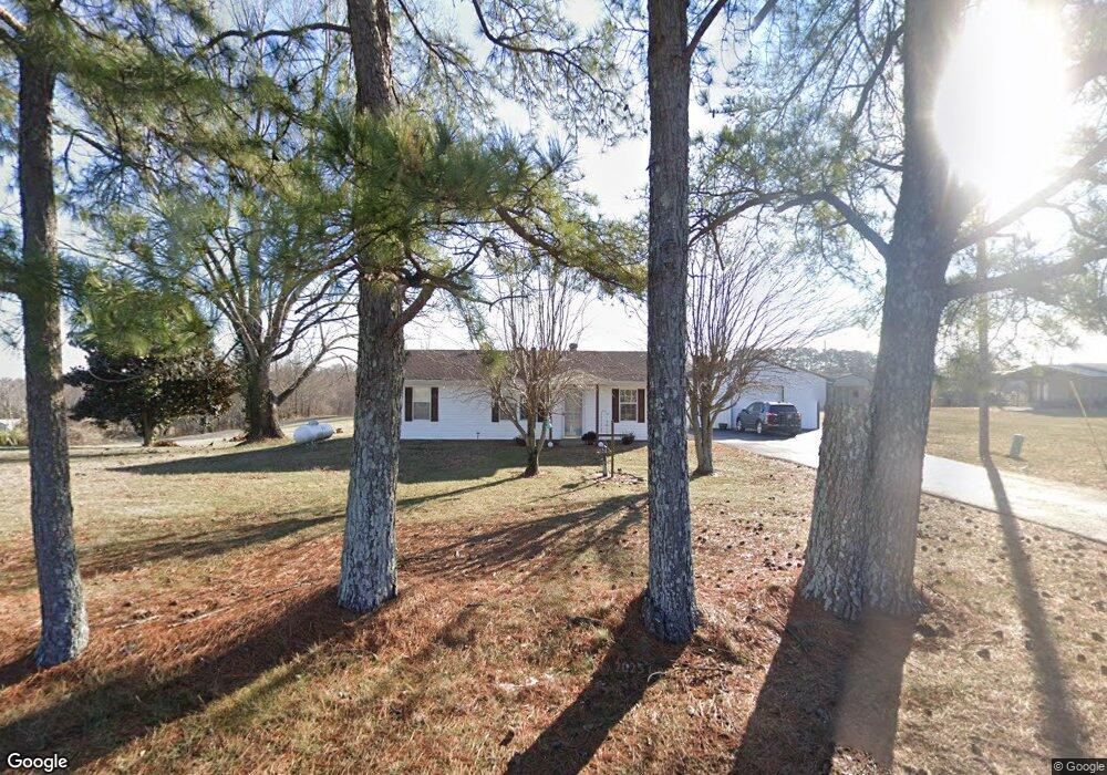
550 Shrum Cemetery Rd Westmoreland, TN 37186
Estimated Value: $177,263 - $237,000
--
Bed
1
Bath
1,232
Sq Ft
$163/Sq Ft
Est. Value
About This Home
This home is located at 550 Shrum Cemetery Rd, Westmoreland, TN 37186 and is currently estimated at $201,316, approximately $163 per square foot. 550 Shrum Cemetery Rd is a home located in Macon County with nearby schools including Lighthouse Academy.
Ownership History
Date
Name
Owned For
Owner Type
Purchase Details
Closed on
Aug 6, 2024
Sold by
Slayton Penny A
Bought by
Slayton Ramsey E and Slayton Penny A
Current Estimated Value
Purchase Details
Closed on
Apr 27, 2005
Sold by
Woodard Tina M
Bought by
Robertson Brinda
Home Financials for this Owner
Home Financials are based on the most recent Mortgage that was taken out on this home.
Original Mortgage
$54,000
Interest Rate
5.99%
Mortgage Type
Cash
Purchase Details
Closed on
Nov 7, 2003
Sold by
Murrell Whittemore
Bought by
Woodard Tina M
Purchase Details
Closed on
Dec 27, 2002
Sold by
Harper Billie R
Bought by
Whittemore Murrel
Purchase Details
Closed on
Sep 16, 1996
Sold by
Harper Billy R and Harper Helen
Bought by
Oliver Billy W and Oliver Carol J
Purchase Details
Closed on
Apr 16, 1996
Sold by
Harper Billie R and Harper Helen R
Bought by
Harper Billie R and Harper Teres
Purchase Details
Closed on
Mar 29, 1982
Bought by
Harper Billy R and Harper Helen
Create a Home Valuation Report for This Property
The Home Valuation Report is an in-depth analysis detailing your home's value as well as a comparison with similar homes in the area
Home Values in the Area
Average Home Value in this Area
Purchase History
| Date | Buyer | Sale Price | Title Company |
|---|---|---|---|
| Slayton Ramsey E | -- | Andrew A Stanford Attorney At | |
| Slayton Ramsey E | -- | Andrew A Stanford Attorney At | |
| Robertson Brinda | $59,000 | -- | |
| Woodard Tina M | $52,000 | -- | |
| Whittemore Murrel | $22,500 | -- | |
| Oliver Billy W | $7,803 | -- | |
| Harper Billie R | $31,500 | -- | |
| Harper Billy R | -- | -- |
Source: Public Records
Mortgage History
| Date | Status | Borrower | Loan Amount |
|---|---|---|---|
| Previous Owner | Harper Billy R | $54,000 |
Source: Public Records
Tax History Compared to Growth
Tax History
| Year | Tax Paid | Tax Assessment Tax Assessment Total Assessment is a certain percentage of the fair market value that is determined by local assessors to be the total taxable value of land and additions on the property. | Land | Improvement |
|---|---|---|---|---|
| 2024 | $561 | $39,675 | $4,250 | $35,425 |
| 2023 | $561 | $39,675 | $0 | $0 |
| 2022 | $476 | $19,850 | $3,125 | $16,725 |
| 2021 | $476 | $19,850 | $3,125 | $16,725 |
| 2020 | $476 | $19,850 | $3,125 | $16,725 |
| 2019 | $476 | $19,850 | $3,125 | $16,725 |
| 2018 | $329 | $14,875 | $3,125 | $11,750 |
| 2017 | $307 | $12,200 | $2,125 | $10,075 |
| 2016 | $293 | $12,200 | $2,125 | $10,075 |
| 2015 | $293 | $12,200 | $2,125 | $10,075 |
| 2014 | $293 | $12,212 | $0 | $0 |
Source: Public Records
Map
Nearby Homes
- 98 Andrea Ln
- 779 Oakdale Rd
- 0 Highway 52 W Unit RTC2944821
- 8141 Old Highway 52
- 177 Lauren Ln
- 397 Lauren Ln
- 2192 Shrum Cemetery Rd
- 2166 Shrum Cemetery Rd
- 2134 Shrum Cemetery Rd
- 1701 Wixtown Rd
- 1733 Wixtown Rd
- 2134 Oakdale Rd
- 2486 Oakdale Rd
- 6704 Highway 52 W
- 6606 Highway 52 W
- 221 Creekside Ln
- 1314 Green Grove Rd
- 5071 Old Highway 52
- 10029 Old Highway 52
- 0 Highway 52 W Unit RTC2515576
- 512 Shrum Cemetery Rd
- 594 Shrum Cemetery Rd
- 618 Shrum Cemetery Rd
- 489 Shrum Cemetery Rd
- 687 Shrum Cemetery Rd
- 741 Shrum Cemetery Rd
- 765 Shrum Cemetery Rd
- 464 Shrum Cemetery Rd
- 699 Shrum Cemetery Rd
- 408 Shrum Cemetery Rd
- 679 Shrum Cemetery Rd
- 527 Hunters Ln
- 370 Shrum Cemetery Rd
- 94 Hunters Ln
- 714 Shrum Cemetery Rd
- 576 Shrum Cemetery Rd
- 320 Shrum Cemetery Rd
- 738 Shrum Cemetery Rd
- 266 Shrum Cemetery Rd
- 184 Hunters Ln