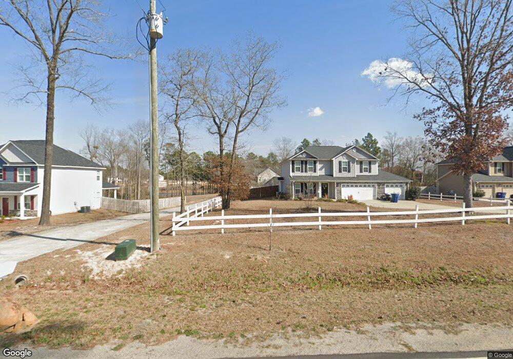
550 Townsend Rd Raeford, NC 28376
Estimated Value: $367,000 - $417,462
4
Beds
3
Baths
2,334
Sq Ft
$167/Sq Ft
Est. Value
About This Home
This home is located at 550 Townsend Rd, Raeford, NC 28376 and is currently estimated at $389,116, approximately $166 per square foot. 550 Townsend Rd is a home located in Hoke County with nearby schools including Scurlock Elementary School, East Hoke Middle, and Hoke County High.
Ownership History
Date
Name
Owned For
Owner Type
Purchase Details
Closed on
Sep 25, 2018
Sold by
Thomas Nicholas B and Thomas Anna Clair E
Bought by
Martinez Ehiliana and Martinez Jesse
Current Estimated Value
Home Financials for this Owner
Home Financials are based on the most recent Mortgage that was taken out on this home.
Original Mortgage
$240,052
Outstanding Balance
$209,340
Interest Rate
4.5%
Mortgage Type
VA
Estimated Equity
$179,776
Purchase Details
Closed on
Mar 1, 2016
Sold by
Wood James G and Wood Angela V
Bought by
Pa Tim Incorporated
Purchase Details
Closed on
Apr 21, 2015
Sold by
Wood James G and Wood Angela V
Bought by
Strickland Construction & Development In
Purchase Details
Closed on
May 27, 2014
Sold by
Floyd Properties & Development Inc
Bought by
H & H Constructors Inc
Create a Home Valuation Report for This Property
The Home Valuation Report is an in-depth analysis detailing your home's value as well as a comparison with similar homes in the area
Home Values in the Area
Average Home Value in this Area
Purchase History
| Date | Buyer | Sale Price | Title Company |
|---|---|---|---|
| Martinez Ehiliana | $235,000 | None Available | |
| Pa Tim Incorporated | $26,000 | None Available | |
| Strickland Construction & Development In | $26,000 | None Available | |
| H & H Constructors Inc | $415,000 | None Available |
Source: Public Records
Mortgage History
| Date | Status | Borrower | Loan Amount |
|---|---|---|---|
| Open | Martinez Ehiliana | $240,052 |
Source: Public Records
Tax History Compared to Growth
Tax History
| Year | Tax Paid | Tax Assessment Tax Assessment Total Assessment is a certain percentage of the fair market value that is determined by local assessors to be the total taxable value of land and additions on the property. | Land | Improvement |
|---|---|---|---|---|
| 2024 | $2,739 | $322,110 | $115,150 | $206,960 |
| 2023 | $2,739 | $322,110 | $115,150 | $206,960 |
| 2022 | $2,739 | $322,110 | $115,150 | $206,960 |
| 2021 | $1,831 | $209,130 | $15,310 | $193,820 |
| 2020 | $1,864 | $209,130 | $15,310 | $193,820 |
| 2019 | $1,864 | $209,130 | $15,310 | $193,820 |
| 2018 | $1,864 | $209,130 | $15,310 | $193,820 |
| 2017 | $1,864 | $209,130 | $15,310 | $193,820 |
| 2016 | -- | $26,630 | $26,630 | $0 |
| 2015 | $259 | $31,800 | $31,800 | $0 |
Source: Public Records
Map
Nearby Homes
- 512 Townsend Rd
- 176 Grove Walk Rd
- 531 Southerland Peak
- 499 Southerland Peak Dr
- 739 Southerland Peak (Lot 46) Dr
- 711 Southerland Peak (Lot 43) Dr
- 499 Dr
- 281 Leland Ln
- 283 Leach Creek Dr
- 723 Southerland Peak Dr
- 739 Southerland Peak Rd
- 969 Townsend Rd
- 731 Southerland Peak (Lot 45) Dr
- 192 Grove Walk Rd
- 731 Southerland Peak Dr
- 711 Southerland Peak Rd
- 2911 Rockfish Rd
- Lot 7 Southerland Peak
- Lot 11 Southerland Peak
- 534 Townsend Rd
- 159 Sweet Potato Dr
- 562 Townsend Rd
- 121 Sweet Potato Dr
- 654 Townsend Rd
- 614 Townsend Rd
- 183 Sweet Potato Dr
- 475 Townsend Rd
- Lot 4 Southerland Peak
- 114 Burnside Dr
- Lot 3 Southerland Peak
- 668 Townsend Rd
- 150 Leach Creek Dr
- tbd Southerland Peak Dr
- 276 Southerland Peak Dr
- 164 Leach Creek Dr Unit Lot 35
- 258 Southerland Peak Dr
- 334 Southerland Peak (Lot 14) Dr