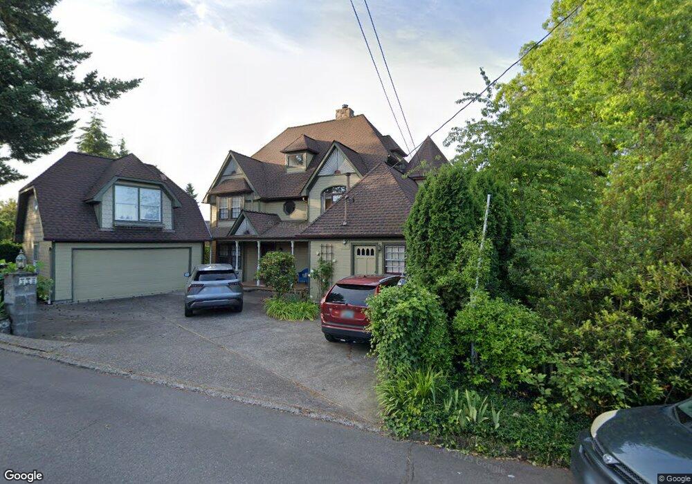
550 Upper Ben Lomond Dr SE Salem, OR 97302
South Central NeighborhoodEstimated Value: $580,000 - $995,000
4
Beds
4
Baths
3,206
Sq Ft
$231/Sq Ft
Est. Value
About This Home
This home is located at 550 Upper Ben Lomond Dr SE, Salem, OR 97302 and is currently estimated at $739,406, approximately $230 per square foot. 550 Upper Ben Lomond Dr SE is a home located in Marion County with nearby schools including McKinley Elementary School, Leslie Middle School, and South Salem High School.
Ownership History
Date
Name
Owned For
Owner Type
Purchase Details
Closed on
Oct 31, 2014
Sold by
Isom Matthew and Isom Thomas P
Bought by
Isom Matthew
Current Estimated Value
Purchase Details
Closed on
Sep 14, 2010
Sold by
Scott Jerry W and Scott Sharon A
Bought by
Isom Dallas W
Purchase Details
Closed on
Jul 10, 2009
Sold by
Hare Pauline
Bought by
Hare Dana R
Purchase Details
Closed on
Jul 27, 2007
Sold by
Scott Jerry W and Scott Sharon A
Bought by
Hare Pauline
Purchase Details
Closed on
Dec 31, 2003
Sold by
Scott Jerry W and Scott Sharon A
Bought by
Stringham Renee
Create a Home Valuation Report for This Property
The Home Valuation Report is an in-depth analysis detailing your home's value as well as a comparison with similar homes in the area
Home Values in the Area
Average Home Value in this Area
Purchase History
| Date | Buyer | Sale Price | Title Company |
|---|---|---|---|
| Isom Matthew | -- | None Available | |
| Isom Dallas W | $329,000 | Fidelity Natl Title Co Of Or | |
| Hare Dana R | -- | None Available | |
| Hare Pauline | $75,000 | None Available | |
| Stringham Renee | $100,000 | -- |
Source: Public Records
Tax History Compared to Growth
Tax History
| Year | Tax Paid | Tax Assessment Tax Assessment Total Assessment is a certain percentage of the fair market value that is determined by local assessors to be the total taxable value of land and additions on the property. | Land | Improvement |
|---|---|---|---|---|
| 2025 | $8,319 | $436,400 | -- | -- |
| 2024 | $8,319 | $423,690 | -- | -- |
| 2023 | $8,074 | $411,350 | $0 | $0 |
| 2022 | $7,612 | $399,370 | $0 | $0 |
| 2021 | $7,395 | $387,740 | $0 | $0 |
| 2020 | $7,179 | $376,450 | $0 | $0 |
| 2019 | $6,927 | $365,490 | $0 | $0 |
| 2018 | $7,049 | $0 | $0 | $0 |
| 2017 | $6,362 | $0 | $0 | $0 |
| 2016 | $6,060 | $0 | $0 | $0 |
| 2015 | $6,106 | $0 | $0 | $0 |
| 2014 | $5,846 | $0 | $0 | $0 |
Source: Public Records
Map
Nearby Homes
- 2640 High St SE
- 2490 E Nob Hill St SE
- 2210 Winter St SE Unit 2220
- 530 Fairview Ave SE
- 2220 High St SE
- 999 Cedar Way SE
- 995 Fairview Ave SE
- 2009 Church St SE
- 2756 Pheasant Ave SE
- 2375 Saginaw St S
- 2005 Summer St SE Unit 2045
- 210 Hoyt St S
- 2872 Bluff Ave SE
- 2630 Mountain View Dr S
- 1075 Vista Ave SE
- 1875 High St SE
- 340 Boice St S
- 1880 W Nob Hill St SE
- 2310 Mountain View Dr S
- 3070 Troth Ct SE
- 545 Wildwind Dr SE
- 590 Upper Ben Lomond Dr SE
- 585 Upper Ben Lomond Dr SE
- 544 Tillman Ave SE
- 595 Upper Ben Lomond Dr SE
- 605 Upper Ben Lomond Dr SE
- 535 Wildwind Dr SE
- 610 Upper Ben Lomond Dr SE
- 560 Wildwind Dr SE
- 540 Tillman Ave SE
- 710 Tillman Ave SE
- 540 Wildwind Dr SE
- 714 Tillman Ave SE
- 620 Upper Ben Lomond Dr SE
- 530 Wildwind Dr SE
- 590 Wildwind Dr SE
- 2590 High St SE
- 2610 High St SE
- 720 Tillman Ave SE
- 585 Tillman Ave SE