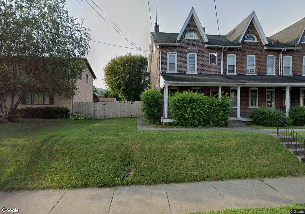
550 W Emaus Ave Unit 552 Allentown, PA 18103
Southside NeighborhoodEstimated Value: $268,000 - $307,000
3
Beds
2
Baths
1,920
Sq Ft
$147/Sq Ft
Est. Value
About This Home
This home is located at 550 W Emaus Ave Unit 552, Allentown, PA 18103 and is currently estimated at $281,542, approximately $146 per square foot. 550 W Emaus Ave Unit 552 is a home located in Lehigh County with nearby schools including Hiram W Dodd Elementary School, South Mountain Middle School, and Louis E. Dieruff High School.
Ownership History
Date
Name
Owned For
Owner Type
Purchase Details
Closed on
Apr 24, 1998
Sold by
Simon Michael
Bought by
Mckeon James
Current Estimated Value
Purchase Details
Closed on
Mar 25, 1998
Sold by
Hud
Bought by
Simon Michael
Purchase Details
Closed on
Dec 23, 1997
Sold by
Mellon Mtg Company
Bought by
Hud
Purchase Details
Closed on
Sep 30, 1997
Sold by
Rossi Ronald W
Bought by
Mellon Mtg Company
Purchase Details
Closed on
Apr 22, 1997
Bought by
Hatfield J Scott
Create a Home Valuation Report for This Property
The Home Valuation Report is an in-depth analysis detailing your home's value as well as a comparison with similar homes in the area
Home Values in the Area
Average Home Value in this Area
Purchase History
| Date | Buyer | Sale Price | Title Company |
|---|---|---|---|
| Mckeon James | $80,000 | -- | |
| Simon Michael | $47,101 | -- | |
| Hud | -- | -- | |
| Mellon Mtg Company | -- | -- | |
| Hatfield J Scott | -- | -- |
Source: Public Records
Tax History Compared to Growth
Tax History
| Year | Tax Paid | Tax Assessment Tax Assessment Total Assessment is a certain percentage of the fair market value that is determined by local assessors to be the total taxable value of land and additions on the property. | Land | Improvement |
|---|---|---|---|---|
| 2025 | $4,376 | $128,300 | $21,700 | $106,600 |
| 2024 | $4,376 | $128,300 | $21,700 | $106,600 |
| 2023 | $4,376 | $128,300 | $21,700 | $106,600 |
| 2022 | $4,229 | $128,300 | $106,600 | $21,700 |
| 2021 | $4,149 | $128,300 | $21,700 | $106,600 |
| 2020 | $4,046 | $128,300 | $21,700 | $106,600 |
| 2019 | $3,984 | $128,300 | $21,700 | $106,600 |
| 2018 | $3,689 | $128,300 | $21,700 | $106,600 |
| 2017 | $3,600 | $128,300 | $21,700 | $106,600 |
| 2016 | -- | $128,300 | $21,700 | $106,600 |
| 2015 | -- | $128,300 | $21,700 | $106,600 |
| 2014 | -- | $128,300 | $21,700 | $106,600 |
Source: Public Records
Map
Nearby Homes
- 2347 S Law St Unit 2349
- 566 W Emaus Ave
- 566 588 W Emaus Ave
- 2416 S Alice St Unit 2418
- 2401 S Church St
- 2413 S Church St
- 642 W Emaus Ave
- 2441 S 4th St
- 206 208 W Emaus Ave
- 316 W Mountain Rd
- 618 Clifford St
- 2429 S Front St
- 2421 S Wood St
- 1852 S 2nd St
- 1831 S Church St
- 148 W Brookdale St
- 203 W Brookdale St
- 2531 S Carbon St
- 121 Woodcrest Cir
- 102 W Brookdale St
- 546 W Emaus Ave Unit 548
- 554 W Emaus Ave
- 556 W Emaus Ave
- 542 W Emaus Ave
- 560 W Emaus Ave Unit 564
- 538 W Emaus Ave Unit 540
- 2315 S Law St Unit 2321
- 2325 S Law St
- 2323 S Law St Unit 2327
- 2324 S Alice St Unit 2328
- 545 W Emaus Ave
- 2330 S Alice St Unit 2332
- 2329 S Law St Unit 2331
- 551 W Emaus Ave Unit 553
- 547 W Emaus Ave Unit 549
- 530 W Emaus Ave
- 543 W Emaus Ave Unit 545
- 555 W Emaus Ave Unit 561
- 2333 S Law St Unit 2335
- 2338 S Alice St Unit 2340