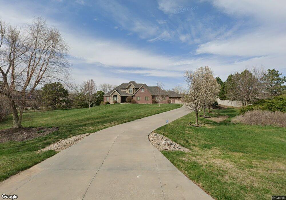
5500 New Castle Rd Lincoln, NE 68516
South Lincoln NeighborhoodEstimated Value: $1,254,624 - $1,410,000
4
Beds
6
Baths
3,508
Sq Ft
$380/Sq Ft
Est. Value
About This Home
This home is located at 5500 New Castle Rd, Lincoln, NE 68516 and is currently estimated at $1,332,312, approximately $379 per square foot. 5500 New Castle Rd is a home located in Lancaster County with nearby schools including Norris Elementary School, Norris Middle School, and Norris High School.
Ownership History
Date
Name
Owned For
Owner Type
Purchase Details
Closed on
Aug 5, 2010
Sold by
Izaguirre Gerardo and Izaguirre Angelica
Bought by
Glade Stephen F and Glade Mary Jane
Current Estimated Value
Purchase Details
Closed on
Feb 25, 2004
Sold by
United Development Inc
Bought by
Izaguirre Gerardo and Izaguirre Angelica
Create a Home Valuation Report for This Property
The Home Valuation Report is an in-depth analysis detailing your home's value as well as a comparison with similar homes in the area
Home Values in the Area
Average Home Value in this Area
Purchase History
| Date | Buyer | Sale Price | Title Company |
|---|---|---|---|
| Glade Stephen F | $84,000 | Multiple | |
| Izaguirre Gerardo | $81,000 | -- |
Source: Public Records
Tax History Compared to Growth
Tax History
| Year | Tax Paid | Tax Assessment Tax Assessment Total Assessment is a certain percentage of the fair market value that is determined by local assessors to be the total taxable value of land and additions on the property. | Land | Improvement |
|---|---|---|---|---|
| 2025 | $8,722 | $1,123,000 | $203,600 | $919,400 |
| 2024 | $8,722 | $987,200 | $203,600 | $783,600 |
| 2023 | $12,397 | $987,200 | $203,600 | $783,600 |
| 2022 | $14,005 | $851,600 | $180,000 | $671,600 |
| 2021 | $13,089 | $851,600 | $144,000 | $707,600 |
| 2020 | $13,368 | $851,600 | $144,000 | $707,600 |
| 2019 | $13,357 | $851,600 | $144,000 | $707,600 |
| 2018 | $12,151 | $770,900 | $90,000 | $680,900 |
| 2017 | $12,144 | $770,900 | $90,000 | $680,900 |
| 2016 | $10,942 | $700,000 | $82,800 | $617,200 |
| 2015 | $11,036 | $700,000 | $82,800 | $617,200 |
| 2014 | $9,366 | $581,600 | $71,300 | $510,300 |
| 2013 | -- | $497,100 | $71,300 | $425,800 |
Source: Public Records
Map
Nearby Homes
- 5501 Aaron Cir
- 6000 Rokeby Rd
- 9415 S 86th St
- 9405 S 86th St
- 4855 Johnson Rd
- 4356 Coral Bell Ct
- 4349 Coral Bell Ct
- 4343 Coral Bell Ct
- 4321 Coral Bell Ct
- 4309 Coral Bell Ct
- TBD Wilderness Heights L5 B3 St
- TBD Wilderness Heights L6 B3 St
- 4300 Sundrop Ct
- TBD Wilderness Heights L3 B3 St
- 4224 Sundrop Ct
- TBD Wilderness Heights L8 B2 St
- TBD Wilderness Heights L2 B3 St
- TBD St
- 9347 S 86th St
- 9401 S 87th St
- 5450 New Castle Rd
- 5455 New Castle Rd
- 5420 New Castle Rd
- 5600 Rokeby Rd
- 5330 New Castle Rd
- 5601 Rokeby Rd
- 5401 New Castle Rd
- 10000 S 56th St
- 9930 S 56th St
- 10200 S 56th St
- 9909 S 56th St
- 10140 S 56th St
- 9900 S 56th St
- 5333 New Castle Rd
- 5300 New Castle Rd
- 10000 Cromwell Dr
- 9800 S 56th St
- 5301 New Castle Rd
- 10400 S 56th St
- 5505 New Castle Rd