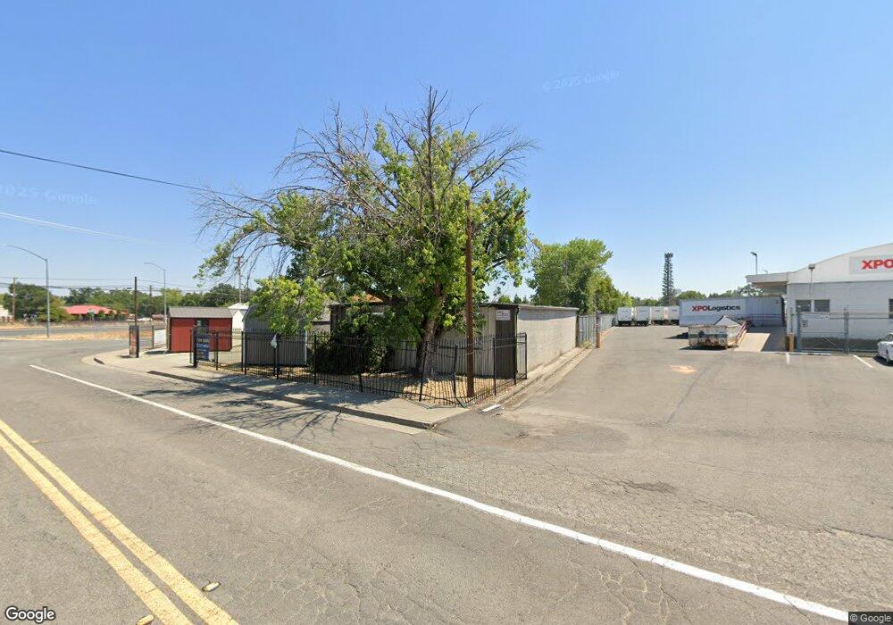
5500 Westside Rd Redding, CA 96001
Branstetter NeighborhoodEstimated Value: $132,682
Studio
--
Bath
1,800
Sq Ft
$74/Sq Ft
Est. Value
About This Home
This home is located at 5500 Westside Rd, Redding, CA 96001 and is currently estimated at $132,682, approximately $73 per square foot. 5500 Westside Rd is a home located in Shasta County with nearby schools including Sycamore Elementary School, Sequoia Middle School, and Shasta High School.
Ownership History
Date
Name
Owned For
Owner Type
Purchase Details
Closed on
Mar 2, 2018
Sold by
Richardson Sarah and Richardson Glene Thomas
Bought by
Richardson Glen Thomas
Current Estimated Value
Purchase Details
Closed on
Jun 8, 2016
Sold by
Owens Mary R
Bought by
Kirby Christopher
Purchase Details
Closed on
Oct 7, 1998
Sold by
Owens Harold D and Owens Mary R
Bought by
Owens Harold D and Owens Mary R
Create a Home Valuation Report for This Property
The Home Valuation Report is an in-depth analysis detailing your home's value as well as a comparison with similar homes in the area
Home Values in the Area
Average Home Value in this Area
Purchase History
| Date | Buyer | Sale Price | Title Company |
|---|---|---|---|
| Richardson Glen Thomas | -- | First American Title Co | |
| Richardson Glen Thomas | -- | First American Title Co | |
| Kirby Christopher | $80,000 | Placer Title Company | |
| Owens Harold D | -- | -- |
Source: Public Records
Tax History Compared to Growth
Tax History
| Year | Tax Paid | Tax Assessment Tax Assessment Total Assessment is a certain percentage of the fair market value that is determined by local assessors to be the total taxable value of land and additions on the property. | Land | Improvement |
|---|---|---|---|---|
| 2025 | $989 | $93,294 | $45,510 | $47,784 |
| 2024 | $975 | $91,466 | $44,618 | $46,848 |
| 2023 | $975 | $89,674 | $43,744 | $45,930 |
| 2022 | $959 | $87,917 | $42,887 | $45,030 |
| 2021 | $955 | $86,195 | $42,047 | $44,148 |
| 2020 | $968 | $85,312 | $41,616 | $43,696 |
| 2019 | $920 | $83,640 | $40,800 | $42,840 |
| 2018 | $942 | $83,232 | $41,616 | $41,616 |
| 2017 | $955 | $81,600 | $40,800 | $40,800 |
| 2016 | $1,416 | $125,000 | $40,000 | $85,000 |
| 2015 | $1,365 | $120,000 | $40,000 | $80,000 |
| 2014 | $1,412 | $174,487 | $68,875 | $105,612 |
Source: Public Records
Map
Nearby Homes
- 5812 Cedars Rd Unit 19
- 5812 Cedars Rd Unit 36
- 5812 Cedars Rd Unit 3
- 2381 S Bonnyview Rd
- 2200 Jewell Ln
- 2001 Jewell Ln
- 2339 North Dr
- 3385 Pioneer Ln
- 2048 Wilder Dr
- 2940 Felstet Ln
- 6405 El Camino Dr
- 4549 Harrison Ave
- 764 Branstetter Ln
- 6323 Oxbow St
- 5367 Rosswood Ln
- 6551 El Camino Dr
- 2850 Balaton Ave
- 0 Lot4 Unit 2 Ph 2 Stillwater Unit 25-4962
- 0 Lot3 Unit 2 Ph 2 Stillwater Unit 25-4961
- 0 Lot6 Unit 2 Ph 2 Stillwater Unit 25-4964
- 5460 Westside Rd
- 5574 Westside Rd
- 4648 Westside Rd
- 6220 Westside Rd
- 6220/6260 Westside Rd
- 4420 Westside Rd
- 4200 Westside Rd
- 2190 Branstetter Ln
- 5578 Westside Rd
- 2175 Branstetter Ln
- 5400 Westside Rd
- 2170 Branstetter Ln
- 5420 Westside Rd
- 2162 Bransetter
- 2160 Branstetter Ln
- 2192 Branstetter Ln
- 5481 Eastside Rd
- 2140 Branstetter Ln
- 5599 Eastside Rd
- 2158 Branstetter Ln
