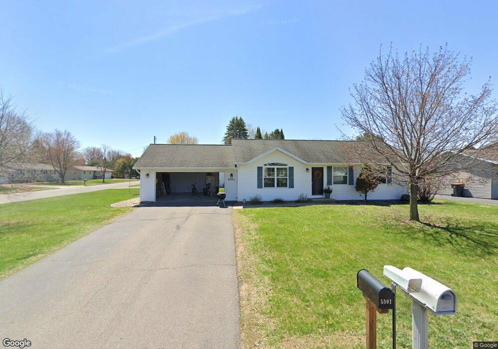
5501 Jacob St Schofield, WI 54476
Estimated Value: $215,000 - $293,000
2
Beds
--
Bath
1,679
Sq Ft
$151/Sq Ft
Est. Value
About This Home
This home is located at 5501 Jacob St, Schofield, WI 54476 and is currently estimated at $254,000, approximately $151 per square foot. 5501 Jacob St is a home located in Marathon County with nearby schools including Riverside Elementary School, D.C. Everest Middle School, and D.C. Everest Junior High School.
Ownership History
Date
Name
Owned For
Owner Type
Purchase Details
Closed on
Jan 20, 2021
Sold by
Tappe & Tappe Rentals Llc
Bought by
Lind Michael C and Lind Kerielle B
Current Estimated Value
Home Financials for this Owner
Home Financials are based on the most recent Mortgage that was taken out on this home.
Original Mortgage
$190,000
Outstanding Balance
$168,016
Interest Rate
2.71%
Mortgage Type
New Conventional
Estimated Equity
$85,984
Purchase Details
Closed on
Jan 1, 2005
Sold by
Tappe John and Tappe Forrest
Bought by
Tappe & Tappe Rentale Llc
Create a Home Valuation Report for This Property
The Home Valuation Report is an in-depth analysis detailing your home's value as well as a comparison with similar homes in the area
Home Values in the Area
Average Home Value in this Area
Purchase History
| Date | Buyer | Sale Price | Title Company |
|---|---|---|---|
| Lind Michael C | $205,000 | None Available | |
| Tappe & Tappe Rentale Llc | -- | None Available |
Source: Public Records
Mortgage History
| Date | Status | Borrower | Loan Amount |
|---|---|---|---|
| Open | Lind Michael C | $190,000 |
Source: Public Records
Tax History
| Year | Tax Paid | Tax Assessment Tax Assessment Total Assessment is a certain percentage of the fair market value that is determined by local assessors to be the total taxable value of land and additions on the property. | Land | Improvement |
|---|---|---|---|---|
| 2025 | $3,961 | $254,000 | $32,200 | $221,800 |
| 2024 | $2,002 | $254,000 | $32,200 | $221,800 |
| 2023 | $3,479 | $153,100 | $32,200 | $120,900 |
| 2022 | $3,639 | $153,100 | $32,200 | $120,900 |
| 2021 | $3,792 | $153,100 | $32,200 | $120,900 |
| 2020 | $3,705 | $153,100 | $32,200 | $120,900 |
| 2019 | $3,635 | $153,100 | $32,200 | $120,900 |
| 2018 | $3,293 | $153,100 | $32,200 | $120,900 |
| 2017 | $3,354 | $153,100 | $32,200 | $120,900 |
| 2016 | $3,320 | $153,100 | $32,200 | $120,900 |
| 2015 | $3,078 | $153,100 | $32,200 | $120,900 |
| 2014 | $3,043 | $153,100 | $32,200 | $120,900 |
Source: Public Records
Map
Nearby Homes
- 5407 Roxann Dr
- 3806 Schoonover Rd
- 5601 Rock Rapids Dr
- 4112 River Bend Rd
- 3706 Muskie Dr
- 3714 Muskie Dr
- 3802 Muskie Dr
- 3806 Muskie Dr
- 3810 Muskie Dr
- 3725 Muskie Dr
- 3836 Muskie Dr
- 3840 Muskie Dr
- 3819 Muskie Dr
- 3852 Muskie Dr
- 3848 Muskie Dr
- 3824 Muskie Dr
- 3844 Muskie Dr
- 3807 Muskie Dr
- 3830 Muskie Dr
- 3805 Muskie Dr
- 5411 Jacob St
- 3706 Michael Dr
- 5502 Louann Dr
- 3611 Michael Dr
- 5502 Jacob St
- 5407 Jacob St
- 3703 Michael Dr
- 3607 Michael Dr
- 5410 Louann Dr
- 3707 Michael Dr
- 5410 Jacob St
- 3602 Michael Dr
- 3603 Michael Dr
- 5403 Jacob St
- 5406 Jacob St
- 5406 Louann Dr
- 3711 Michael Dr
- 3610 Sandy Ln
- 3802 Michael Dr
- 5503 Louann Dr
Your Personal Tour Guide
Ask me questions while you tour the home.