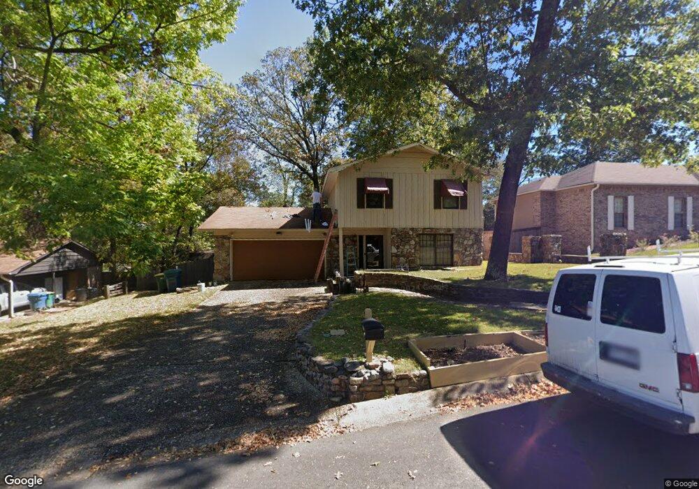
5501 Robin Rd Little Rock, AR 72204
Westwood NeighborhoodEstimated Value: $153,376 - $173,000
--
Bed
4
Baths
1,505
Sq Ft
$110/Sq Ft
Est. Value
About This Home
This home is located at 5501 Robin Rd, Little Rock, AR 72204 and is currently estimated at $165,344, approximately $109 per square foot. 5501 Robin Rd is a home located in Pulaski County with nearby schools including Western Hills Elementary School, Cloverdale Middle School, and Little Rock Southwest High School.
Ownership History
Date
Name
Owned For
Owner Type
Purchase Details
Closed on
Jun 29, 2006
Sold by
Beard Charles
Bought by
Beard Charles and Dunn Roderick Lee
Current Estimated Value
Home Financials for this Owner
Home Financials are based on the most recent Mortgage that was taken out on this home.
Original Mortgage
$22,720
Outstanding Balance
$13,128
Interest Rate
6.36%
Mortgage Type
Fannie Mae Freddie Mac
Estimated Equity
$152,216
Purchase Details
Closed on
May 2, 2006
Sold by
Marbley Darryl A and Marbley Cassuandra Q
Bought by
Beard Charles
Home Financials for this Owner
Home Financials are based on the most recent Mortgage that was taken out on this home.
Original Mortgage
$22,720
Outstanding Balance
$13,128
Interest Rate
6.36%
Mortgage Type
Fannie Mae Freddie Mac
Estimated Equity
$152,216
Purchase Details
Closed on
May 22, 1998
Sold by
Carter Michael D and Carter Allison
Bought by
Marbley Darryl A
Home Financials for this Owner
Home Financials are based on the most recent Mortgage that was taken out on this home.
Original Mortgage
$75,315
Interest Rate
7%
Mortgage Type
VA
Create a Home Valuation Report for This Property
The Home Valuation Report is an in-depth analysis detailing your home's value as well as a comparison with similar homes in the area
Home Values in the Area
Average Home Value in this Area
Purchase History
| Date | Buyer | Sale Price | Title Company |
|---|---|---|---|
| Beard Charles | -- | Stewart Title Of Ar Inc | |
| Beard Charles | $114,000 | Stewart Title Of Arkansas | |
| Marbley Darryl A | $72,000 | American Abstract & Title Co |
Source: Public Records
Mortgage History
| Date | Status | Borrower | Loan Amount |
|---|---|---|---|
| Open | Beard Charles | $22,720 | |
| Open | Beard Charles | $90,880 | |
| Previous Owner | Marbley Darryl A | $75,315 |
Source: Public Records
Tax History Compared to Growth
Tax History
| Year | Tax Paid | Tax Assessment Tax Assessment Total Assessment is a certain percentage of the fair market value that is determined by local assessors to be the total taxable value of land and additions on the property. | Land | Improvement |
|---|---|---|---|---|
| 2025 | $1,594 | $26,421 | $4,200 | $22,221 |
| 2024 | $1,461 | $26,421 | $4,200 | $22,221 |
| 2023 | $1,461 | $26,421 | $4,200 | $22,221 |
| 2022 | $1,394 | $26,421 | $4,200 | $22,221 |
| 2021 | $1,337 | $18,970 | $2,200 | $16,770 |
| 2020 | $953 | $18,970 | $2,200 | $16,770 |
| 2019 | $953 | $18,970 | $2,200 | $16,770 |
| 2018 | $978 | $18,970 | $2,200 | $16,770 |
| 2017 | $978 | $18,970 | $2,200 | $16,770 |
| 2016 | $1,579 | $22,550 | $4,000 | $18,550 |
| 2015 | $1,581 | $22,550 | $4,000 | $18,550 |
| 2014 | $1,581 | $22,550 | $4,000 | $18,550 |
Source: Public Records
Map
Nearby Homes
- TBD Cardinal Rd
- 8012 Westwood Ave
- 5116 Nancy Ct
- Lot 53 Block 5 Westwood Ave
- 8307 Ascension Rd
- 8110 Ascension Rd
- 40 W Windsor Dr
- 27 Westmont Cir
- 29 Rosewood Dr
- 1 W Windsor Dr
- 15 Ardmore Dr
- 4705 Elmwood Dr
- 5813 Forest View Rd
- 48 Westmont Cir
- 8416 Westwood Ln
- 5718 Forest View Rd
- 4814 Manor Ave
- 17 Belmar Dr
- 5 Westwood Ln
- 5 Delrose Dr
- 5507 Robin Rd Unit Corner of Robin Road
- 5427 Robin Rd
- 5511 Robin Rd
- 5502 Wren Rd
- 5508 Wren Rd
- 5508 Wren Rd Unit 4109 Lee Avenue
- 0 Wren Unit 15024540
- 0 Wren Unit 4109 Lee Avenue
- 0 Wren
- 5428 Wren Rd
- 5419 Robin Rd
- 7919 Lee Summit Dr
- lot 23,24,25,26 Lee Summit Dr
- Lot 7 Lee Summit Dr
- Lot 5 Lee Summit Dr
- 000 Lee Summit Dr
- 0 Robin Rd Unit 17010729
- 0 Robin Rd
- 5502 Robin Rd
- 7818 Lee Summit Dr