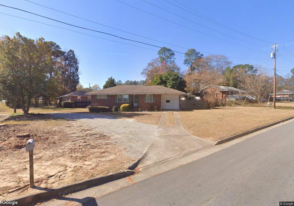
5503 Perry Ave Columbus, GA 31909
North Columbus NeighborhoodEstimated Value: $138,380 - $175,000
3
Beds
2
Baths
1,170
Sq Ft
$137/Sq Ft
Est. Value
About This Home
This home is located at 5503 Perry Ave, Columbus, GA 31909 and is currently estimated at $159,845, approximately $136 per square foot. 5503 Perry Ave is a home located in Muscogee County with nearby schools including Allen Elementary School, Arnold Middle School, and Jordan Vocational High School.
Ownership History
Date
Name
Owned For
Owner Type
Purchase Details
Closed on
Oct 22, 2024
Sold by
Overby Margaret Sue
Bought by
Overby Margaret Sue and Overby Andrew Jonathan
Current Estimated Value
Purchase Details
Closed on
Jun 29, 2007
Sold by
Ellis William Jack
Bought by
Overby Margaret S
Home Financials for this Owner
Home Financials are based on the most recent Mortgage that was taken out on this home.
Original Mortgage
$70,000
Interest Rate
6.35%
Mortgage Type
Purchase Money Mortgage
Create a Home Valuation Report for This Property
The Home Valuation Report is an in-depth analysis detailing your home's value as well as a comparison with similar homes in the area
Home Values in the Area
Average Home Value in this Area
Purchase History
| Date | Buyer | Sale Price | Title Company |
|---|---|---|---|
| Overby Margaret Sue | -- | None Listed On Document | |
| Overby Margaret S | $70,000 | None Available |
Source: Public Records
Mortgage History
| Date | Status | Borrower | Loan Amount |
|---|---|---|---|
| Previous Owner | Overby Margaret S | $70,000 |
Source: Public Records
Tax History
| Year | Tax Paid | Tax Assessment Tax Assessment Total Assessment is a certain percentage of the fair market value that is determined by local assessors to be the total taxable value of land and additions on the property. | Land | Improvement |
|---|---|---|---|---|
| 2025 | $961 | $37,496 | $8,436 | $29,060 |
| 2024 | $961 | $37,496 | $8,436 | $29,060 |
| 2023 | $273 | $37,496 | $8,436 | $29,060 |
| 2022 | $1,003 | $35,104 | $8,436 | $26,668 |
| 2021 | $1,003 | $35,976 | $8,436 | $27,540 |
| 2020 | $1,003 | $35,976 | $8,436 | $27,540 |
| 2019 | $1,006 | $35,976 | $8,436 | $27,540 |
| 2018 | $1,006 | $35,976 | $8,436 | $27,540 |
| 2017 | $1,009 | $35,976 | $8,436 | $27,540 |
| 2016 | $1,013 | $46,056 | $5,113 | $40,943 |
| 2015 | $405 | $46,056 | $5,113 | $40,943 |
| 2014 | $405 | $46,056 | $5,113 | $40,943 |
| 2013 | -- | $46,056 | $5,113 | $40,943 |
Source: Public Records
Map
Nearby Homes
- 3091 Mustang Dr
- 3121 Bellanca St
- 2924 Beech St
- 5724 Sanford Ave
- 5829 Ventura Dr
- 3308 Mustang Dr
- 3342 Windermere St
- 2528 Lorraine St
- 2516 Lorraine St
- 3411 Tewson Dr
- 2977 Blanchard Place
- 5502 Southlea Ln
- 6321 Blanchard Ct
- 6002 Canterbury Dr
- 3325 N Quay Dr
- 2325 Coventry Dr
- 3710 Winkfield Place
- 5239 23rd Ave
- 5235 23rd Ave
- 5224 23rd Ave
- 2909 Piper St
- 5513 Perry Ave
- 5502 Perry Ave
- 2918 Piper St
- 5519 Perry Ave
- 2935 W Britt David Rd
- 5510 Perry Ave
- 2927 W Britt David Rd
- 2900 Piper St
- 5516 Perry Ave
- 2919 W Britt David Rd
- 3004 Piper St
- 5525 Perry Ave
- 2955 W Britt David Rd
- 2913 W Britt David Rd
- 5524 Perry Ave
- 3009 Piper St
- 3010 Piper St
- 2907 W Britt David Rd
- 3001 W Britt David Rd
Your Personal Tour Guide
Ask me questions while you tour the home.