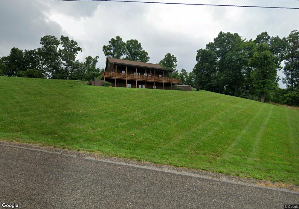
5505 Dalzell Rd Whipple, OH 45788
Estimated Value: $263,000 - $358,000
3
Beds
4
Baths
2,448
Sq Ft
$126/Sq Ft
Est. Value
About This Home
This home is located at 5505 Dalzell Rd, Whipple, OH 45788 and is currently estimated at $308,820, approximately $126 per square foot. 5505 Dalzell Rd is a home with nearby schools including Fort Frye High School.
Ownership History
Date
Name
Owned For
Owner Type
Purchase Details
Closed on
Oct 21, 2019
Sold by
Griffin Cody A and Griffin Emily D
Bought by
Kirkbride Janet
Current Estimated Value
Purchase Details
Closed on
Aug 17, 2009
Sold by
Adams Malissa
Bought by
Griffin Cody A and Parks Emily D
Home Financials for this Owner
Home Financials are based on the most recent Mortgage that was taken out on this home.
Original Mortgage
$14,000
Interest Rate
5.21%
Mortgage Type
Purchase Money Mortgage
Purchase Details
Closed on
Jun 4, 1999
Bought by
Hendershot Larry Gene
Create a Home Valuation Report for This Property
The Home Valuation Report is an in-depth analysis detailing your home's value as well as a comparison with similar homes in the area
Home Values in the Area
Average Home Value in this Area
Purchase History
| Date | Buyer | Sale Price | Title Company |
|---|---|---|---|
| Kirkbride Janet | $238,000 | None Available | |
| Griffin Cody A | $15,000 | None Available | |
| Hendershot Larry Gene | -- | -- |
Source: Public Records
Mortgage History
| Date | Status | Borrower | Loan Amount |
|---|---|---|---|
| Previous Owner | Griffin Cody A | $14,000 |
Source: Public Records
Tax History Compared to Growth
Tax History
| Year | Tax Paid | Tax Assessment Tax Assessment Total Assessment is a certain percentage of the fair market value that is determined by local assessors to be the total taxable value of land and additions on the property. | Land | Improvement |
|---|---|---|---|---|
| 2024 | $2,304 | $79,470 | $5,970 | $73,500 |
| 2023 | $2,304 | $79,470 | $5,970 | $73,500 |
| 2022 | $2,293 | $79,470 | $5,970 | $73,500 |
| 2021 | $1,994 | $67,490 | $4,860 | $62,630 |
| 2020 | $1,997 | $67,490 | $4,860 | $62,630 |
| 2019 | $1,656 | $56,130 | $4,860 | $51,270 |
| 2018 | $1,497 | $49,620 | $4,050 | $45,570 |
| 2017 | $1,502 | $49,620 | $4,050 | $45,570 |
| 2016 | $2,919 | $49,620 | $4,050 | $45,570 |
| 2015 | $1,309 | $40,450 | $3,940 | $36,510 |
| 2014 | $2,365 | $40,450 | $3,940 | $36,510 |
| 2013 | $660 | $40,450 | $3,940 | $36,510 |
Source: Public Records
Map
Nearby Homes
- 2115 Goss Fork Rd
- 200 Frakes Rd
- 2800 Tick Ridge Rd
- Lot 4 Moss Run Rd
- 9865 State Route 821
- 34799 Paw Rd
- 0 Stanleyville Rd
- 65 Warner Second St
- 50 & 60 Railroad St
- 15999 Ohio 26
- 4 Moss Run Rd
- 15999 State Route 26
- 0 Moss Run Rd
- Lot 3 Brooks Rd
- Lot 1 Brooks Rd
- 3275 Highland Ridge Rd
- 0 Highland Ridge Rd
- 0 Township Highway 272
- 1240 Shay Ridge Rd
- 0 Heddleson Ridge Unit 223033844
- 5707 Dalzell Rd
- 5350 Dalzell Rd
- 5919 Dalzell Rd
- 5840 Dalzell Rd
- 330 Scotts Ridge Rd
- 6080 Dalzell Rd
- 4955 Dalzell Rd
- 4700 Dalzell Rd
- 6190 Dalzell Rd
- 3121 Deans Fork Rd
- 0 Kohl Rd
- 6410 Dalzell Rd
- 810 Best Hollow Rd
- 75 Goss Fork Rd
- 445 Goss Fork Rd
- 4470 Dalzell Rd
- 2115 T24
- 515 Scotts Ridge Rd
- 4385 Dalzell Rd
- 700 Scotts Ridge Rd