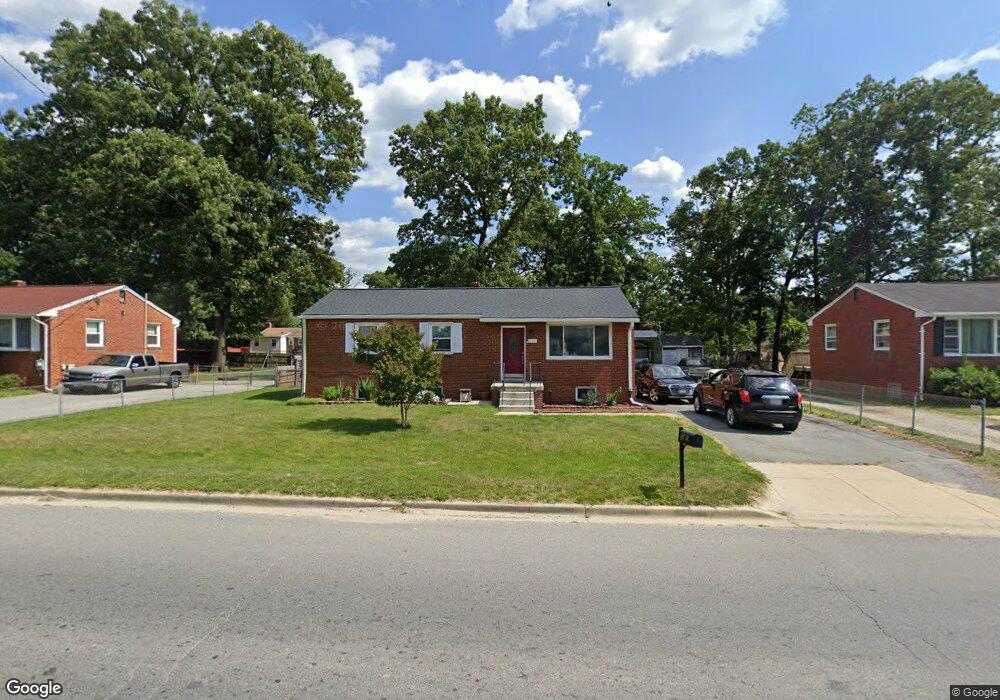
5505 Kirby Rd Clinton, MD 20735
Estimated Value: $332,000 - $371,000
--
Bed
1
Bath
1,100
Sq Ft
$327/Sq Ft
Est. Value
About This Home
This home is located at 5505 Kirby Rd, Clinton, MD 20735 and is currently estimated at $359,743, approximately $327 per square foot. 5505 Kirby Rd is a home located in Prince George's County with nearby schools including James Ryder Randall Elementary School, Stephen Decatur Middle School, and Surrattsville High School.
Ownership History
Date
Name
Owned For
Owner Type
Purchase Details
Closed on
Jun 19, 2015
Sold by
Perry Gail D and Haynie Gail Denise
Bought by
Haynie Gail Denise and Haynie Niles Thaddeus
Current Estimated Value
Purchase Details
Closed on
Apr 8, 2004
Sold by
Cain Gail D
Bought by
Perry Gail D
Purchase Details
Closed on
Feb 20, 2004
Sold by
Cain Gail D
Bought by
Perry Gail D
Purchase Details
Closed on
Jul 11, 2000
Sold by
Vincent Gregory L
Bought by
Cain Gail D
Purchase Details
Closed on
Nov 24, 1998
Sold by
Coulter Jacob W
Bought by
Vincent Gregory L
Purchase Details
Closed on
Jun 15, 1998
Sold by
Coulter Elwood W and Coulter Doris L
Bought by
Coulter Jacob W
Create a Home Valuation Report for This Property
The Home Valuation Report is an in-depth analysis detailing your home's value as well as a comparison with similar homes in the area
Home Values in the Area
Average Home Value in this Area
Purchase History
| Date | Buyer | Sale Price | Title Company |
|---|---|---|---|
| Haynie Gail Denise | -- | Attorney | |
| Perry Gail D | -- | -- | |
| Perry Gail D | -- | -- | |
| Cain Gail D | $115,000 | -- | |
| Vincent Gregory L | $100,000 | -- | |
| Coulter Jacob W | -- | -- |
Source: Public Records
Tax History Compared to Growth
Tax History
| Year | Tax Paid | Tax Assessment Tax Assessment Total Assessment is a certain percentage of the fair market value that is determined by local assessors to be the total taxable value of land and additions on the property. | Land | Improvement |
|---|---|---|---|---|
| 2025 | $3,516 | $292,300 | $101,300 | $191,000 |
| 2024 | $3,516 | $275,133 | $0 | $0 |
| 2023 | $3,380 | $257,967 | $0 | $0 |
| 2022 | $3,214 | $240,800 | $101,300 | $139,500 |
| 2021 | $3,092 | $231,800 | $0 | $0 |
| 2020 | $3,033 | $222,800 | $0 | $0 |
| 2019 | $2,958 | $213,800 | $100,600 | $113,200 |
| 2018 | $2,870 | $204,833 | $0 | $0 |
| 2017 | $2,798 | $195,867 | $0 | $0 |
| 2016 | -- | $186,900 | $0 | $0 |
| 2015 | $2,533 | $186,900 | $0 | $0 |
| 2014 | $2,533 | $186,900 | $0 | $0 |
Source: Public Records
Map
Nearby Homes
- 5900 Arbroath Dr
- 5218 Kenstan Dr
- 7308 Berkshire Dr
- 6006 Runnymeade Ave
- 6009 Sellner Ln
- 7100 Murphy Ct
- 6109 Kirby Rd
- 7300 Roselynn Ln
- 7201 Loch Raven Rd
- 7107 Loch Raven Rd
- 5209 Sumter Ct
- 8605 Sumter Ln
- 5700 Mansfield Dr
- 5509 Windsor Dr
- 6901 Westchester Dr
- 5506 San Juan Dr
- 5801 San Juan Dr
- 6807 Allentown Rd
- 6702 Berkshire Dr
- 5402 Trent St
- 5503 Kirby Rd
- 5507 Kirby Rd
- 5604 Spruce Dr
- 5602 Spruce Dr
- 5606 Spruce Dr
- 5509 Kirby Rd
- 5504 Ramblewood Ave
- 5501 Kirby Rd
- 5608 Spruce Dr
- 5600 Spruce Dr
- 5511 Kirby Rd
- 5514 Rockfish Way
- 5512 Rockfish Way
- 5510 Rockfish Way
- 5518 Rockfish Way
- 5508 Rockfish Way
- 5520 Rockfish Way
- 5610 Spruce Dr
- 5506 Rockfish Way
- 5522 Rockfish Way