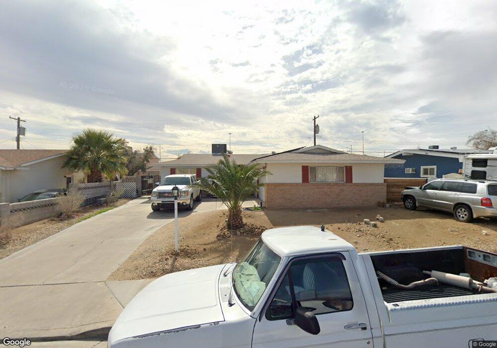
5505 Morendo Dr Las Vegas, NV 89107
Michael Way NeighborhoodEstimated Value: $330,402 - $371,000
3
Beds
2
Baths
1,134
Sq Ft
$305/Sq Ft
Est. Value
About This Home
This home is located at 5505 Morendo Dr, Las Vegas, NV 89107 and is currently estimated at $345,351, approximately $304 per square foot. 5505 Morendo Dr is a home located in Clark County with nearby schools including J.T. McWlliams Elementary School, Robert O Gibson Middle School, and Western High School.
Ownership History
Date
Name
Owned For
Owner Type
Purchase Details
Closed on
Mar 19, 2021
Sold by
Adams Ryan and Donna J Cristino Trust
Bought by
Adams Ryan Brady
Current Estimated Value
Purchase Details
Closed on
Aug 11, 2004
Sold by
Cristino Anthony E
Bought by
Donna J Cristino Trust
Purchase Details
Closed on
Oct 30, 1999
Sold by
Cristino Anthony E and Cristino Audrey L
Bought by
Cristino Anthony E and Cristino Family Trust
Purchase Details
Closed on
Mar 5, 1995
Sold by
Cristino Anthony E and Cristino Audrey L
Bought by
Cristino Anthony E and Cristino Audrey L
Create a Home Valuation Report for This Property
The Home Valuation Report is an in-depth analysis detailing your home's value as well as a comparison with similar homes in the area
Home Values in the Area
Average Home Value in this Area
Purchase History
| Date | Buyer | Sale Price | Title Company |
|---|---|---|---|
| Adams Ryan Brady | -- | None Available | |
| Donna J Cristino Trust | -- | -- | |
| Cristino Anthony E | -- | -- | |
| Cristino Anthony E | -- | -- |
Source: Public Records
Tax History Compared to Growth
Tax History
| Year | Tax Paid | Tax Assessment Tax Assessment Total Assessment is a certain percentage of the fair market value that is determined by local assessors to be the total taxable value of land and additions on the property. | Land | Improvement |
|---|---|---|---|---|
| 2025 | $752 | $52,025 | $29,750 | $22,275 |
| 2024 | $752 | $52,025 | $29,750 | $22,275 |
| 2023 | $752 | $49,072 | $29,050 | $20,022 |
| 2022 | $696 | $43,494 | $25,550 | $17,944 |
| 2021 | $645 | $41,183 | $24,500 | $16,683 |
| 2020 | $596 | $37,233 | $21,000 | $16,233 |
| 2019 | $578 | $33,128 | $17,500 | $15,628 |
| 2018 | $562 | $30,497 | $15,750 | $14,747 |
| 2017 | $997 | $30,415 | $15,750 | $14,665 |
| 2016 | $533 | $25,299 | $11,200 | $14,099 |
| 2015 | $531 | $23,473 | $9,800 | $13,673 |
| 2014 | $515 | $15,250 | $5,250 | $10,000 |
Source: Public Records
Map
Nearby Homes
- 208 Orland St Unit 10
- 208 Orland St Unit 9
- 204 Orland St Unit 2
- 212 Orland St Unit 23
- 212 Orland St Unit 28
- 212 Orland St Unit 22
- 212 Orland St Unit 19
- 212 Orland St Unit 17
- 304 Orland St Unit 53
- 304 Orland St Unit 56
- 304 Orland St Unit 39
- 304 Orland St Unit 38
- 304 Orland St Unit 47
- 304 Orland St Unit 43
- 5620 Roseridge Ave
- 5420 Moonstruck Ave
- 600 Woodmount Dr
- 5713 Whiteridge Ave
- 5705 Pearldrop Ave
- 5612 Pearldrop Ave
- 5509 Morendo Dr
- 5501 Morendo Dr
- 5504 Tanya Ave
- 5508 Tanya Ave
- 5500 Tanya Ave
- 5513 Morendo Dr
- 5417 Morendo Dr
- 5504 Morendo Dr
- 5508 Morendo Dr
- 5512 Tanya Ave
- 5416 Tanya Ave
- 5512 Morendo Dr
- 5517 Morendo Dr
- 5416 Morendo Dr
- 5413 Morendo Dr
- 5413 Morendo Dr
- 5516 Tanya Ave
- 5412 Tanya Ave
- 5516 Morendo Dr
- 5501 Tanya Ave