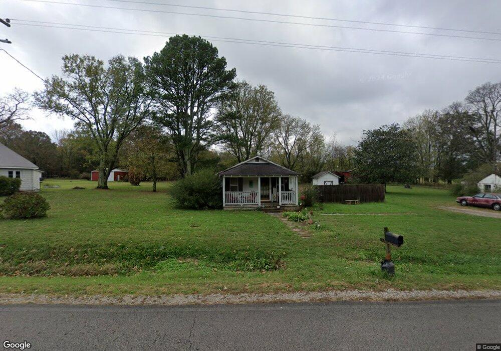
5505 Roarks Cove Rd Decherd, TN 37324
Estimated Value: $82,865 - $162,000
--
Bed
1
Bath
772
Sq Ft
$166/Sq Ft
Est. Value
About This Home
This home is located at 5505 Roarks Cove Rd, Decherd, TN 37324 and is currently estimated at $128,216, approximately $166 per square foot. 5505 Roarks Cove Rd is a home located in Franklin County with nearby schools including North Middle School and Franklin County High School.
Ownership History
Date
Name
Owned For
Owner Type
Purchase Details
Closed on
Mar 11, 1998
Sold by
Russell Richard A
Bought by
Gipson James A
Current Estimated Value
Home Financials for this Owner
Home Financials are based on the most recent Mortgage that was taken out on this home.
Original Mortgage
$40,388
Outstanding Balance
$7,369
Interest Rate
6.99%
Estimated Equity
$120,847
Purchase Details
Closed on
Feb 28, 1992
Bought by
Russell Richard A and Russell Shirley M
Purchase Details
Closed on
Jul 13, 1967
Bought by
Morris Elbert Wayne and Cloris Marie
Create a Home Valuation Report for This Property
The Home Valuation Report is an in-depth analysis detailing your home's value as well as a comparison with similar homes in the area
Home Values in the Area
Average Home Value in this Area
Purchase History
| Date | Buyer | Sale Price | Title Company |
|---|---|---|---|
| Gipson James A | $39,150 | -- | |
| Russell Richard A | $25,000 | -- | |
| Morris Elbert Wayne | -- | -- |
Source: Public Records
Mortgage History
| Date | Status | Borrower | Loan Amount |
|---|---|---|---|
| Open | Morris Elbert Wayne | $40,388 |
Source: Public Records
Tax History Compared to Growth
Tax History
| Year | Tax Paid | Tax Assessment Tax Assessment Total Assessment is a certain percentage of the fair market value that is determined by local assessors to be the total taxable value of land and additions on the property. | Land | Improvement |
|---|---|---|---|---|
| 2024 | $346 | $17,350 | $4,025 | $13,325 |
| 2023 | $451 | $17,350 | $4,025 | $13,325 |
| 2022 | $424 | $22,625 | $4,025 | $18,600 |
| 2021 | $350 | $22,625 | $4,025 | $18,600 |
| 2020 | $350 | $12,175 | $3,075 | $9,100 |
| 2019 | $350 | $12,175 | $3,075 | $9,100 |
| 2018 | $326 | $12,175 | $3,075 | $9,100 |
| 2017 | $326 | $12,175 | $3,075 | $9,100 |
| 2016 | $263 | $9,825 | $2,600 | $7,225 |
| 2015 | $263 | $9,825 | $2,600 | $7,225 |
| 2014 | $263 | $9,826 | $0 | $0 |
Source: Public Records
Map
Nearby Homes
- 9616 Old Alto Hwy
- 8084 Old Alto Hwy
- 836 Spur Rd
- 0 Spur Rd Unit RTC3013804
- 0 Spur Rd Unit RTC3013799
- 0 Spur Rd Unit RTC3013780
- 0 Spur Rd Unit RTC2991940
- 0 Greenhaw Rd Unit RTC2963691
- 0 Greenhaw Rd Unit RTC2940890
- 0 Greenhaw Rd Unit RTC2940888
- 0 Greenhaw Rd Unit RTC2940887
- 0 Greenhaw Rd Unit RTC2940886
- 0 Greenhaw Rd Unit RTC2940878
- 0 Greenhaw Rd Unit RTC2923551
- 0 Providence Rd
- 106 Wilder Chapel Rd
- 66 Wilder Chapel Rd
- 761 Cedar Mountain Place
- 0 Laxton Rd Unit RTC2957818
- 72 Lady Slipper Ln
- 5485 Roarks Cove Rd
- 5461 Roarks Cove Rd
- 5510 Roarks Cove Rd
- 5445 Roarks Cove Rd
- 5548 Roarks Cove Rd
- 5420 Roarks Cove Rd
- 5627 Roarks Cove Rd
- 9712 Old Alto Hwy
- 9711 Old Alto Hwy
- 9697 Old Alto Hwy
- 9890 Old Alto Hwy
- 9815 Old Alto Hwy
- 45 Rutledge Ford Rd
- 60 Rutledge Ford Rd
- 69 Rutledge Ford Rd
- 9847 Old Alto Hwy
- 9539 Old Alto Hwy
- 9993 Old Alto Hwy
- 9507 Old Alto Hwy
- 10045 Old Alto Hwy