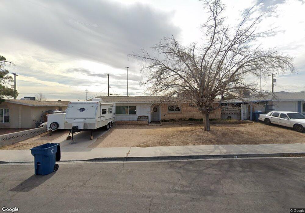
5505 Tanya Ave Las Vegas, NV 89107
Michael Way NeighborhoodEstimated Value: $329,525 - $367,000
3
Beds
2
Baths
1,457
Sq Ft
$239/Sq Ft
Est. Value
About This Home
This home is located at 5505 Tanya Ave, Las Vegas, NV 89107 and is currently estimated at $348,881, approximately $239 per square foot. 5505 Tanya Ave is a home located in Clark County with nearby schools including J.T. McWlliams Elementary School, Robert O Gibson Middle School, and Western High School.
Ownership History
Date
Name
Owned For
Owner Type
Purchase Details
Closed on
Aug 8, 2001
Sold by
Ferris Gary L and Ferris Gary Lynn
Bought by
Kleinpeter Phillander J and Kleinpeter Paula
Current Estimated Value
Home Financials for this Owner
Home Financials are based on the most recent Mortgage that was taken out on this home.
Original Mortgage
$114,000
Outstanding Balance
$44,662
Interest Rate
7.21%
Estimated Equity
$304,219
Purchase Details
Closed on
Nov 29, 1993
Sold by
Ferris Gary Lynn
Bought by
Ferris Gary Lynn and Ferris Joanne T
Home Financials for this Owner
Home Financials are based on the most recent Mortgage that was taken out on this home.
Original Mortgage
$74,470
Interest Rate
6.85%
Mortgage Type
VA
Create a Home Valuation Report for This Property
The Home Valuation Report is an in-depth analysis detailing your home's value as well as a comparison with similar homes in the area
Home Values in the Area
Average Home Value in this Area
Purchase History
| Date | Buyer | Sale Price | Title Company |
|---|---|---|---|
| Kleinpeter Phillander J | $120,000 | Stewart Title | |
| Ferris Gary Lynn | -- | Nevada Title Company |
Source: Public Records
Mortgage History
| Date | Status | Borrower | Loan Amount |
|---|---|---|---|
| Open | Kleinpeter Phillander J | $114,000 | |
| Previous Owner | Ferris Gary Lynn | $74,470 |
Source: Public Records
Tax History Compared to Growth
Tax History
| Year | Tax Paid | Tax Assessment Tax Assessment Total Assessment is a certain percentage of the fair market value that is determined by local assessors to be the total taxable value of land and additions on the property. | Land | Improvement |
|---|---|---|---|---|
| 2025 | $780 | $48,603 | $29,750 | $18,853 |
| 2024 | $723 | $48,603 | $29,750 | $18,853 |
| 2023 | $723 | $46,072 | $29,050 | $17,022 |
| 2022 | $670 | $40,725 | $25,550 | $15,175 |
| 2021 | $621 | $38,641 | $24,500 | $14,141 |
| 2020 | $573 | $34,732 | $21,000 | $13,732 |
| 2019 | $537 | $30,770 | $17,500 | $13,270 |
| 2018 | $513 | $28,175 | $15,750 | $12,425 |
| 2017 | $920 | $28,060 | $15,750 | $12,310 |
| 2016 | $481 | $23,084 | $11,200 | $11,884 |
| 2015 | $479 | $21,326 | $9,800 | $11,526 |
| 2014 | $465 | $13,762 | $5,250 | $8,512 |
Source: Public Records
Map
Nearby Homes
- 208 Orland St Unit 10
- 208 Orland St Unit 9
- 204 Orland St Unit 2
- 212 Orland St Unit 23
- 212 Orland St Unit 28
- 212 Orland St Unit 22
- 212 Orland St Unit 19
- 212 Orland St Unit 17
- 304 Orland St Unit 53
- 304 Orland St Unit 56
- 304 Orland St Unit 39
- 304 Orland St Unit 38
- 304 Orland St Unit 47
- 304 Orland St Unit 43
- 5620 Roseridge Ave
- 5420 Moonstruck Ave
- 600 Woodmount Dr
- 5713 Whiteridge Ave
- 5705 Pearldrop Ave
- 5612 Pearldrop Ave
- 5501 Tanya Ave
- 5509 Tanya Ave
- 5513 Tanya Ave
- 5508 Tanya Ave
- 5504 Tanya Ave
- 5512 Tanya Ave
- 5500 Tanya Ave
- 5517 Tanya Ave
- 116 Reese St
- 5516 Tanya Ave
- 112 Reese St
- 5416 Tanya Ave
- 5509 Morendo Dr
- 5505 Morendo Dr
- 5513 Morendo Dr
- 5520 Tanya Ave
- 5501 Morendo Dr
- 5521 Tanya Ave
- 5412 Tanya Ave
- 5517 Morendo Dr