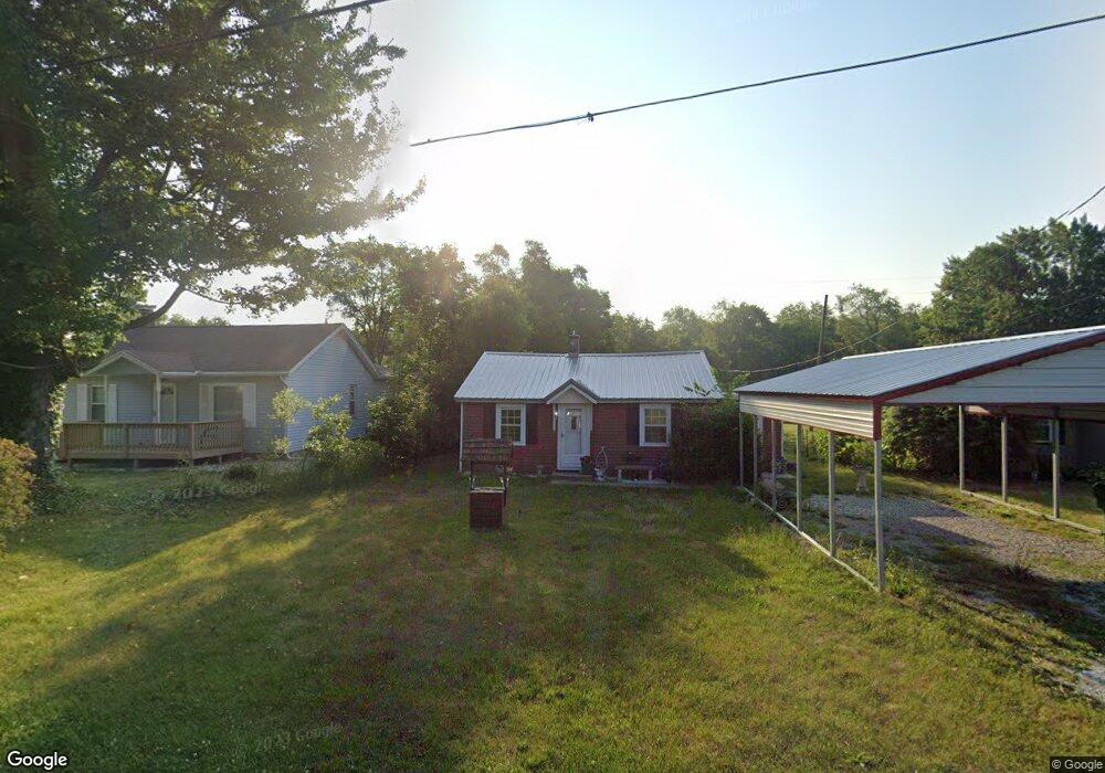
55060 Fresno St South Bend, IN 46628
Estimated Value: $92,000 - $170,000
2
Beds
1
Bath
624
Sq Ft
$198/Sq Ft
Est. Value
About This Home
This home is located at 55060 Fresno St, South Bend, IN 46628 and is currently estimated at $123,739, approximately $198 per square foot. 55060 Fresno St is a home located in St. Joseph County with nearby schools including Paton-Churdan Elementary School, Warren Elementary School, and Clay Intermediate Center.
Ownership History
Date
Name
Owned For
Owner Type
Purchase Details
Closed on
Aug 11, 2014
Sold by
Kikly Frank H
Bought by
Slone Eugene and Slone Mattie M
Current Estimated Value
Purchase Details
Closed on
Aug 17, 2009
Sold by
Kikly Frank H and Kikly Christine E
Bought by
Kikly Frank H and Kikly Lorraine M
Purchase Details
Closed on
Aug 14, 2006
Sold by
Kikly Lorraine M and Kikly Frank H
Bought by
Kikly Frank H and Kikly Christine E
Create a Home Valuation Report for This Property
The Home Valuation Report is an in-depth analysis detailing your home's value as well as a comparison with similar homes in the area
Home Values in the Area
Average Home Value in this Area
Purchase History
| Date | Buyer | Sale Price | Title Company |
|---|---|---|---|
| Slone Eugene | -- | Meridian Title | |
| Kikly Frank H | -- | None Available | |
| Kikly Frank H | -- | None Available |
Source: Public Records
Tax History Compared to Growth
Tax History
| Year | Tax Paid | Tax Assessment Tax Assessment Total Assessment is a certain percentage of the fair market value that is determined by local assessors to be the total taxable value of land and additions on the property. | Land | Improvement |
|---|---|---|---|---|
| 2024 | $2,948 | $55,700 | $19,500 | $36,200 |
| 2023 | $1,345 | $56,000 | $19,500 | $36,500 |
| 2022 | $1,356 | $56,100 | $19,500 | $36,600 |
| 2021 | $946 | $35,200 | $10,300 | $24,900 |
| 2020 | $348 | $35,200 | $10,300 | $24,900 |
| 2019 | $321 | $35,200 | $10,300 | $24,900 |
| 2018 | $288 | $35,300 | $10,300 | $25,000 |
| 2017 | $239 | $29,200 | $10,300 | $18,900 |
| 2016 | $245 | $29,300 | $10,300 | $19,000 |
| 2014 | $205 | $29,100 | $10,300 | $18,800 |
| 2013 | -- | $29,100 | $10,300 | $18,800 |
Source: Public Records
Map
Nearby Homes
- 54962 Quince Rd
- 54520 Norwood Dr
- 54483 Whitesell Dr
- 26366 Hummingbird Rd
- 54492 Avalon Dr
- 55629 Cardinal Dr
- 0 Lakewood Dr
- 25849 Kenwood Dr
- 54221 Longwood Dr
- 25700 Lakewood Dr
- 54000 Block Whitesell Dr
- 26427 Evans Dr
- VL Kenmore Dr
- 26896 Mcarthur Ct
- 26896 Mc Arthur Ct
- 26882 Marshall Dr N
- 26428 US Highway 20
- 26912 U S 20
- Integrity 1605 Plan at West Pointe Estates
- Integrity 2060 Plan at West Pointe Estates
- 55070 Fresno St
- 26259 Eunice St
- 26269 Eunice St
- 26240 Edison Rd
- 26222 Edison Rd
- 26279 Eunice St
- 26300 Eunice St
- 26202 Edison Rd
- 26194 Edison Rd
- 26299 Eunice St
- 26298 Edison Rd
- 26239 Edison Rd
- 26324 Eunice St
- 26308 Edison Rd
- 26259 Edison Rd
- 26158 Edison Rd
- 26326 Edison Rd
- 26344 Eunice St
- 26305 Edison Rd
- 26148 Edison Rd