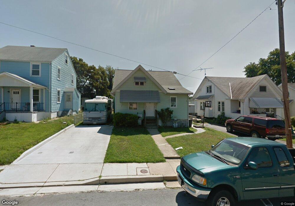
5507 Link Ave Halethorpe, MD 21227
Estimated Value: $270,754 - $330,000
Studio
1
Bath
1,534
Sq Ft
$203/Sq Ft
Est. Value
About This Home
This home is located at 5507 Link Ave, Halethorpe, MD 21227 and is currently estimated at $310,689, approximately $202 per square foot. 5507 Link Ave is a home located in Baltimore County with nearby schools including Arbutus Elementary School, Arbutus Middle School, and Lansdowne High School.
Ownership History
Date
Name
Owned For
Owner Type
Purchase Details
Closed on
Oct 19, 2022
Sold by
Emge B Carol
Bought by
Emge B Carol
Current Estimated Value
Create a Home Valuation Report for This Property
The Home Valuation Report is an in-depth analysis detailing your home's value as well as a comparison with similar homes in the area
Home Values in the Area
Average Home Value in this Area
Purchase History
| Date | Buyer | Sale Price | Title Company |
|---|---|---|---|
| Emge B Carol | -- | -- | |
| Emge B Carol | -- | None Listed On Document |
Source: Public Records
Tax History
| Year | Tax Paid | Tax Assessment Tax Assessment Total Assessment is a certain percentage of the fair market value that is determined by local assessors to be the total taxable value of land and additions on the property. | Land | Improvement |
|---|---|---|---|---|
| 2025 | $3,563 | $214,767 | -- | -- |
| 2024 | $3,563 | $197,900 | $90,700 | $107,200 |
| 2023 | $1,674 | $195,233 | $0 | $0 |
| 2022 | $3,180 | $192,567 | $0 | $0 |
| 2021 | $2,904 | $189,900 | $61,400 | $128,500 |
| 2020 | $2,904 | $185,000 | $0 | $0 |
| 2019 | $3,032 | $180,100 | $0 | $0 |
| 2018 | $3,311 | $175,200 | $61,400 | $113,800 |
| 2017 | $3,112 | $168,367 | $0 | $0 |
| 2016 | $2,427 | $161,533 | $0 | $0 |
| 2015 | $2,427 | $154,700 | $0 | $0 |
| 2014 | $2,427 | $154,700 | $0 | $0 |
Source: Public Records
Map
Nearby Homes
- 5521 Willys Ave
- 1416 Sulphur Spring Rd
- 5522 Ashbourne Rd
- 1328 Stevens Ave
- 5605 Oregon Ave
- 5402 Council St
- 1207 Brewster St
- 1258 Linden Ave
- 1204 Birch Ave
- 1211 Poplar Ave
- 0 Dewitt Rd
- 4412 Maple Ave
- 1078 Downton Rd
- 4606 Ridge Ave
- 1212 Seven Oaks Rd
- 1027 Downton Rd
- 1710H Selma Ave
- 1816 Fairview Ave
- 1015 Stormont Cir
- 4624 Magnolia Ave
- 5509 Link Ave
- 5505 Link Ave
- 5511 Link Ave
- 1325 Sulphur Spring Rd
- 1323 Sulphur Spring Rd
- 5504 Carville Ave Unit B
- 5504 Carville Ave
- 5508 Carville Ave
- 1327 Sulphur Spring Rd
- 5513 Link Ave
- 1329 Sulphur Spring Rd
- 5510 Carville Ave
- 5506 Link Ave
- 5508 Link Ave
- 5504 Link Ave
- 1331 Sulphur Spring Rd
- 5515 Link Ave
- 1319 Sulphur Spring Rd
- 1333 Sulphur Spring Rd
- 5514 Carville Ave
Your Personal Tour Guide
Ask me questions while you tour the home.