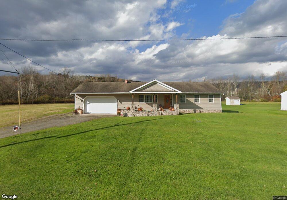
5507 State Route 374 Clifford Township, PA 18441
Estimated Value: $169,000 - $216,000
--
Bed
--
Bath
--
Sq Ft
0.42
Acres
About This Home
This home is located at 5507 State Route 374, Clifford Township, PA 18441 and is currently estimated at $194,504. 5507 State Route 374 is a home with nearby schools including Mountain View Elementary School and Mountain View Junior/Senior High School.
Ownership History
Date
Name
Owned For
Owner Type
Purchase Details
Closed on
Oct 30, 2019
Sold by
Depew Donald Lee and Depew Christine
Bought by
Conroe Ashley Renee
Current Estimated Value
Home Financials for this Owner
Home Financials are based on the most recent Mortgage that was taken out on this home.
Original Mortgage
$102,845
Outstanding Balance
$90,477
Interest Rate
3.6%
Mortgage Type
New Conventional
Estimated Equity
$104,027
Purchase Details
Closed on
Jul 18, 2006
Sold by
Wilder George Glenn and Wilder Mary Elizabeth
Bought by
Depew Donald Lee and Depew Christine
Home Financials for this Owner
Home Financials are based on the most recent Mortgage that was taken out on this home.
Original Mortgage
$128,500
Interest Rate
6.67%
Mortgage Type
New Conventional
Create a Home Valuation Report for This Property
The Home Valuation Report is an in-depth analysis detailing your home's value as well as a comparison with similar homes in the area
Home Values in the Area
Average Home Value in this Area
Purchase History
| Date | Buyer | Sale Price | Title Company |
|---|---|---|---|
| Conroe Ashley Renee | $108,250 | None Available | |
| Depew Donald Lee | $132,500 | None Available |
Source: Public Records
Mortgage History
| Date | Status | Borrower | Loan Amount |
|---|---|---|---|
| Open | Conroe Ashley Renee | $102,845 | |
| Previous Owner | Depew Donald Lee | $128,500 |
Source: Public Records
Tax History Compared to Growth
Tax History
| Year | Tax Paid | Tax Assessment Tax Assessment Total Assessment is a certain percentage of the fair market value that is determined by local assessors to be the total taxable value of land and additions on the property. | Land | Improvement |
|---|---|---|---|---|
| 2025 | $2,386 | $36,700 | $3,800 | $32,900 |
| 2024 | $2,324 | $36,700 | $3,800 | $32,900 |
| 2023 | $2,169 | $36,700 | $3,800 | $32,900 |
| 2022 | $2,157 | $36,700 | $3,800 | $32,900 |
| 2021 | $2,121 | $36,700 | $3,800 | $32,900 |
| 2020 | $2,039 | $36,700 | $3,800 | $32,900 |
| 2019 | $2,039 | $36,700 | $3,800 | $32,900 |
| 2018 | $1,998 | $36,700 | $3,800 | $32,900 |
| 2017 | $36,700 | $36,700 | $3,800 | $32,900 |
| 2016 | $1,864 | $36,700 | $3,800 | $32,900 |
| 2015 | $385 | $36,700 | $0 | $0 |
| 2014 | $385 | $36,700 | $0 | $0 |
Source: Public Records
Map
Nearby Homes
- 4562 Pennsylvania 374
- 0 Louise Dr
- Lot 4 State Route 2014
- 260 Johnson Hill Rd
- 0 Knickerbocker Rd
- 1095 High Bridge Rd
- 589 Church St
- 0 State Route 2014
- 272 Lake Blvd
- 3533 Route 2012
- 00 Elkdale Rd
- L 4 5 6 Lake Unit L 4 5 6
- 8104 State Route 92
- 505 Creek Rd
- 111 Ruthland Rd
- 0 Hack Rd Unit GSBSC251411
- 163 Wagner Blvd
- 169 Wagner Blvd
- 818 Zablotsky Rd
- 0 Boulevard L17i21 Ave Unit GSBSC4519
- 5545 State Route 374
- 5542 State Route 374
- 5522 State Route 374
- 5570 State Route 374
- 5598 State Route 374
- 0 0-2 Oswald Johnson Unit 24-2613
- 477T Rr 1
- 189 Oswald Johnson Rd
- 252 Oswald Johnson Rd
- 330 Oswald Johnson Rd
- 350 Oswald Johnson Rd
- 419 Oswald Johnson Rd
- 6 Wells Rd
- 392 Oswald Johnson Rd
- 1464 Thorn Hill Rd
- 119 Wallace Rd
- 1520 Thorn Hill Rd
- 1290 Thornhill Rd
- 99 Wallace Rd
- 1290 Thorn Hill Rd