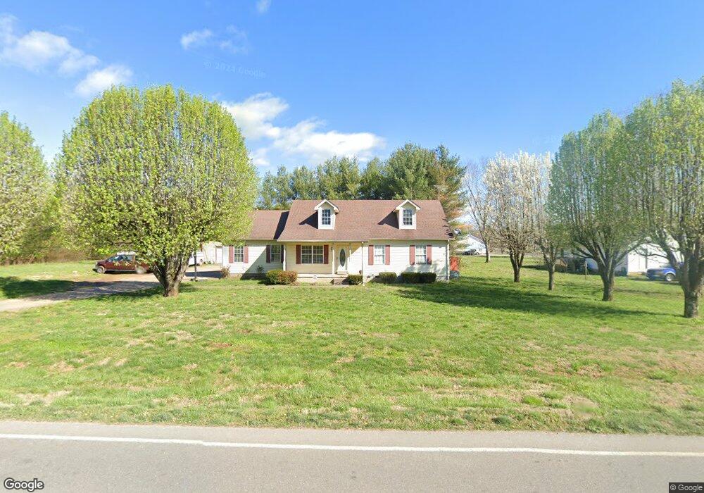
5508 Burnt Knob Rd Murfreesboro, TN 37129
Estimated Value: $332,190 - $383,000
--
Bed
2
Baths
1,218
Sq Ft
$290/Sq Ft
Est. Value
About This Home
This home is located at 5508 Burnt Knob Rd, Murfreesboro, TN 37129 and is currently estimated at $353,548, approximately $290 per square foot. 5508 Burnt Knob Rd is a home located in Rutherford County with nearby schools including Brown's Chapel Elementary School, Blackman Middle School, and Stewarts Creek High School.
Ownership History
Date
Name
Owned For
Owner Type
Purchase Details
Closed on
Nov 2, 1998
Sold by
Casey Michael A
Bought by
Bullard David M and Bullard Julie L
Current Estimated Value
Home Financials for this Owner
Home Financials are based on the most recent Mortgage that was taken out on this home.
Original Mortgage
$86,912
Outstanding Balance
$18,954
Interest Rate
6.58%
Estimated Equity
$334,594
Create a Home Valuation Report for This Property
The Home Valuation Report is an in-depth analysis detailing your home's value as well as a comparison with similar homes in the area
Home Values in the Area
Average Home Value in this Area
Purchase History
| Date | Buyer | Sale Price | Title Company |
|---|---|---|---|
| Bullard David M | $87,000 | -- |
Source: Public Records
Mortgage History
| Date | Status | Borrower | Loan Amount |
|---|---|---|---|
| Open | Bullard David M | $86,912 |
Source: Public Records
Tax History Compared to Growth
Tax History
| Year | Tax Paid | Tax Assessment Tax Assessment Total Assessment is a certain percentage of the fair market value that is determined by local assessors to be the total taxable value of land and additions on the property. | Land | Improvement |
|---|---|---|---|---|
| 2025 | $1,285 | $68,475 | $13,750 | $54,725 |
| 2024 | $1,285 | $68,475 | $13,750 | $54,725 |
| 2023 | $1,285 | $68,475 | $13,750 | $54,725 |
| 2022 | $1,107 | $68,475 | $13,750 | $54,725 |
| 2021 | $1,081 | $48,725 | $8,625 | $40,100 |
| 2020 | $1,081 | $48,725 | $8,625 | $40,100 |
| 2019 | $1,081 | $48,725 | $8,625 | $40,100 |
| 2018 | $1,023 | $48,725 | $0 | $0 |
| 2017 | $935 | $34,900 | $0 | $0 |
| 2016 | $935 | $34,900 | $0 | $0 |
| 2015 | $935 | $34,900 | $0 | $0 |
| 2014 | $868 | $34,900 | $0 | $0 |
| 2013 | -- | $31,025 | $0 | $0 |
Source: Public Records
Map
Nearby Homes
- 5363 Candy Cane Ct
- 5320 Candy Cane Ct
- 0 Vaughn Rd
- 5925 Burnt Knob Rd
- 0 Burnt Knob Rd
- 1217 Westlawn Blvd
- 5900 Willoughby Way
- 5826 Willoughby Way
- 5818 Willoughby Way
- 5802 Willoughby Way
- 5762 Willoughby Way
- Piper Plan at Shelton Square
- Grace Plan at Shelton Square
- 5747 Sagebrush Dr
- 5738 Lennis Ln
- 5743 Sagebrush Dr
- 1526 Dewsbury Dr
- 5731 Sagebrush Dr
- 6410 Hickory Bell Dr
- 1320 Hartlepool Dr
- 2003 Sugartree Dr
- 2007 Sugartree Dr
- 5525 Burnt Knob Rd
- 5496 Burnt Knob Rd
- 5534 Burnt Knob Rd
- 2006 Sugartree Dr
- 5533 Burnt Knob Rd
- 5492 Burnt Knob Rd
- 2011 Sugartree Dr
- 2010 Sugartree Dr
- 5488 Burnt Knob Rd
- 5547 Burnt Knob Rd
- 2015 Sugartree Dr
- 5439 Candy Cane Ct
- 2019 Sugartree Dr
- 5435 Candy Cane Ct
- 5484 Burnt Knob Rd
- 5442 Candy Cane Ct
- 5431 Candy Cane Ct
- 5438 Candy Cane Ct