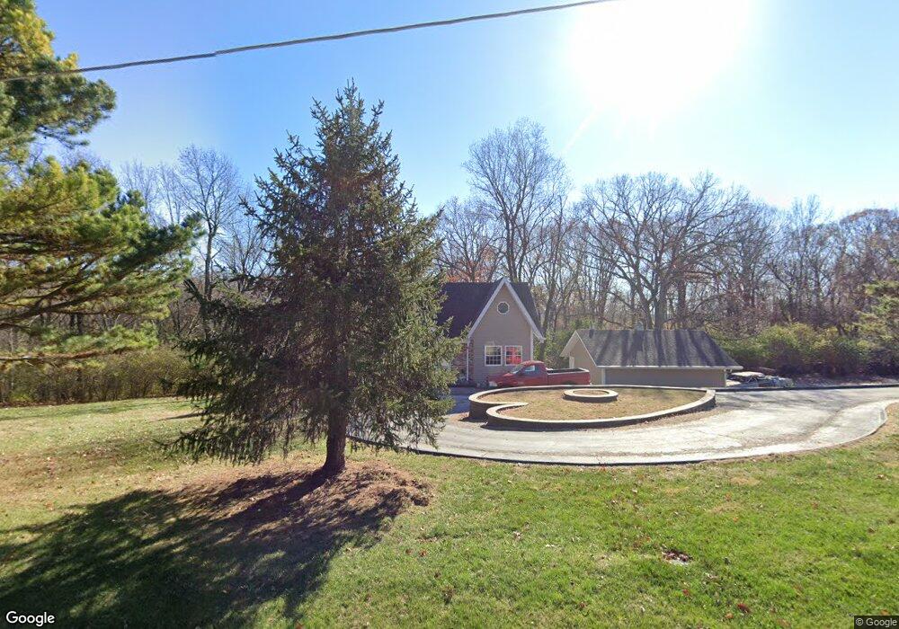
5508 Sassafras Ln High Ridge, MO 63049
Estimated Value: $257,000 - $308,958
--
Bed
--
Bath
1,008
Sq Ft
$276/Sq Ft
Est. Value
About This Home
This home is located at 5508 Sassafras Ln, High Ridge, MO 63049 and is currently estimated at $278,490, approximately $276 per square foot. 5508 Sassafras Ln is a home located in Jefferson County with nearby schools including Northwest High School and St. Anthony School.
Ownership History
Date
Name
Owned For
Owner Type
Purchase Details
Closed on
Nov 8, 2004
Sold by
Middlesworth James R and Middlesworth Janelle M
Bought by
Landess Michael and Landess Patricia
Current Estimated Value
Home Financials for this Owner
Home Financials are based on the most recent Mortgage that was taken out on this home.
Original Mortgage
$145,500
Outstanding Balance
$72,319
Interest Rate
5.72%
Mortgage Type
Purchase Money Mortgage
Estimated Equity
$206,171
Create a Home Valuation Report for This Property
The Home Valuation Report is an in-depth analysis detailing your home's value as well as a comparison with similar homes in the area
Home Values in the Area
Average Home Value in this Area
Purchase History
| Date | Buyer | Sale Price | Title Company |
|---|---|---|---|
| Landess Michael | -- | Heritage Title |
Source: Public Records
Mortgage History
| Date | Status | Borrower | Loan Amount |
|---|---|---|---|
| Open | Landess Michael | $145,500 |
Source: Public Records
Tax History Compared to Growth
Tax History
| Year | Tax Paid | Tax Assessment Tax Assessment Total Assessment is a certain percentage of the fair market value that is determined by local assessors to be the total taxable value of land and additions on the property. | Land | Improvement |
|---|---|---|---|---|
| 2025 | $2,166 | $32,700 | $1,800 | $30,900 |
| 2024 | $2,166 | $30,000 | $1,800 | $28,200 |
| 2023 | $2,166 | $30,000 | $1,800 | $28,200 |
| 2022 | $2,156 | $30,000 | $1,800 | $28,200 |
| 2021 | $2,143 | $30,000 | $1,800 | $28,200 |
| 2020 | $1,961 | $26,800 | $1,400 | $25,400 |
| 2019 | $1,959 | $26,800 | $1,400 | $25,400 |
| 2018 | $1,985 | $26,800 | $1,400 | $25,400 |
| 2017 | $1,814 | $26,800 | $1,400 | $25,400 |
| 2016 | $1,741 | $25,500 | $2,100 | $23,400 |
| 2015 | $1,788 | $25,500 | $2,100 | $23,400 |
| 2013 | -- | $25,500 | $2,100 | $23,400 |
Source: Public Records
Map
Nearby Homes
- 3112 Edgewood Dr
- 9 Amber Ridge Ct
- 5211 Hunning Rd
- 5800 5800 St Rd Pp
- 6029 Timber Hollow Ln
- 2908 Elderwood Cir
- 2801 High Ridge Blvd
- 2713 Ridge Dr
- 5590 Stonecrest Dr
- 4057 Crest Dr
- 4050 Crest Dr
- 0 High Ridge Manor Resub Lot 6 Unit MIS25049757
- 0 High Ridge Manor Resub Lot 7 Unit MAR25011806
- 0 High Ridge Manor Resub Lot 6 Unit MIS25065011
- 1020 Elderberry Dr
- 0 Old Gravois Rd
- 2715 Royal Oak Dr
- TBD State Route 30
- 6152 Franks Rd
- 5050 Schumacher Rd
- 5513 Sassafras Ln
- 5505 Sassafras Ln
- 5500 Sassafras Ln
- 5517 Sassafras Ln
- 3414 Rock Creek Rd
- 5501 Sassafras Ln
- 5511 Sassafras Ln
- 3424 Rock Creek Rd
- 5521 Sassafras Ln
- 3346 Rock Creek Rd
- 3442 Rock Creek Rd
- 3332 Rock Creek Rd
- 3446 Rock Creek Rd
- 5516 Jo Mar Dr
- 3328 Rock Creek Rd
- 3437 Rock Creek Rd
- 3405 Rock Creek Rd
- 3441 Rock Creek Rd
- 5538 Jo Mar Dr
- 3450 Rock Creek Rd