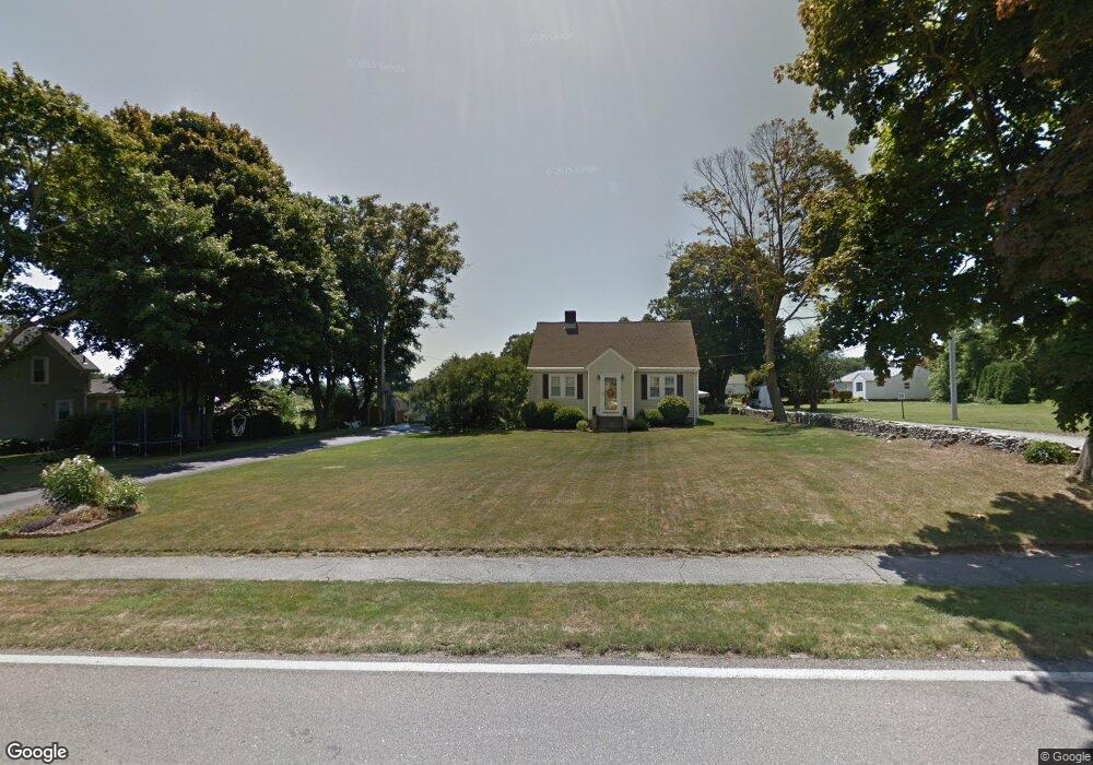
551 Green End Ave Middletown, RI 02842
Estimated Value: $782,556 - $1,007,000
3
Beds
2
Baths
2,070
Sq Ft
$429/Sq Ft
Est. Value
About This Home
This home is located at 551 Green End Ave, Middletown, RI 02842 and is currently estimated at $887,889, approximately $428 per square foot. 551 Green End Ave is a home located in Newport County with nearby schools including Middletown High School, St Michael's Country Day School, and All Saints STEAM Academy.
Ownership History
Date
Name
Owned For
Owner Type
Purchase Details
Closed on
Oct 26, 2022
Sold by
Virgadamo Lori A
Bought by
Virgadamo Taylor A and Virgadamo Alexandra R
Current Estimated Value
Purchase Details
Closed on
Oct 19, 2017
Sold by
Virgadamo John J
Bought by
Virgadamo Lori A
Purchase Details
Closed on
Sep 22, 1992
Sold by
Managhan Kathleen
Bought by
Virgadamo John J and Virgadamo Lori
Create a Home Valuation Report for This Property
The Home Valuation Report is an in-depth analysis detailing your home's value as well as a comparison with similar homes in the area
Home Values in the Area
Average Home Value in this Area
Purchase History
| Date | Buyer | Sale Price | Title Company |
|---|---|---|---|
| Virgadamo Taylor A | -- | None Available | |
| Virgadamo Lori A | -- | -- | |
| Virgadamo John J | $157,500 | -- |
Source: Public Records
Mortgage History
| Date | Status | Borrower | Loan Amount |
|---|---|---|---|
| Previous Owner | Virgadamo John J | $15,000 | |
| Previous Owner | Virgadamo John J | $7,000 | |
| Previous Owner | Virgadamo John J | $15,000 | |
| Previous Owner | Virgadamo John J | $7,000 |
Source: Public Records
Tax History Compared to Growth
Tax History
| Year | Tax Paid | Tax Assessment Tax Assessment Total Assessment is a certain percentage of the fair market value that is determined by local assessors to be the total taxable value of land and additions on the property. | Land | Improvement |
|---|---|---|---|---|
| 2025 | $7,151 | $606,500 | $346,300 | $260,200 |
| 2024 | $6,829 | $606,500 | $346,300 | $260,200 |
| 2023 | $4,833 | $383,900 | $169,800 | $214,100 |
| 2022 | $5,355 | $383,900 | $169,800 | $214,100 |
| 2021 | $4,614 | $383,900 | $169,800 | $214,100 |
| 2020 | $4,718 | $342,900 | $155,400 | $187,500 |
| 2018 | $4,715 | $342,900 | $155,400 | $187,500 |
| 2016 | $4,393 | $284,900 | $110,800 | $174,100 |
| 2015 | $4,285 | $284,900 | $110,800 | $174,100 |
| 2014 | $4,403 | $274,000 | $117,500 | $156,500 |
| 2013 | $4,305 | $274,000 | $117,500 | $156,500 |
Source: Public Records
Map
Nearby Homes
- 0 Honeyman Ave
- 476 Green End Ave
- 318 Corey Ln
- 310 Corey Ln
- 119 Corey Ln
- 223 Corey Ln
- 0 Wolcott Ave
- 980 Green End Ave
- 55 John Clarke Rd Unit 8
- 55 John Clarke Rd Unit 3
- 202 Reservoir Rd
- 138 Green End Ave
- 118 Wolcott Ave
- 16 Sachuest Dr
- 0 Saltwood Dr
- 65 Seascape Ave
- 6 Wabasso Terrace
- 74 Valley Rd
- 162 Center Ave
- 141 Gray Craig Rd
- 20 Morrison Ave
- 563 Green End Ave
- 571 Green End Ave
- 537 Green End Ave
- 558 Green End Ave
- 552 Green End Ave
- 577 Green End Ave
- 531 Green End Ave
- 9 Harvey Rd
- 574 Green End Ave
- 527 Green End Ave
- 635 Turner Rd
- 23 Morrison Ave
- 19 Harvey Rd
- 528 Green End Ave
- 35 Morrison Ave
- 519 Green End Ave
- 625 Turner Rd
- 630 Turner Rd
- 12 Harvey Rd