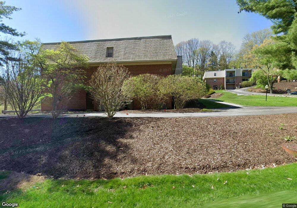
551 Sloop Rd Pittsburgh, PA 15237
Estimated Value: $148,995 - $163,000
2
Beds
2
Baths
1,001
Sq Ft
$156/Sq Ft
Est. Value
About This Home
This home is located at 551 Sloop Rd, Pittsburgh, PA 15237 and is currently estimated at $155,665, approximately $155 per square foot. 551 Sloop Rd is a home located in Allegheny County with nearby schools including McKnight Elementary School, Ingomar Middle School, and North Allegheny High School.
Ownership History
Date
Name
Owned For
Owner Type
Purchase Details
Closed on
Nov 23, 2015
Sold by
Moschella Domenico and Moschella Danielle M
Bought by
Rvsc Properties Llc
Current Estimated Value
Purchase Details
Closed on
May 21, 2008
Sold by
Krepp Ruth P
Bought by
Moschella Domenico
Purchase Details
Closed on
Apr 16, 2001
Sold by
Russ Thoerner Ruth and Thoerner Charles
Bought by
Krepp Ruth P
Purchase Details
Closed on
May 17, 1996
Sold by
Smith Florence V
Bought by
Russ Ruth E
Create a Home Valuation Report for This Property
The Home Valuation Report is an in-depth analysis detailing your home's value as well as a comparison with similar homes in the area
Home Values in the Area
Average Home Value in this Area
Purchase History
| Date | Buyer | Sale Price | Title Company |
|---|---|---|---|
| Rvsc Properties Llc | $85,000 | None Available | |
| Moschella Domenico | $77,500 | -- | |
| Krepp Ruth P | $67,000 | Commonwealth Land Title Ins | |
| Russ Ruth E | $54,000 | -- |
Source: Public Records
Tax History
| Year | Tax Paid | Tax Assessment Tax Assessment Total Assessment is a certain percentage of the fair market value that is determined by local assessors to be the total taxable value of land and additions on the property. | Land | Improvement |
|---|---|---|---|---|
| 2023 | $2,036 | $79,200 | $0 | $79,200 |
| 2022 | $1,988 | $79,200 | $0 | $79,200 |
| 2020 | $1,988 | $79,200 | $0 | $79,200 |
| 2019 | $1,933 | $79,200 | $0 | $79,200 |
| 2018 | $1,898 | $79,200 | $0 | $79,200 |
| 2017 | $1,898 | $79,200 | $0 | $79,200 |
| 2016 | $375 | $79,200 | $0 | $79,200 |
| 2015 | $375 | $79,200 | $0 | $79,200 |
| 2014 | $1,856 | $79,200 | $0 | $79,200 |
Source: Public Records
Map
Nearby Homes
- 603 Calais Dr Unit 2210
- 8732 Breezewood Dr
- 8612 E Barkhurst Dr
- 708 Brookshire Dr
- 8784 Terrace Dr
- 815 Village Dr Unit 102
- 8300 Reagan Dr
- 8180 Roosevelt Blvd
- 598 Olive St
- 8225 E Van Buren Dr
- 469 Inwood Rd
- 9261 Harmony Dr
- 9275 Harmony Dr
- 12 Oxford Ct
- 44 Oxford Ct Unit 44
- 205 Sandle Ave W
- 9403 Almar Place
- 7914 Hemlock St
- 1401 Field Club Ct
- 110 Point Vue Dr
- 551 Sloop Rd Unit 63
- 551 Sloop Rd Unit 62
- 551 Sloop Rd Unit 64
- 551 Sloop Rd
- 551 Sloop Rd Unit 70
- 551 Sloop Rd
- 551 Sloop Rd Unit 67
- 551 Sloop Rd Unit 66
- 551 Sloop Rd Unit 65
- 551 Sloop Rd
- 551 Sloop Rd
- 551 Sloop Rd
- 551 Sloop Rd Unit 58
- 551 Sloop Rd Unit 56
- 551 Sloop Rd Unit 54
- 551 Sloop Rd
- 551 Sloop Rd Unit 52
- 551 Sloop Rd Unit 51
- 551 Sloop Rd Unit 50
- 551 Sloop Rd
Your Personal Tour Guide
Ask me questions while you tour the home.