Estimated Value: $108,610 - $224,000
2
Beds
1
Bath
1,451
Sq Ft
$119/Sq Ft
Est. Value
About This Home
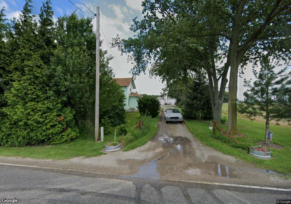
This home is located at 5510 County Road 10, Delta, OH 43515 and is currently estimated at $173,153, approximately $119 per square foot. 5510 County Road 10 is a home located in Fulton County with nearby schools including Delta Elementary School, Pike-Delta-York Middle School, and Pike-Delta-York High School.
Ownership History
Date
Name
Owned For
Owner Type
Purchase Details
Closed on
Apr 20, 2007
Sold by
Cole Thomas B and Cole Kathy J
Bought by
Main Cyndee A
Current Estimated Value
Purchase Details
Closed on
Oct 18, 2004
Sold by
Rae Michael T
Bought by
Cole Thomas B and Cole Kathy J
Home Financials for this Owner
Home Financials are based on the most recent Mortgage that was taken out on this home.
Original Mortgage
$62,000
Interest Rate
5.89%
Mortgage Type
Purchase Money Mortgage
Purchase Details
Closed on
Jul 17, 1997
Sold by
Michael T Rae
Bought by
Michael T Rae
Home Financials for this Owner
Home Financials are based on the most recent Mortgage that was taken out on this home.
Original Mortgage
$39,500
Interest Rate
7.94%
Mortgage Type
New Conventional
Purchase Details
Closed on
Jan 1, 1990
Bought by
Rae Michael - Connie
Create a Home Valuation Report for This Property
The Home Valuation Report is an in-depth analysis detailing your home's value as well as a comparison with similar homes in the area
Home Values in the Area
Average Home Value in this Area
Purchase History
| Date | Buyer | Sale Price | Title Company |
|---|---|---|---|
| Main Cyndee A | $72,000 | Attorney | |
| Cole Thomas B | $62,500 | -- | |
| Michael T Rae | $45,000 | -- | |
| Rae Michael - Connie | -- | -- |
Source: Public Records
Mortgage History
| Date | Status | Borrower | Loan Amount |
|---|---|---|---|
| Previous Owner | Cole Thomas B | $62,000 | |
| Previous Owner | Michael T Rae | $39,500 |
Source: Public Records
Tax History Compared to Growth
Tax History
| Year | Tax Paid | Tax Assessment Tax Assessment Total Assessment is a certain percentage of the fair market value that is determined by local assessors to be the total taxable value of land and additions on the property. | Land | Improvement |
|---|---|---|---|---|
| 2024 | $680 | $27,300 | $9,100 | $18,200 |
| 2023 | $682 | $27,300 | $9,100 | $18,200 |
| 2022 | $673 | $22,160 | $7,600 | $14,560 |
| 2021 | $720 | $22,160 | $7,600 | $14,560 |
| 2020 | $692 | $22,160 | $7,600 | $14,560 |
| 2019 | $619 | $20,870 | $7,460 | $13,410 |
| 2018 | $765 | $20,550 | $7,460 | $13,090 |
| 2017 | $763 | $20,550 | $7,460 | $13,090 |
| 2016 | $990 | $19,360 | $7,460 | $11,900 |
| 2015 | $946 | $19,360 | $7,460 | $11,900 |
| 2014 | $945 | $19,360 | $7,460 | $11,900 |
| 2013 | $873 | $18,100 | $8,230 | $9,870 |
Source: Public Records
Map
Nearby Homes
- 2872 County Road 11
- 7373 County Road 12
- 7620 County Road 12
- 421 Providence St
- 207 Wood St
- 308 Monroe St
- 518 Providence St
- 1090 Seneca Dr
- 1058 Seneca Dr
- 1066 Seneca Dr
- 1062 Seneca Dr
- Integrity 1830 Plan at Arrowhead Trails
- integrity 2280 Plan at Arrowhead Trails
- Integrity 2080 Plan at Arrowhead Trails
- 413 Fernwood St
- 305 Mckinley St
- 701 Palmwood St
- 1209 Apache Dr
- 703 Linwood Ave
- 908 Fernwood St
- 5598 County Road 10
- 5643 County Road 10
- 5423 County Road 10
- 5723 County Road 10
- 5835 County Road 10
- 5859 County Road 10
- 5889 County Road 10
- 5901 County Road 10
- 10035 County Road F
- 10079 County Road F
- 10056 County Road E Unit 18-1
- 0 Co Rd E Lot 2
- 0
- 9819 County Road F
- 9945 County Road Ef
- 10165 County Road F
- 9905 County Road E
- 10349 County Road F
- 10552 County Rd E
- 9678 County Road F