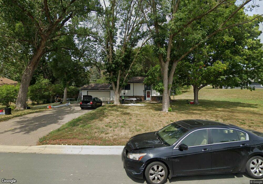
5512 Woodside Rd SE Prior Lake, MN 55372
Estimated Value: $366,000 - $401,000
4
Beds
2
Baths
960
Sq Ft
$397/Sq Ft
Est. Value
About This Home
This home is located at 5512 Woodside Rd SE, Prior Lake, MN 55372 and is currently estimated at $381,237, approximately $397 per square foot. 5512 Woodside Rd SE is a home located in Scott County with nearby schools including Westwood Elementary School, Hidden Oaks Middle School, and Twin Oaks Middle School.
Ownership History
Date
Name
Owned For
Owner Type
Purchase Details
Closed on
Dec 19, 2017
Sold by
Anderson Vicki J
Bought by
Fordyce Zachary R and Fordyce Deidra L
Current Estimated Value
Home Financials for this Owner
Home Financials are based on the most recent Mortgage that was taken out on this home.
Original Mortgage
$208,050
Outstanding Balance
$174,978
Interest Rate
3.9%
Mortgage Type
New Conventional
Estimated Equity
$206,259
Purchase Details
Closed on
Aug 22, 2011
Sold by
Borka Darlene
Bought by
Anderson Norman G and Anderson Vicki J
Create a Home Valuation Report for This Property
The Home Valuation Report is an in-depth analysis detailing your home's value as well as a comparison with similar homes in the area
Home Values in the Area
Average Home Value in this Area
Purchase History
| Date | Buyer | Sale Price | Title Company |
|---|---|---|---|
| Fordyce Zachary R | $219,000 | Trademark Title Services Inc | |
| Anderson Norman G | $140,000 | -- |
Source: Public Records
Mortgage History
| Date | Status | Borrower | Loan Amount |
|---|---|---|---|
| Open | Fordyce Zachary R | $208,050 |
Source: Public Records
Tax History Compared to Growth
Tax History
| Year | Tax Paid | Tax Assessment Tax Assessment Total Assessment is a certain percentage of the fair market value that is determined by local assessors to be the total taxable value of land and additions on the property. | Land | Improvement |
|---|---|---|---|---|
| 2025 | $4,312 | $332,400 | $174,500 | $157,900 |
| 2024 | $4,260 | $332,600 | $174,500 | $158,100 |
| 2023 | $4,196 | $314,000 | $164,600 | $149,400 |
| 2022 | $4,208 | $314,000 | $164,600 | $149,400 |
| 2021 | $4,032 | $264,400 | $137,800 | $126,600 |
| 2020 | $3,870 | $240,600 | $114,000 | $126,600 |
| 2019 | $3,858 | $214,500 | $97,900 | $116,600 |
| 2018 | $3,146 | $0 | $0 | $0 |
| 2016 | $577 | $0 | $0 | $0 |
| 2014 | -- | $0 | $0 | $0 |
Source: Public Records
Map
Nearby Homes
- 5375 Centennial St SE
- 5344 Candy Cove Trail SE
- TBD Mitchell Cir SE
- 15563 Ridgemont Ave SE
- 16067 Simms Ct SE
- 5453 Brooks Cir SE
- 6065 White Dr
- 5283 Frost Point Cir SE
- 15337 Breezy Point Rd SE
- 5636 150th St SE
- 1X Credit River Rd
- 16154 Main Ave SE Unit 212
- 15153 Cates Lake Dr
- 4943 Bluff Heights Trail SE
- 14966 Pixie Point Cir SE
- 6082 150th St SE
- 4567 Colorado St SE
- 8396 157th St
- 8388 157th St
- 4303 Bass St SE
- 15711 Santee Cir SE
- 15691 Santee Cir SE
- 5554 Woodside Rd SE
- 5530 Woodside Rd SE
- 5491 Woodside Rd SE
- 15681 Santee Cir SE
- 5572 Woodside Rd SE
- 15743 Candy Cove Trail SE
- 15711 Candy Cove Trail SE
- 15674 Santee Cir SE
- 5577 Huron St SE
- 15691 Candy Cove Trail SE
- 5585 Woodside Rd SE
- 15761 Candy Cove Trail SE
- 15682 Santee Cir SE
- 5593 Huron St SE
- 5604 Huron St SE
- 5603 Woodside Rd SE
- 15740 Candy Cove Trail SE
- 5611 Huron St SE