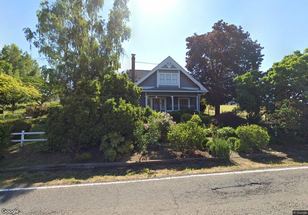
5514 SE 302nd Ave Gresham, OR 97080
Sandy River NeighborhoodEstimated Value: $583,000 - $627,000
4
Beds
2
Baths
2,620
Sq Ft
$232/Sq Ft
Est. Value
About This Home
This home is located at 5514 SE 302nd Ave, Gresham, OR 97080 and is currently estimated at $607,078, approximately $231 per square foot. 5514 SE 302nd Ave is a home located in Multnomah County with nearby schools including East Orient Elementary School, West Orient Middle School, and Sam Barlow High School.
Ownership History
Date
Name
Owned For
Owner Type
Purchase Details
Closed on
Nov 24, 2009
Sold by
Powers Christopher A
Bought by
Doan Deborah M and Powers Christopher A
Current Estimated Value
Home Financials for this Owner
Home Financials are based on the most recent Mortgage that was taken out on this home.
Original Mortgage
$269,700
Outstanding Balance
$174,303
Interest Rate
4.88%
Mortgage Type
New Conventional
Estimated Equity
$432,775
Purchase Details
Closed on
Aug 23, 2006
Sold by
Newton Michael J
Bought by
Powers Christopher A
Home Financials for this Owner
Home Financials are based on the most recent Mortgage that was taken out on this home.
Original Mortgage
$271,600
Interest Rate
6.67%
Mortgage Type
Unknown
Purchase Details
Closed on
Nov 30, 2004
Sold by
Page Dewayne
Bought by
Newton Michael J and Newton Melanie J
Home Financials for this Owner
Home Financials are based on the most recent Mortgage that was taken out on this home.
Original Mortgage
$214,000
Interest Rate
5.65%
Mortgage Type
FHA
Create a Home Valuation Report for This Property
The Home Valuation Report is an in-depth analysis detailing your home's value as well as a comparison with similar homes in the area
Home Values in the Area
Average Home Value in this Area
Purchase History
| Date | Buyer | Sale Price | Title Company |
|---|---|---|---|
| Doan Deborah M | -- | Ticor Title | |
| Powers Christopher A | $339,500 | First American | |
| Newton Michael J | $267,900 | Lawyers Title Ins |
Source: Public Records
Mortgage History
| Date | Status | Borrower | Loan Amount |
|---|---|---|---|
| Open | Doan Deborah M | $269,700 | |
| Closed | Powers Christopher A | $271,600 | |
| Previous Owner | Newton Michael J | $214,000 | |
| Closed | Newton Michael J | $26,750 |
Source: Public Records
Tax History
| Year | Tax Paid | Tax Assessment Tax Assessment Total Assessment is a certain percentage of the fair market value that is determined by local assessors to be the total taxable value of land and additions on the property. | Land | Improvement |
|---|---|---|---|---|
| 2025 | $6,477 | $340,780 | -- | -- |
| 2024 | $6,192 | $330,860 | -- | -- |
| 2023 | $6,056 | $321,230 | $0 | $0 |
| 2022 | $5,902 | $311,880 | $0 | $0 |
| 2021 | $5,743 | $302,800 | $0 | $0 |
| 2020 | $5,404 | $293,990 | $0 | $0 |
| 2019 | $5,268 | $285,430 | $0 | $0 |
| 2018 | $5,022 | $277,120 | $0 | $0 |
| 2017 | $4,826 | $269,050 | $0 | $0 |
| 2016 | $4,256 | $261,220 | $0 | $0 |
Source: Public Records
Map
Nearby Homes
- 30945 SE Lusted Rd
- 31616 SE Pipeline Rd
- 31563 SE Lusted Rd
- 6231 SE 21st St
- 6490 SE 21st St
- 6443 SE 22nd St
- 6421 SE 22nd St
- 2766 SE Teal Ave
- 6195 SE 16th St
- 6192 SE 15th St
- 6187 SE 16th St
- 6171 SE 16th St
- 6115 SE 16th St
- 6109 SE 16th St
- 6103 SE 16th St
- 1490 SE Pheasant Ave
- 6164 SE 29th Way
- 6055 SE 28th St
- 2952 SE Pheasant Ave
- 32404 SE Pipeline Rd
- 30326 SE Lusted Rd
- 5535 SE 302nd Ave
- 30316 SE Lusted Rd
- 30306 SE Lusted Rd
- 30304 SE Lusted Rd
- 30351 SE Lusted Rd
- 30341 SE Lusted Rd
- 5741 SE 302nd Ave
- 30313 SE Lusted Rd
- 30521 SE Lusted Rd
- 5821 SE 302nd Ave
- 30303 SE Lusted Rd
- 30532 SE Lusted Rd
- 30532 SE Lusted Rd Unit 3
- 30233 SE Lusted Rd
- 30125 SE Chase Rd
- 30031 SE Chase Rd
- 30116 SE Chase Rd
- 29917 SE Chase Rd
- 30608 SE Pipeline Rd
Your Personal Tour Guide
Ask me questions while you tour the home.