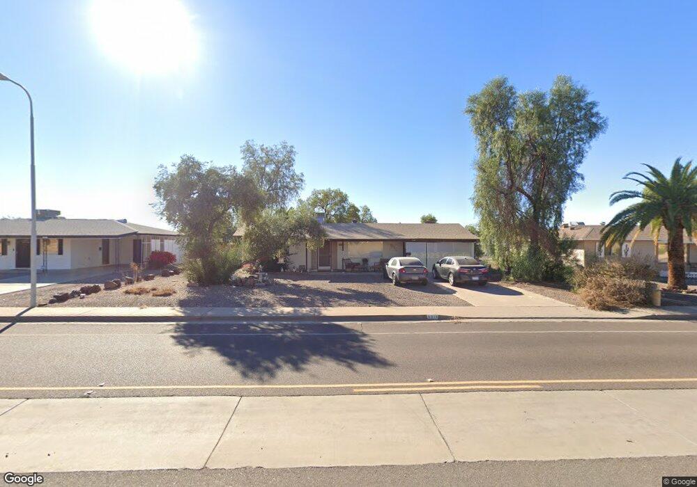
5515 E Adobe Rd Mesa, AZ 85205
Central Mesa East NeighborhoodEstimated Value: $230,812 - $305,000
2
Beds
1
Bath
1,064
Sq Ft
$250/Sq Ft
Est. Value
About This Home
This home is located at 5515 E Adobe Rd, Mesa, AZ 85205 and is currently estimated at $266,453, approximately $250 per square foot. 5515 E Adobe Rd is a home located in Maricopa County with nearby schools including O'Connor Elementary School, Franklin at Brimhall Elementary School, and Franklin West Elementary School.
Ownership History
Date
Name
Owned For
Owner Type
Purchase Details
Closed on
Apr 27, 2001
Sold by
Jarvis Robert Gordon
Bought by
Rathburn Mary Ann
Current Estimated Value
Home Financials for this Owner
Home Financials are based on the most recent Mortgage that was taken out on this home.
Original Mortgage
$75,967
Outstanding Balance
$28,072
Interest Rate
6.89%
Mortgage Type
Seller Take Back
Estimated Equity
$238,381
Purchase Details
Closed on
Nov 25, 1997
Sold by
Jarvis Joyce Elsie
Bought by
Jarvis Robert Gordon
Create a Home Valuation Report for This Property
The Home Valuation Report is an in-depth analysis detailing your home's value as well as a comparison with similar homes in the area
Home Values in the Area
Average Home Value in this Area
Purchase History
| Date | Buyer | Sale Price | Title Company |
|---|---|---|---|
| Rathburn Mary Ann | $77,000 | Transnation Title Insurance | |
| Jarvis Robert Gordon | -- | -- | |
| May Jarvis Robert Gordon | -- | -- |
Source: Public Records
Mortgage History
| Date | Status | Borrower | Loan Amount |
|---|---|---|---|
| Open | Rathburn Mary Ann | $75,967 |
Source: Public Records
Tax History
| Year | Tax Paid | Tax Assessment Tax Assessment Total Assessment is a certain percentage of the fair market value that is determined by local assessors to be the total taxable value of land and additions on the property. | Land | Improvement |
|---|---|---|---|---|
| 2025 | $780 | $9,821 | -- | -- |
| 2024 | $793 | $9,353 | -- | -- |
| 2023 | $793 | $21,950 | $4,390 | $17,560 |
| 2022 | $774 | $16,670 | $3,330 | $13,340 |
| 2021 | $782 | $14,700 | $2,940 | $11,760 |
| 2020 | $775 | $12,630 | $2,520 | $10,110 |
| 2019 | $720 | $11,380 | $2,270 | $9,110 |
| 2018 | $701 | $10,210 | $2,040 | $8,170 |
| 2017 | $679 | $8,920 | $1,780 | $7,140 |
| 2016 | $612 | $8,350 | $1,670 | $6,680 |
| 2015 | $619 | $7,870 | $1,570 | $6,300 |
Source: Public Records
Map
Nearby Homes
- 5502 E Duncan St
- 5422 E Dodge St
- 708 N 56th St
- 5410 E Dodge St
- 5422 E Des Moines St
- 5552 E Enrose St
- 5634 E Dodge St
- 5644 E Duncan St
- 5533 E Decatur St
- 5331 E Dodge St
- 5409 E Decatur St
- 5606 E Enrose St
- 5704 E Dodge St
- 5325 E Des Moines St
- 5519 E Casper Rd
- 639 N 57th Place
- 440 N 56th St
- 5207 E Dodge St
- 1020 N Sinova
- 509 N 53rd Place
- 5509 E Adobe Rd
- 5521 E Adobe Rd
- 504 Luscomb --
- 5516 E Duncan St
- 5522 E Duncan St
- 5510 E Duncan St
- 5527 E Adobe Rd
- 5528 E Duncan St
- 5517 E Ellis St
- 5523 E Ellis St
- 5509 E Ellis St
- 5445 E Adobe Rd
- 5531 E Ellis St
- 5515 E Duncan St
- 5446 E Duncan St
- 5501 E Ellis St
- 5501 E Ellis St
- 5509 E Duncan St
- 5539 E Ellis St
- 5503 E Duncan St
Your Personal Tour Guide
Ask me questions while you tour the home.