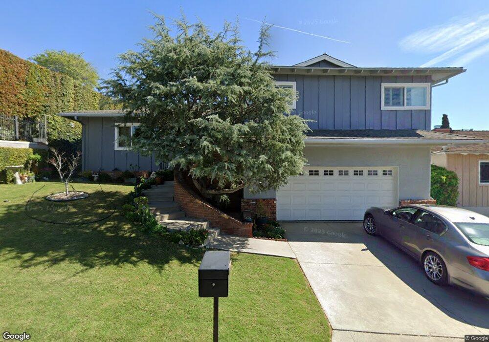
5516 Arrambide Dr Whittier, CA 90601
West Whittier NeighborhoodEstimated Value: $996,658 - $1,159,000
3
Beds
3
Baths
2,222
Sq Ft
$495/Sq Ft
Est. Value
About This Home
This home is located at 5516 Arrambide Dr, Whittier, CA 90601 and is currently estimated at $1,100,665, approximately $495 per square foot. 5516 Arrambide Dr is a home located in Los Angeles County with nearby schools including Longfellow Elementary School, Walter F. Dexter Middle School, and Whittier High School.
Ownership History
Date
Name
Owned For
Owner Type
Purchase Details
Closed on
Oct 8, 2012
Sold by
Teresa Chanchorena Revocable Trust
Bought by
Chanchorena Albert and Chanchorena Hilda Gabriela
Current Estimated Value
Purchase Details
Closed on
Aug 4, 2012
Sold by
Chanchorena Teresa
Bought by
Chanchorena Teresa and Teresa Chanchorena Revocable Trust
Purchase Details
Closed on
Jul 26, 2000
Sold by
G Garcia Joseph D and Mac Dowell Su
Bought by
Garcia Joseph D
Create a Home Valuation Report for This Property
The Home Valuation Report is an in-depth analysis detailing your home's value as well as a comparison with similar homes in the area
Home Values in the Area
Average Home Value in this Area
Purchase History
| Date | Buyer | Sale Price | Title Company |
|---|---|---|---|
| Chanchorena Albert | -- | None Available | |
| Chanchorena Teresa | -- | None Available | |
| Garcia Joseph D | -- | -- |
Source: Public Records
Tax History Compared to Growth
Tax History
| Year | Tax Paid | Tax Assessment Tax Assessment Total Assessment is a certain percentage of the fair market value that is determined by local assessors to be the total taxable value of land and additions on the property. | Land | Improvement |
|---|---|---|---|---|
| 2025 | $5,373 | $423,907 | $172,633 | $251,274 |
| 2024 | $5,373 | $415,597 | $169,249 | $246,348 |
| 2023 | $5,223 | $407,449 | $165,931 | $241,518 |
| 2022 | $5,117 | $399,461 | $162,678 | $236,783 |
| 2021 | $4,998 | $391,630 | $159,489 | $232,141 |
| 2019 | $4,903 | $380,015 | $154,759 | $225,256 |
| 2018 | $4,604 | $361,655 | $151,725 | $209,930 |
| 2016 | $4,407 | $347,613 | $145,834 | $201,779 |
| 2015 | $4,326 | $342,393 | $143,644 | $198,749 |
| 2014 | $4,244 | $335,687 | $140,831 | $194,856 |
Source: Public Records
Map
Nearby Homes
- 5655 Pickering Ave
- 12417 Rose Dr
- 11840 Nixon Ln
- 5840 Citrus Ave
- 11905 Mendenhall Ln
- 12031 Beverly Blvd Unit 1D
- 11759 S Circle Dr
- 5827 Washington Ave
- 11511 Beverly Dr
- 6217 Greenleaf Ave
- 6251 Milton Ave
- 6222 Magnolia Ave
- 6242 Comstock Ave
- 6333 Milton Ave
- 6340 Newlin Ave
- 11818 Pocasset Dr
- 5307 Woodward Ln
- 12711 Hadley St Unit 14
- 5315 Bihr Ct
- 6226 Washington Ave
- 5522 Arrambide Dr
- 12408 Honolulu Terrace
- 12420 Honolulu Terrace
- 5528 Arrambide Dr
- 12346 Avalon Rd
- 12426 Honolulu Terrace
- 12345 Avalon Rd
- 12340 Avalon Rd
- 12432 Honolulu Terrace
- 12405 Beverly Dr
- 12411 Beverly Dr
- 12337 Avalon Rd
- 12413 Honolulu Terrace
- 12435 Beverly Dr
- 12345 Beverly Dr
- 12419 Honolulu Terrace
- 0 Honohulu Tr Unit PW14109081
- 0 Honolulu Tr Unit PW13207309
- 0 Honolulu Tr Unit P835666
- 12407 Honolulu Terrace